Terrestrial Surveying
The 2D and 3D measurement of points, distances and angles of features and objects on the Earth’s surface. See also Surveying Instrumentation topic. This topic covers the science and techniques that govern the 2D and 3D measurement of points, distances and angles of natural and man-made features and objects on the Earth’s surface. These measurements are acquired for a wide range of practical applications in construction, engineering, land use planning, mapmaking and cadastral projects, See also Surveying Instrumentation topic for the various tools employed to acquire survey measurements.
Terra Drone India surveys 4,200 sq km in Maharashtra
9th May 2019
Terra Drone India surveys 4,200 sq km in MaharashtraRene Worms joins Atmos UAV as Head of Global Sales
8th May 2019
Rene Worms joins Atmos UAV as Head of Global SalesInfrastructure Inspection – UAS Are All Over It
8th May 2019
Infrastructure Inspection – UAS Are All Over ItCSA Completes Field Surveys Offshore Puerto Rico
8th May 2019
CSA Completes Field Surveys Offshore Puerto RicoTCarta teams up with King’s College London and wins ESA Funding
7th May 2019
TCarta teams up with King’s College London and wins ESA Funding
Firefighting drones are the future of fire safety
7th May 2019
Firefighting drones are the future of fire safety
Globalstar Satellite IoT Devices for Smart Animal Tracking
7th May 2019
Globalstar Satellite IoT Devices for Smart Animal TrackingWood Adopts Delair UX11 UAV For Large Scale Surveying
7th May 2019
Wood Adopts Delair UX11 UAV For Large Scale Surveying
Airbus takes next major step for Telesat’s LEO satellite constellation
6th May 2019
Airbus takes next major step for Telesat’s LEO satellite constellationAirbus to build multimission satellite for MEASAT
6th May 2019
Airbus to build multimission satellite for MEASATHisdesat appoints Airbus and Thales Alenia Space
6th May 2019
Hisdesat appoints Airbus and Thales Alenia SpaceLaunch of the second SpaceDataHighway satellite
6th May 2019
Launch of the second SpaceDataHighway satellite
Space Flight Laboratory Highlights Microspace Earth Observation
4th May 2019
Space Flight Laboratory Highlights Microspace Earth ObservationThe Future is Two-Stroke: Hirth Engines Look to the Future of Hybrid UAVs
3rd May 2019
The Future is Two-Stroke: Hirth Engines Look to the Future of Hybrid UAVs
A new, high-performing USV for ocean surveying
2nd May 2019
A new, high-performing USV for ocean surveying
Submissions for Galileo Masters 2019 Open May 1
2nd May 2019
Submissions for Galileo Masters 2019 Open May 1
Samsung SDS and Telensa Partner for Smart City Infrastructure
2nd May 2019
Samsung SDS and Telensa Partner for Smart City InfrastructureISG Transforms BIM Delivery Using Pointfuse Laser Scanning Software
1st May 2019
ISG Transforms BIM Delivery Using Pointfuse Laser Scanning SoftwareBench-Guard™ and Table-Guard™ - Laser Barriers
1st May 2019
Bench-Guard™ and Table-Guard™ - Laser BarriersBluesky Tree Map Aids Natural Flood Management Project
1st May 2019
Bluesky Tree Map Aids Natural Flood Management ProjectWingtra partners with 3DR to offer a complete aerial surveying solution
30th April 2019
Wingtra partners with 3DR to offer a complete aerial surveying solutionSSTL announces new Earth Observation data contract with Airbus
30th April 2019
SSTL announces new Earth Observation data contract with AirbusWhat’s behind the ground-breaking 3D habitat map of the Great Barrier Reef?
30th April 2019
What’s behind the ground-breaking 3D habitat map of the Great Barrier Reef?senseFly introduces the Solar 360 thermal drone solution
30th April 2019
senseFly introduces the Solar 360 thermal drone solution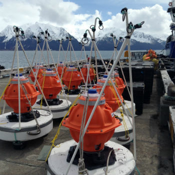
Sonardyne technology chosen for new Canadian seabed observatory
30th April 2019
Sonardyne technology chosen for new Canadian seabed observatory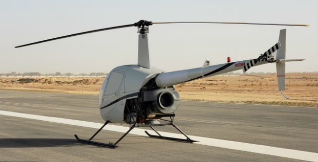
Helicopter Robinson Converted by UAVOS to Unmanned Drone
30th April 2019
Helicopter Robinson Converted by UAVOS to Unmanned Drone
Fortem Technologies and Unifly Collaborate to Keep Airspace Safe
30th April 2019
Fortem Technologies and Unifly Collaborate to Keep Airspace Safe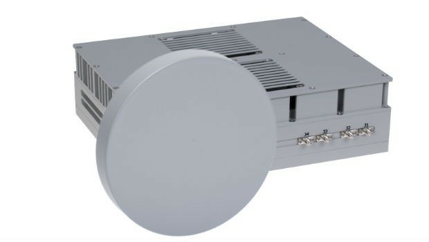
DA-Group and Elbit Systems EW & SIGINT – Elisra Partner
29th April 2019
DA-Group and Elbit Systems EW & SIGINT – Elisra Partner
Geneq Inc. Announces New Website Launch For Its SXblue Products and Services
27th April 2019
Geneq Inc. Announces New Website Launch For Its SXblue Products and Services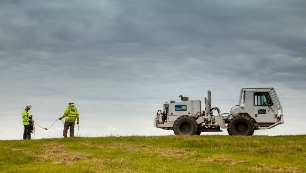
Fugro’s free seminars reveal the benefits of smart site investigation
26th April 2019
Fugro’s free seminars reveal the benefits of smart site investigation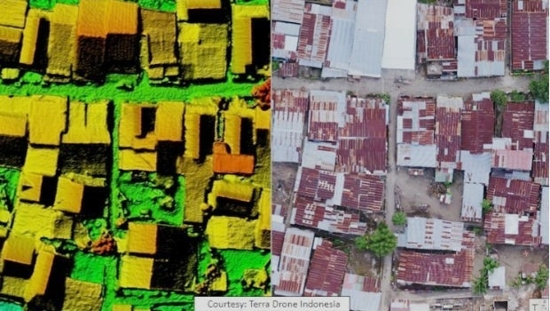
Terra Drone Indonesia Performed Baseline Modeling
26th April 2019
Terra Drone Indonesia Performed Baseline Modeling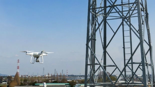
Terra Drone and KDDI launch drone infrastructure inspection services
25th April 2019
Terra Drone and KDDI launch drone infrastructure inspection services
Photobioreactor: oxygen and a source of nutrition for astronauts
25th April 2019
Photobioreactor: oxygen and a source of nutrition for astronauts
RIEGL to Attend and Exhibit at AUVSI XPONENTIAL 2019 !
25th April 2019
RIEGL to Attend and Exhibit at AUVSI XPONENTIAL 2019 !Brazil’s Civil Aviation Authority Approves senseFly Drones
24th April 2019
Brazil’s Civil Aviation Authority Approves senseFly DronesAdvanced mapping and object tracking technology to be featured at AUVSI 2019
24th April 2019
Advanced mapping and object tracking technology to be featured at AUVSI 2019Airbus and Orbital Insight launch Earth Monitor
24th April 2019
Airbus and Orbital Insight launch Earth Monitor
RIEGL to Attend and Exhibit at AEC BuildTech 2019!
24th April 2019
RIEGL to Attend and Exhibit at AEC BuildTech 2019!Micro Optical Power Meter - Compatible with Single-Mode and Multi-Mode Networks
23rd April 2019
Micro Optical Power Meter - Compatible with Single-Mode and Multi-Mode Networks
GeoCue Releases New and Improved Way to Access Public LIDAR and Image Data
22nd April 2019
GeoCue Releases New and Improved Way to Access Public LIDAR and Image DataJuniper Systems Limited Releases Two New Rugged Handheld Computers
19th April 2019
Juniper Systems Limited Releases Two New Rugged Handheld Computers