
NM Group become first to test Beyond-Visual-Line-of-Sight LiDAR UAV
28th September 2016
NM Group become first to test Beyond-Visual-Line-of-Sight LiDAR UAVThe 2D and 3D measurement of points, distances and angles of features and objects on the Earth’s surface. See also Surveying Instrumentation topic. This topic covers the science and techniques that govern the 2D and 3D measurement of points, distances and angles of natural and man-made features and objects on the Earth’s surface. These measurements are acquired for a wide range of practical applications in construction, engineering, land use planning, mapmaking and cadastral projects, See also Surveying Instrumentation topic for the various tools employed to acquire survey measurements.
28th September 2016
NM Group become first to test Beyond-Visual-Line-of-Sight LiDAR UAV28th September 2016
Bluesky’s Aerial Thermal Surveys Helps Enfield Identify Illegal Dwellings
27th September 2016
ABPmer to assist Tobermory Harbour Association27th September 2016
New Portfolio Wireless IoT Sensors for Water Monitoring from Trimble27th September 2016
New partnership brings senseFly drones to Maptek mining customers23rd September 2016
GSSI will showcase and demonstrate GPR equipment at 2016 CCGA23rd September 2016
Moorside site investigations approach final stages22nd September 2016
Lithuanian Survey Experts take delivery of SITECO Road-Scanner21st September 2016
Fugro Focuses On Innovation At Wind Energy, Hamburg21st September 2016
Call to truly understand accuracy requirements in UAV LiDAR surveys15th September 2016
New integration of satellite and terrestrial technologies15th September 2016
Trimble Ag products distribution in Ireland transformed15th September 2016
Sokkia announce further compatibility with Autodesk layout application15th September 2016
Seafloor Systems Expands Its Sales Support Services In Latin America8th September 2016
Spotlight on New HyperStacking Ground Penetrating Radar Technology7th September 2016
Bluesky Publishes First Online 3D Maps of Isle of Man6th September 2016
Sokkia introduces lighter and faster line of robotic total stations5th September 2016
Aibotix - All-new UAV solutions for your business
2nd September 2016
Scientists take to the skies to track West African pollution1st September 2016
Cardinal Systems adds new UAS module to the Vr Mapping Software1st September 2016
Discover the new Trimble Geospatial Webinar Series - Preview31st August 2016
3D Laser Mapping Unveils New Multi-Platform Mapping System In Africa30th August 2016
Earthquake in Myanmar Damage 171 Ancient Buddhist Pagodas29th August 2016
VisionMap A3 Edge Innovates Precision Agriculture in North Dakota
26th August 2016
Hi-Target Europe successfully launched new products in Czech24th August 2016
Topcon Survey Reveals Huge Potential Of Machine Control24th August 2016
Lithuanian Survey Experts Takes Delivery Of Siteco Road-Scanner23rd August 2016
HERMES® 450 soars during the North Dakota UAS Field Day22nd August 2016
Stesalit Systems Ltd supplies GPS PDA to Odisha Forestry Department18th August 2016
Septentrio Supplies to Oregon Department of Transport17th August 2016
Seafloor’s In-Water Demonstration At Oceans ’1616th August 2016
Fugro Supports Total Ultra-Deep Water Drilling Campaign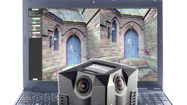
11th August 2016
New SphereVision 360 Imaging Software Integrates iSTAR Measurement Module
10th August 2016
Barrow Upon Soar Rail Closure Prompts Monitoring Calls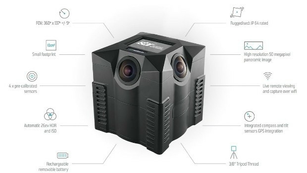
10th August 2016
iSTAR 360 degree Measurement Module integrated by imaging companies

6th August 2016
New Blackfly S - the Latest Imaging Technology in Compact Housing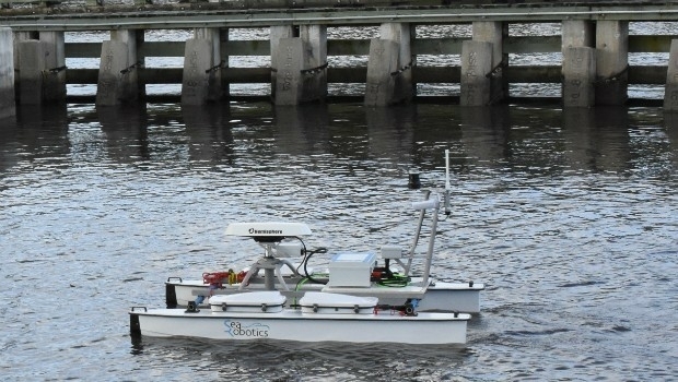
4th August 2016
SeaRobotics Delivers Unmanned Surface Vehicle
2nd August 2016
Fugro Completes Ghana Metocean Data Acquisition For Hess Corporation