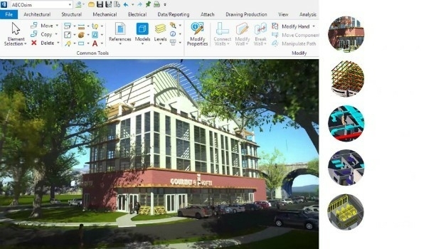
Bentley’s AECOsim Building Designer CONNECT Edition (from import)

Bentley’s AECOsim Building Designer CONNECT Edition

19th September 2017

Bentley’s AECOsim Building Designer CONNECT Edition

Second Annual PrecisionAg® Vision Conference

15th September 2017

Second Annual PrecisionAg® Vision Conference
The PanGeo Alliance welcomes a new member (from import)

The PanGeo Alliance welcomes a new member

14th September 2017

The PanGeo Alliance welcomes a new member

Dstl to develop Active Protection System technology

14th September 2017

Dstl to develop Active Protection System technology
Maxoptra Helps The Tomato Stall Deliver Fresh Produce Across UK (from import)

Maxoptra Helps The Tomato Stall Deliver Fresh Produce Across UK

14th September 2017

Maxoptra Helps The Tomato Stall Deliver Fresh Produce Across UK
Shaping a New 3D World with Portal for Point Clouds and 3D Models (from import)

Shaping a New 3D World with Portal for Point Clouds and 3D Models

12th September 2017

Shaping a New 3D World with Portal for Point Clouds and 3D Models

Drone Software Donation for Hurricane Recovery

12th September 2017

Drone Software Donation for Hurricane Recovery
Making big waves in China to test ship design (from import)

Making big waves in China to test ship design

12th September 2017

Making big waves in China to test ship design

Ctrack Selected by Northumbrian Water Limited

8th September 2017

Ctrack Selected by Northumbrian Water Limited
PTC to Move Global Headquarters to Boston Seaport (from import)

PTC to Move Global Headquarters to Boston Seaport

8th September 2017

PTC to Move Global Headquarters to Boston Seaport
Maxoptra and TomTom Streamline Mobile Operations for Telecom Provider (from import)

Maxoptra and TomTom Streamline Mobile Operations for Telecom Provider

7th September 2017

Maxoptra and TomTom Streamline Mobile Operations for Telecom Provider
Airborne mapping system from 3D Laser Mapping takes off (from import)

Airborne mapping system from 3D Laser Mapping takes off

6th September 2017

Airborne mapping system from 3D Laser Mapping takes off

Public comment on proposed Geocoding API Standards Working Group

5th September 2017

Public comment on proposed Geocoding API Standards Working Group

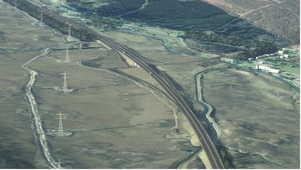
Elbit to Provide a Maritime System to an Asia-Pacific Navy
4th September 2017

Elbit to Provide a Maritime System to an Asia-Pacific Navy
Bentley Systems' 2017 Be Inspired Awards Program (from import)
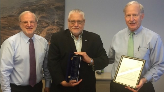
Bentley Systems' 2017 Be Inspired Awards Program

2nd September 2017

Bentley Systems' 2017 Be Inspired Awards Program
OGC recognizes the IJIS Institute with Distinguished Member Award (from import)

OGC recognizes the IJIS Institute with Distinguished Member Award

31st August 2017

OGC recognizes the IJIS Institute with Distinguished Member Award

Astun Technology Supports Most Successful FOSS4G Ever

30th August 2017

Astun Technology Supports Most Successful FOSS4G Ever

OSNI digital mapping now available through viaEuropa web service

29th August 2017

OSNI digital mapping now available through viaEuropa web service

GIS Cloud Exhibiting at the INTERGEO 2017 in Berlin
29th August 2017

GIS Cloud Exhibiting at the INTERGEO 2017 in Berlin
Seen From Space: Landslide in the Swiss Alps (from import)

Seen From Space: Landslide in the Swiss Alps

28th August 2017

Seen From Space: Landslide in the Swiss Alps

Terra Drone is to release Terra Mapper a new image processing software
26th August 2017

Terra Drone is to release Terra Mapper a new image processing software
Free Healthcare Data for Use with Maptitude Mapping Software (from import)

Free Healthcare Data for Use with Maptitude Mapping Software

24th August 2017

Free Healthcare Data for Use with Maptitude Mapping Software
SuperGIS 3D Solutions to View Cities from Different Angles (from import)

SuperGIS 3D Solutions to View Cities from Different Angles

24th August 2017

SuperGIS 3D Solutions to View Cities from Different Angles
1Spatial grows its team of Safe Software FME Certified Trainers (from import)

1Spatial grows its team of Safe Software FME Certified Trainers

22nd August 2017

1Spatial grows its team of Safe Software FME Certified Trainers

Timely, Objective Asset Data to be Delivered to the Public Sector

16th August 2017

Timely, Objective Asset Data to be Delivered to the Public Sector

A.I ASIA 2017

11th August 2017

A.I ASIA 2017

Metering infrastructure connectivity in remote areas solved
10th August 2017

Metering infrastructure connectivity in remote areas solved
Web Mapper in SuperGIS Server 10- Building Web GIS without Coding (from import)

Web Mapper in SuperGIS Server 10- Building Web GIS without Coding

9th August 2017

Web Mapper in SuperGIS Server 10- Building Web GIS without Coding
Upcoming SuperGIS Webinar- Web-based 3D Cadastral Mapping (from import)

Upcoming SuperGIS Webinar- Web-based 3D Cadastral Mapping

9th August 2017

Upcoming SuperGIS Webinar- Web-based 3D Cadastral Mapping

Oracle makes transportation more efficient with HERE

7th August 2017

Oracle makes transportation more efficient with HERE

Skills gap could delay IoT innovation in the energy sector

3rd August 2017

Skills gap could delay IoT innovation in the energy sector

Skyline Software Systems Releases Terraexplorer for Web V7.0
31st July 2017

Skyline Software Systems Releases Terraexplorer for Web V7.0
BP Honored at 2017 Esri International User Conference (from import)
BP Honored at 2017 Esri International User Conference

28th July 2017

BP Honored at 2017 Esri International User Conference
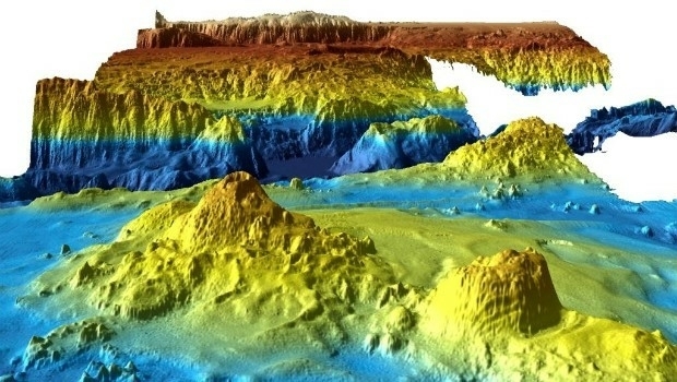
Unique Seafloor Data Provides New Insight To Scientific Communities (from import)

Unique Seafloor Data Provides New Insight To Scientific Communities

28th July 2017

Unique Seafloor Data Provides New Insight To Scientific Communities

Stakeholders in Global Smart City Market Seek New Funding Models
28th July 2017

Stakeholders in Global Smart City Market Seek New Funding Models
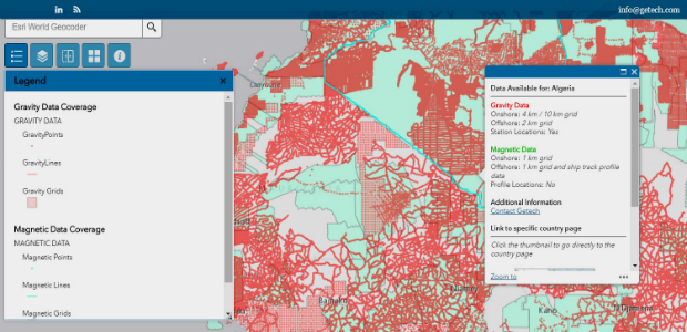
Explore the World’s Geology with Getech’s Interactive Maps (from import)

Explore the World’s Geology with Getech’s Interactive Maps

27th July 2017

Explore the World’s Geology with Getech’s Interactive Maps
Maxoptra Route Planning Helps Sharps Bedrooms Deliver (from import)

Maxoptra Route Planning Helps Sharps Bedrooms Deliver

25th July 2017

Maxoptra Route Planning Helps Sharps Bedrooms Deliver
1Spatial Awarded Safe Software’s Top Partner Award 2016 (from import)

1Spatial Awarded Safe Software’s Top Partner Award 2016

25th July 2017

1Spatial Awarded Safe Software’s Top Partner Award 2016
Brainnwave Expands in Geo with Quarry One Eleven (from import)

Brainnwave Expands in Geo with Quarry One Eleven

22nd July 2017

Brainnwave Expands in Geo with Quarry One Eleven
Interactive digital map of African political violence developed (from import)

Interactive digital map of African political violence developed

21st July 2017

Interactive digital map of African political violence developed

LizardTech and Extensis Optimize Digital Asset Management

20th July 2017

LizardTech and Extensis Optimize Digital Asset Management
Wirral Council migrates existing corporate GIS to Cadcorp (from import)

Wirral Council migrates existing corporate GIS to Cadcorp

19th July 2017

Wirral Council migrates existing corporate GIS to Cadcorp

Yotta Seals Partnership with Engineering Consultancy Giant Ramboll

19th July 2017

Yotta Seals Partnership with Engineering Consultancy Giant Ramboll
Emoji map by Europa Technologies wins Most Unique award at Esri UC (from import)

Emoji map by Europa Technologies wins Most Unique award at Esri UC

19th July 2017

Emoji map by Europa Technologies wins Most Unique award at Esri UC
New RAF Trainer is ‘Ready to Fly’ (from import)

New RAF Trainer is ‘Ready to Fly’

14th July 2017

New RAF Trainer is ‘Ready to Fly’
Managing Assets from Different Angles- SuperGIS 3D Earth Server (from import)

Managing Assets from Different Angles- SuperGIS 3D Earth Server

13th July 2017

Managing Assets from Different Angles- SuperGIS 3D Earth Server
Barnsley Council drives efficiency with 1Spatial and FME (from import)

Barnsley Council drives efficiency with 1Spatial and FME

13th July 2017

Barnsley Council drives efficiency with 1Spatial and FME
Maxoptra Helps Keep Ten Mile Menu Food Deliveries Lean and Green (from import)

Maxoptra Helps Keep Ten Mile Menu Food Deliveries Lean and Green

13th July 2017

Maxoptra Helps Keep Ten Mile Menu Food Deliveries Lean and Green