Fugro Partners With Electricity Transmission System Operator Elia
29th July 2016
Fugro Partners With Electricity Transmission System Operator Elia
29th July 2016
Fugro Partners With Electricity Transmission System Operator Elia

29th July 2016
ContextCapture Improves Quality of Reality Modeling29th July 2016
Trent Stromberg joins Avenza Systems as Business Development Manager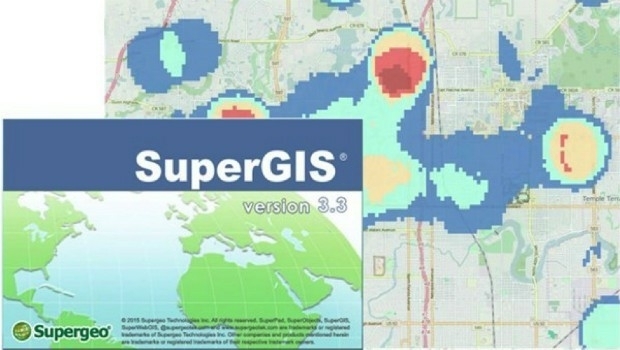
28th July 2016
Local Government in Capoterra Selects SuperGIS Desktop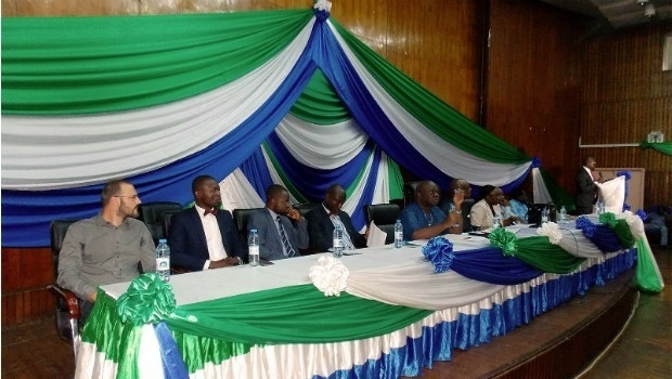
28th July 2016
GAF establishes Geo-Data Information Management System for Sierra Leone28th July 2016
Introducing HERE WeGo, the ultimate urban mobility companion27th July 2016
Future of drone use within business set to change_(1).jpg)
27th July 2016
Airbus Defence and Space Launches “One Tasking”27th July 2016
Esri Selected to Host Services for Michigan State-Wide Imagery Data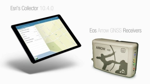
27th July 2016
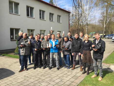
Sokkia receivers to be used for Latvian forest management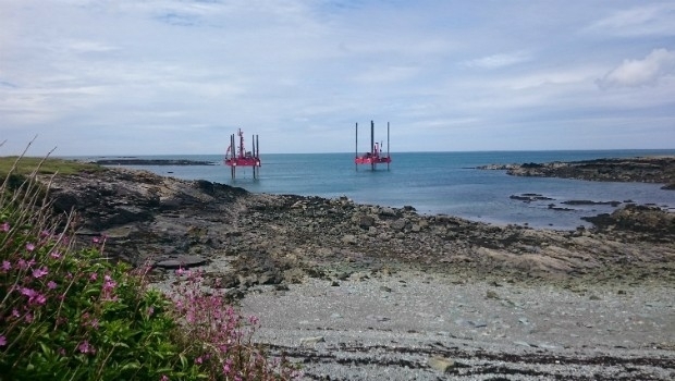
27th July 2016
Fugro Begins Seabed Investigation At Wylfa Newydd Nuclear Power Site26th July 2016
Caribbean GIS Community to Gather in Barbados
26th July 2016
Maptek and BBE collaborate around advanced mine ventilation solutions25th July 2016
HERE appoints Peter Meier as Chief Financial Officer25th July 2016
A look around the UAS boom industry at interaerial SOLUTIONS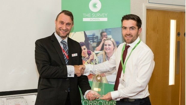
25th July 2016
Praise for The Survey School’s prize-winning 2016 graduates
25th July 2016
Garmin introduces G5 electronic flight instrument
22nd July 2016
Apply to Geovation now to secure funding for your GeoTech start-up
22nd July 2016
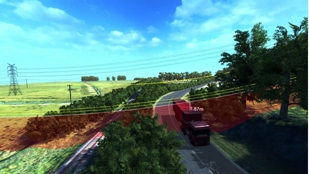
Van Deliveries Growth Highlights Need for Flexible Road Safety Systems22nd July 2016
Loudoun County Honored for 30 Years of Innovation with GIS
21st July 2016
Airbus to operate Heron 1 drones for Germany also in Mali
21st July 2016
BARTHAUER Company Bicycle Program German Company Gets Employees Moving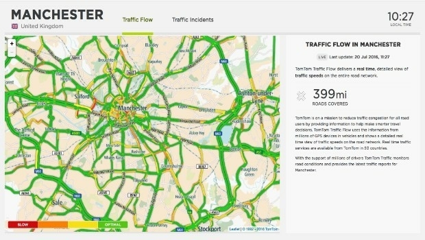
21st July 2016
TomTom City extends to Manchester and Glasgow
21st July 2016
Location Matters in Manchester CityVerve Project
20th July 2016
Airbus Defence and Space Launches “One Tasking”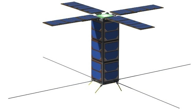
19th July 2016
SSTL expands LEO platform capability with VESTA nanosatellite19th July 2016
Masternaut launches fuel module to improve compliance and cut costs
19th July 2016
Garmin announces new enhancements to the G500/G600
18th July 2016
Fugro Commences Offshore Geotechnical Contract For ONGC India
18th July 2016
QuestUAV Provides Own PPK Solution For Q-200 Surveyor UAV18th July 2016
NM Group awarded contract to deliver transmission powerline survey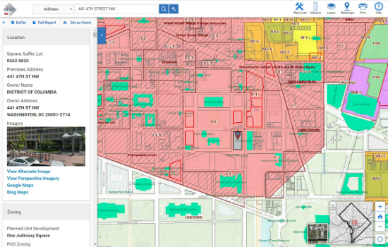
16th July 2016
Blue Raster Incorporates Esri Technology into DC Office of Zoning Map15th July 2016
Esri and ICMA Partner to Educate Smart Communities15th July 2016
OriginGPS and TDK Shrink GNSS Footprint for Wearables
14th July 2016
25 years ago – Europe’s first Earth observation satellite was launched14th July 2016
Eircode data and services now available from Europa Technologies13th July 2016
Cityworks Staff Earn Asset Management Certifications
13th July 2016
Esri finalist for 2016 Microsoft Azure Certified ISV Solution13th July 2016
Advanced GPS-tracking of vehicles with BITREK CONNECT
12th July 2016
Leica Geosystems completes CAA qualifications
12th July 2016
Handheld Launches the NAUTIZ X2 All-in-One Rugged Android Device
12th July 2016
Shelter from the summer sun under legal umbrellas11th July 2016
CompeGPS and the OS team up to produce the ‘OS Range of GPS Units’
11th July 2016
Elbit Systems Launches Light SPEAR™ UAS Jamming System