
Masternaut launches fuel card in partnership with AllStar
7th March 2017
Masternaut launches fuel card in partnership with AllStar
7th March 2017
Masternaut launches fuel card in partnership with AllStar7th March 2017
Virtual Reality: Huge Investment Support Accelerates Innovations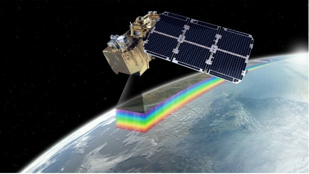

7th March 2017
Second ‘colour vision’ satellite for Copernicus launched7th March 2017
Digital Earth & Locate17 to Boost Transport and Smart Cities
7th March 2017
Esri Honors Microsoft for Innovation in Location Strategy7th March 2017
Esri Honors Partners for Exceptional Use of Mapping and Analytics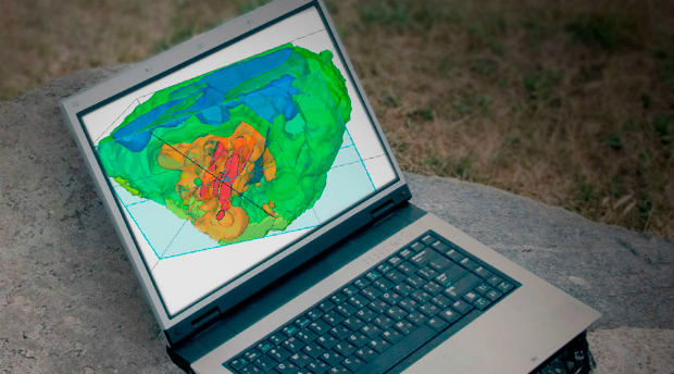
7th March 2017
Geosoft launches new subscription plans for Target geology software
7th March 2017
Getech To Demonstrate Technical Excellence6th March 2017
Orbit GT and GeoCue Group Inc. sign Reseller Agreement6th March 2017
Swedish energy company Lerum Energi has yet again chosen Digpro6th March 2017
Risk Insight improves precision underwriting for RSA and its brokers6th March 2017
FREQUENTIS – 70 years of innovation for a safer world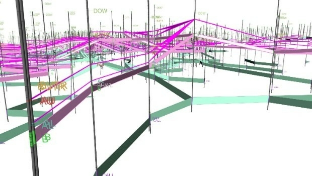
6th March 2017
Maptek resource modelling technology on show at PDAC4th March 2017
HERE welcomes BMW to the Open Location Platform3rd March 2017
Airbus boosts its capacity in the agricultural sector
3rd March 2017
Orbit GT and Five Star Electronic Technology, China sign Agreement
3rd March 2017
New General Manager for Maptek EMEA and CIS operations3rd March 2017
Esri Signs Enterprise Agreement with Harris Corporation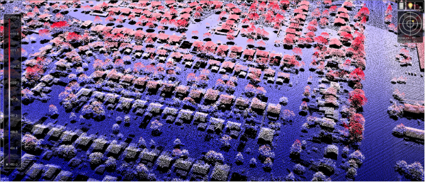
3rd March 2017
New Bathy DataBASE™, HIPS and SIPS™ released by Teledyne CARIS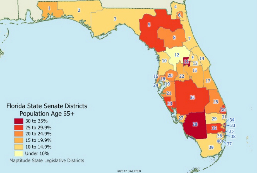
3rd March 2017
Caliper Offers State Legislative Districts with Updated Census Data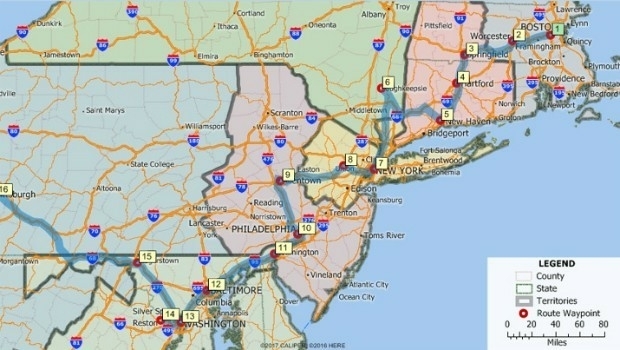
3rd March 2017
Maptitude 2017 Adds Enhanced MapPoint and Streets & Trips Features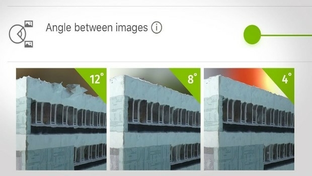
3rd March 2017
How do I choose the right image-capture settings for 3D models?_Gemeente_Amsterdam_2nd_March_2017_rel_compr.jpg)
2nd March 2017
Fugro’s Strategic Role In The Zuidasdok Project In Amsterdam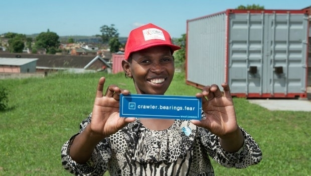
2nd March 2017
what3words addresses South African township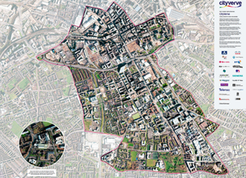
2nd March 2017
Opening the doors to innovation in Manchester’s corridor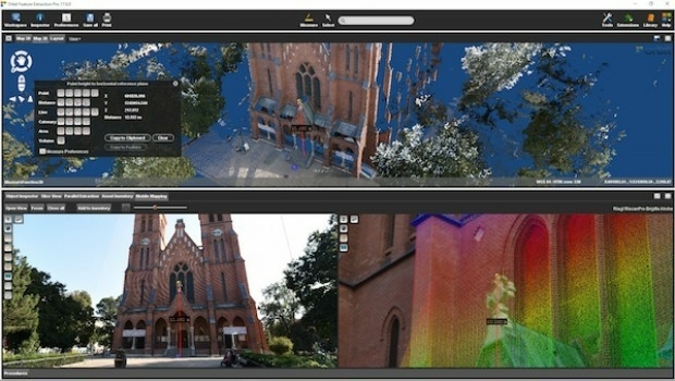
1st March 2017
Orbit GT and RIEGL strengthen data interoperability
1st March 2017
GAF to provide technical assistance to GMES & Africa Support Programme
1st March 2017
Top GIS Housing Officer Links Up With Oxford Data Consultancy
1st March 2017
Bell Group Boosts Tracking Capabilities With Ctrack1st March 2017
UK Input to Phase 3 of European High Resolution Seabed Mapping Project1st March 2017
Mobile Data Collection has never been easier!
1st March 2017
Looking for GNSS receiver for mining or construction?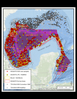
1st March 2017
TDI-Brooks Completes Coring Program for TGS Gigante Mexico GoM Program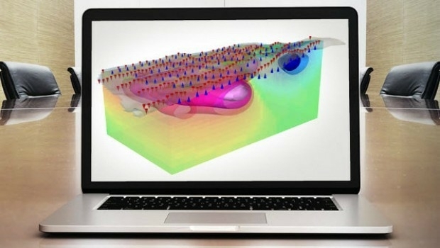
1st March 2017
Geosoft showcases VOXI IP and resistivity inversion technology1st March 2017
Global Mapper LiDAR Module v18.1 Now Available
28th February 2017
Botswana Geoscience Portal serves up 2000 downloads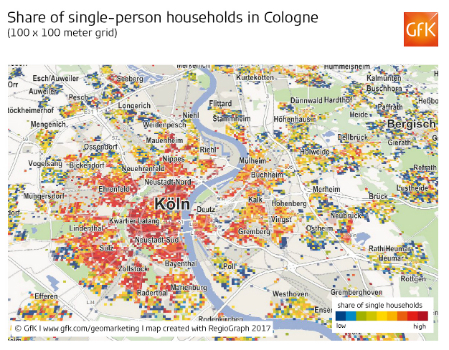
28th February 2017
Share of single-person households in Cologne
28th February 2017
GeoSLAM Growth Continues With Two Senior Appointments
28th February 2017
Leveraging 3D modeling and printing skills as a service28th February 2017
The First Lead’Air OCTOBLIQUE MIDAS in the USA, Purchased
28th February 2017
Solutions for the Commercial Helicopter Market
28th February 2017
Live stream of rare solar eclipse captures imaginations worldwide27th February 2017
2017 version of Mobile Coverage Explorer Released27th February 2017
Airbus Partners with Bird.i for Access to Earth Observation Imagery