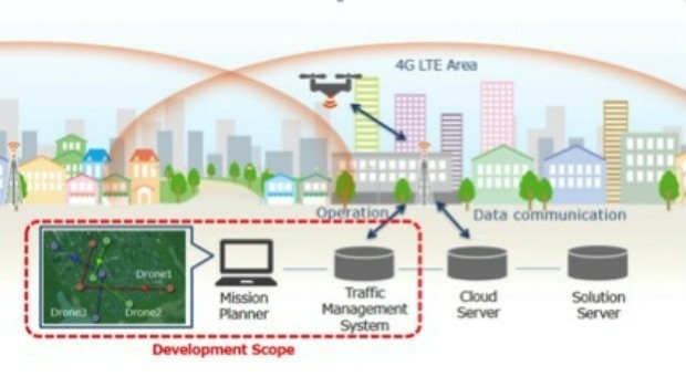
KDDI and Terra Drone announce the invention of “4G LTE control system
14th April 2017
KDDI and Terra Drone announce the invention of “4G LTE control system
14th April 2017
KDDI and Terra Drone announce the invention of “4G LTE control system
13th April 2017
Global push for Earth observations continues13th April 2017
adsquare to enrich its advertisers platform with HERE location data13th April 2017
USGIF Launches Initiative to Grow GEOINT Workforce in St. Louis
13th April 2017
thinkWhere appoints Jumpstart's Brian Williamson as chair
13th April 2017
Millimeter Accuracy for Monitoring Applications13th April 2017
GeoSmart adds Ambiental data to enhance its Flood Risk Assessments
12th April 2017
Leica iCON now integrated in Liebherr LIPOS®
12th April 2017
Vertical Images: from film making to inspection12th April 2017
Ordnance Survey invites you to have a Wild Night Out
12th April 2017
Ecometrica lands on FT1000 list of Europe's fastest growing companies10th April 2017
Terra Drone’s Innovations take off at Brisbane’s Myriad Festival10th April 2017
what3words Launches Addressing System in Arabic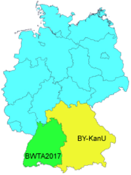
10th April 2017
GeoTools support precise NTv2 Solutions for Real Estate Cadastres.jpg)
10th April 2017
Tracking Solution for Courier and Express Delivery Fleets.jpg)
9th April 2017
6 major construction companies adopt new BIM monitoring solution
8th April 2017
Intranet web mapping to South Gloucestershire Council.jpg)
7th April 2017
Cambridge Conference 2017 - Mapping Nations: The Next Decade.jpg)
7th April 2017
Compact, High-Performance OEM GNSS Sensor for System Integrators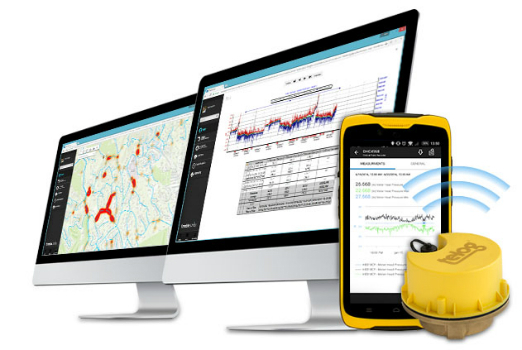
6th April 2017
Wireless Monitoring to Streamline Utility Operations6th April 2017
1Spatial Technology Makes German Mapping Authorities 40% Faster6th April 2017
A mobile phone for the gorilla!: BARTHAUER supports Zoological Society
6th April 2017
New Leica Zeno GG04 smart antenna enhances tracking performance_(002).jpg)
6th April 2017
Intelligent Telematics Shortlisted for Insurance Industry Award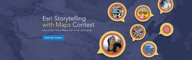
5th April 2017
Esri Announces 2017 Storytelling with Maps Contest
5th April 2017
Avineon Announces Head Start Initiative for Esri Utility Network5th April 2017
OGC appoints Dr. Luis Bermudez to head OGC Innovation Program.jpg)
5th April 2017
Digpro is growing and appoints a new Marketing Manager4th April 2017
Cyient partners with Amdocs to deploy GE's GIS, Smallworld.jpg)
4th April 2017
ClearEdge3D Releases VerityTM Construction Verification Software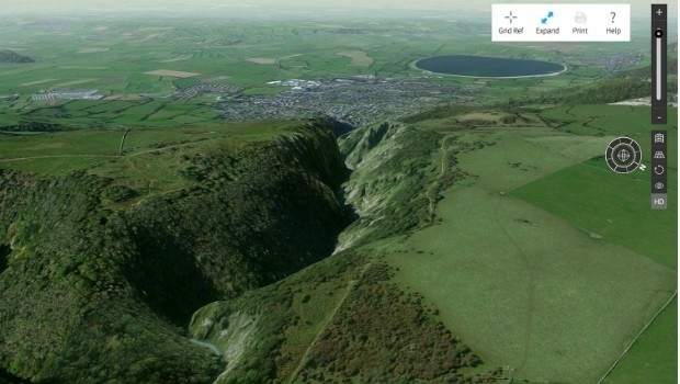
3rd April 2017
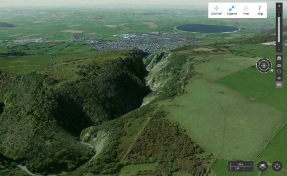
Explore Great Britain with OS’s ultimate adventure planning tool3rd April 2017
TCarta Marine to Introduce Gulf of Mexico Streaming Basemap Service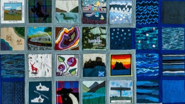
3rd April 2017
Crafty Ordnance Survey has Britain sewn up.jpg)
3rd April 2017
Airbus and SITA Join Forces to provide Advanced Cybersecurity Services2nd April 2017
Blue Marble Adds Flat Earth Support to Geographic Calculator.jpg)
2nd April 2017
Airbus-built satellite SES-10 successfully launched
2nd April 2017
Earth-i Ready to Develop the Australian Earth Observation Marketplace2nd April 2017
National Geospatial-Intelligence Agency Selects Esri_across_Leeds_at_Lower_Super_Output_Area_together_with_the.jpg)
2nd April 2017
Understanding local populations between censuses in Leeds31st March 2017
Solent Mind's training room receives a makeover
30th March 2017
Leica Geosystems opens nominations for Carl Pulfrich Award 2017