Satellite Positioning, Navigation & Timing (PNT)
Don't miss a beat, sign up to our newsletter

LAStools Win Big at INTERGEO Taking Home Two Innovation Awards
2nd October 2017
LAStools Win Big at INTERGEO Taking Home Two Innovation Awards
Fugro Wins Highway Data Collection Contract for The State Of Alaska
30th September 2017
Fugro Wins Highway Data Collection Contract for The State Of Alaska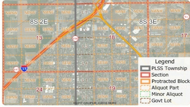
Free Public Land Survey System (PLSS) Data for Use with Maptitude
30th September 2017
Free Public Land Survey System (PLSS) Data for Use with Maptitude
Pitney Bowes selects HERE data to aid insurers
30th September 2017
Pitney Bowes selects HERE data to aid insurers

Successfully launching the 3rd Annual Smart Parking UAE Conference
28th September 2017
Successfully launching the 3rd Annual Smart Parking UAE Conference
INTERGEO 2017 – “We are bringing worlds together”
28th September 2017
INTERGEO 2017 – “We are bringing worlds together”
Astun Technology Supports Ordnance Survey
28th September 2017
Astun Technology Supports Ordnance Survey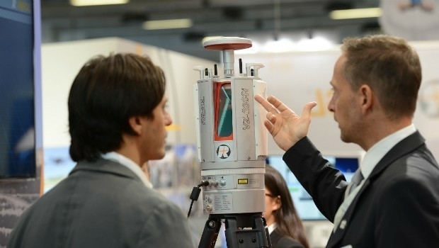
RIEGL announces significant product news at INTERGEO
28th September 2017
RIEGL announces significant product news at INTERGEO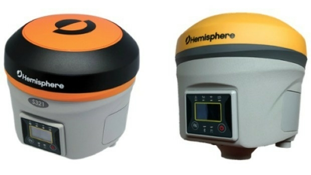
Hemisphere GNSS Debuts Next-Generation S321+ and C321+ GNSS Smart Antennas
28th September 2017
Hemisphere GNSS Debuts Next-Generation S321+ and C321+ GNSS Smart Antennas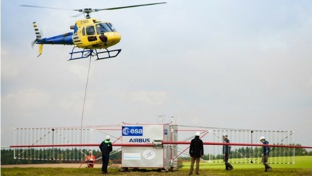
JUICE radar antenna tested in helicopter flight campaign
27th September 2017
JUICE radar antenna tested in helicopter flight campaign
Simplified Map Production from UAVs, from Trimble GNSS Base Station
27th September 2017
Simplified Map Production from UAVs, from Trimble GNSS Base Station.jpg)
First true tilt compensation GNSS is next Leica Captivate Experience
27th September 2017
First true tilt compensation GNSS is next Leica Captivate Experience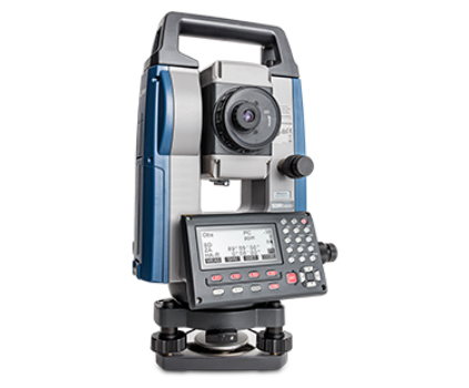
Sokkia introduces new manual total station with sophisticated features
27th September 2017
Sokkia introduces new manual total station with sophisticated features
Brainnwave Brings Unique Data Portal to Scotland Showcase
27th September 2017
Brainnwave Brings Unique Data Portal to Scotland Showcase
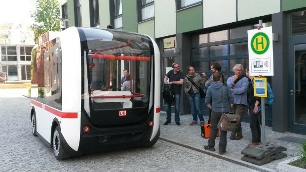
INTERGEO 2017 Berlin: Geo-IT-event officially opened
27th September 2017
INTERGEO 2017 Berlin: Geo-IT-event officially opened
Partnership Offers Analysis Software for Scholarship Winners
26th September 2017
Partnership Offers Analysis Software for Scholarship Winners
ArcGIS Pro Users 'Finding the Best Place for a Public Park'
26th September 2017
ArcGIS Pro Users 'Finding the Best Place for a Public Park'
Commercial UAV Expo Europe Moves to Amsterdam in April, 2018
26th September 2017
Commercial UAV Expo Europe Moves to Amsterdam in April, 2018
New extras added to Global Mapper V.19 - Now Availale
26th September 2017
New extras added to Global Mapper V.19 - Now Availale
YellowScan & Quantum Systems partnership
26th September 2017
YellowScan & Quantum Systems partnership
SSTL announces NovaSAR-S data deal with Australia’s CSIRO
26th September 2017
SSTL announces NovaSAR-S data deal with Australia’s CSIRO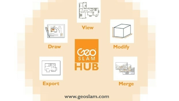
New Product Launches At Intergeo From GeoSLAM
25th September 2017
New Product Launches At Intergeo From GeoSLAM
Bureau Veritas joins Global Industry Alliance (GIA)
25th September 2017
Bureau Veritas joins Global Industry Alliance (GIA)
OS to support Singapore as a smart technology world leader
25th September 2017
OS to support Singapore as a smart technology world leader
Skyline Software Systems Opens Another European Office
25th September 2017
Skyline Software Systems Opens Another European Office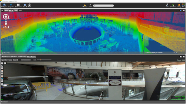
Orbit GT and Applanix, Canada, sign Reseller Agreement
25th September 2017
Orbit GT and Applanix, Canada, sign Reseller Agreement
Real-Time Construction Quality Management, Advanced
22nd September 2017
Real-Time Construction Quality Management, Advanced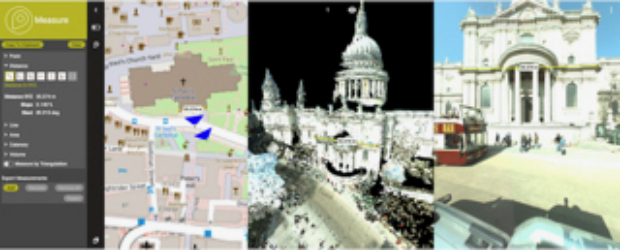
Orbit GT to showcase new 3D Mapping Cloud features at Intergeo, Berlin
22nd September 2017
Orbit GT to showcase new 3D Mapping Cloud features at Intergeo, Berlin
5 ways in which councils are to celebrate Gazetteers@GIS Day
22nd September 2017
5 ways in which councils are to celebrate Gazetteers@GIS Day
2017 URISA Exemplary Systems in Government Award Recipients Announced
21st September 2017
2017 URISA Exemplary Systems in Government Award Recipients Announced
BLK360 3D scanner wins Mondial du Bâtiment Innovation Award
21st September 2017
BLK360 3D scanner wins Mondial du Bâtiment Innovation Award
senseFly to launch industry-specific solutions at INTERGEO 2017
21st September 2017
senseFly to launch industry-specific solutions at INTERGEO 2017
LizardTech Awarded U.S. Patent for LiDAR Point Cloud Compression
21st September 2017
LizardTech Awarded U.S. Patent for LiDAR Point Cloud Compression
Wingtra partners with Kentucky-based Precision Capture
21st September 2017
Wingtra partners with Kentucky-based Precision Capture
Three Swedish neighbouring municipalities choose Digpro
21st September 2017
Three Swedish neighbouring municipalities choose Digpro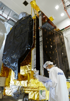
Airbus ships EchoStar 105/SES-11 telecom satellite to launch base
21st September 2017
Airbus ships EchoStar 105/SES-11 telecom satellite to launch base
Juniper Systems Limited Eyes German Market with InterGeo 2017 Exhibit
21st September 2017
Juniper Systems Limited Eyes German Market with InterGeo 2017 Exhibit
Presentations at Airborne ISR Conference
20th September 2017
Presentations at Airborne ISR Conference

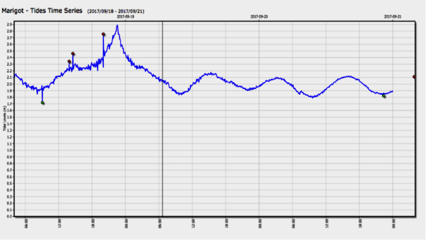
River Thames simulation supports safer navigation for Tideway
20th September 2017
River Thames simulation supports safer navigation for Tideway
Phase One Industrial Introduces 190MP Aerial System
20th September 2017
Phase One Industrial Introduces 190MP Aerial System
GeoCue Group Provides Free Lidar Data For Hurricane Impact Areas
19th September 2017
GeoCue Group Provides Free Lidar Data For Hurricane Impact Areas
Esri Podcast Series Explores How Location Technology Helps Businesses
19th September 2017
Esri Podcast Series Explores How Location Technology Helps Businesses
Bentley’s AECOsim Building Designer CONNECT Edition
19th September 2017
Bentley’s AECOsim Building Designer CONNECT Edition