
Satellite Positioning, Navigation & Timing (PNT)
Don't miss a beat, sign up to our newsletter
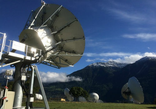
EUMETSAT takes ownership of two MTG ground stations
16th December 2017
EUMETSAT takes ownership of two MTG ground stations
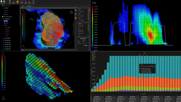
Big Data Analytics for Geospatial Solutions Accelerated
16th December 2017
Big Data Analytics for Geospatial Solutions Accelerated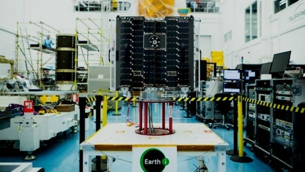
Earth-i chooses Spacemetric for image and video processing
15th December 2017
Earth-i chooses Spacemetric for image and video processing
GeoSLAM Celebrates 5 Years In Business With New HQ & Record Growth
15th December 2017
GeoSLAM Celebrates 5 Years In Business With New HQ & Record Growth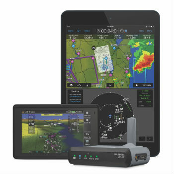
Garmin® announces availability for the GDL® 52
14th December 2017
Garmin® announces availability for the GDL® 52
Mobility on Demand: Demand-driven transport
14th December 2017
Mobility on Demand: Demand-driven transport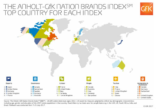
Anholt-GfK Nation Brands Index study, 2017
14th December 2017
Anholt-GfK Nation Brands Index study, 2017
ESA selects Airbus for Copernicus Data and Information Access Service
14th December 2017
ESA selects Airbus for Copernicus Data and Information Access Service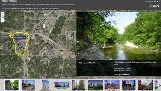
Esri Maps Highlight Net Neutrality Implications
14th December 2017
Esri Maps Highlight Net Neutrality Implications
GPS III and OCX Successfully Complete Factory Mission Readiness Test
14th December 2017
GPS III and OCX Successfully Complete Factory Mission Readiness Test
Caliper Corporation (Maptitude, TransCAD) Joins the USGS Coalition
14th December 2017
Caliper Corporation (Maptitude, TransCAD) Joins the USGS Coalition
Orbit GT and Mena 3D, Germany, sign Reseller Agreement
14th December 2017
Orbit GT and Mena 3D, Germany, sign Reseller Agreement
RUAS and Bangor University work together
13th December 2017
RUAS and Bangor University work together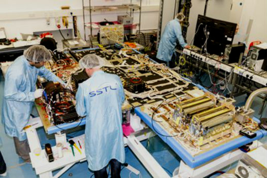

Maptitude Mapping Software Donated to USGIF Academic Partners
13th December 2017
Maptitude Mapping Software Donated to USGIF Academic Partners
Phase One Releases iX Capture 3.0 Software for Aerial Photography
13th December 2017
Phase One Releases iX Capture 3.0 Software for Aerial Photography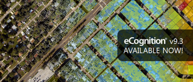
New Version of Trimble eCognition Suite available
12th December 2017
New Version of Trimble eCognition Suite available
Personal touch – what Brits really want this Christmas
12th December 2017
Personal touch – what Brits really want this Christmas
ASCO-DAITO selects Siteco Pave-Scanner Pavement Mobile Mapping System
12th December 2017
ASCO-DAITO selects Siteco Pave-Scanner Pavement Mobile Mapping System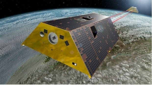
Maptek unveils new strategic panel caving application
12th December 2017
Maptek unveils new strategic panel caving application
Esri Technology Will Help Power United Nations' New Global Data Hub
12th December 2017
Esri Technology Will Help Power United Nations' New Global Data Hub
OGC Calls for Participation in Major Innovation Testbed (Testbed 14)
11th December 2017
OGC Calls for Participation in Major Innovation Testbed (Testbed 14)
HERE announces new appointments for Americas and EMEA regions
11th December 2017
HERE announces new appointments for Americas and EMEA regions
Finding data ranks as top challenge for geoscience data management
8th December 2017
Finding data ranks as top challenge for geoscience data management

Fugro Specialist Takes Up Role With British Geotechnical Association
7th December 2017
Fugro Specialist Takes Up Role With British Geotechnical Association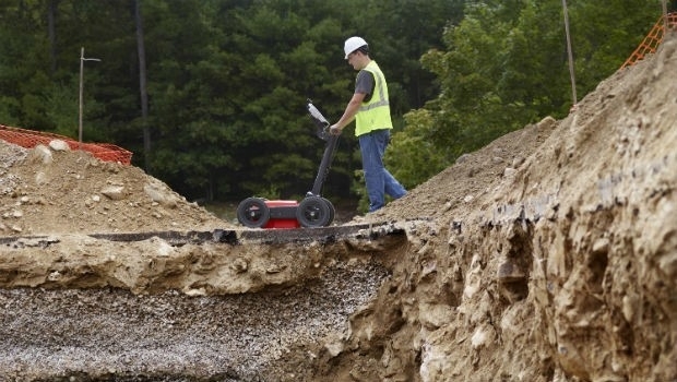
GSSI to Showcase New UtilityScan® GPR System and Profiler™
7th December 2017
GSSI to Showcase New UtilityScan® GPR System and Profiler™
Brampton Brick Chooses Flexipod Proof Of Delivery Software
7th December 2017
Brampton Brick Chooses Flexipod Proof Of Delivery Software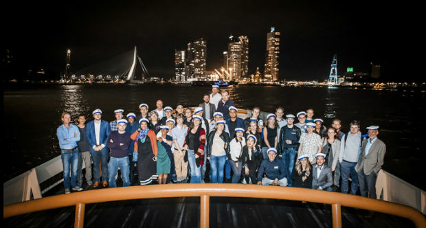
VSTEP Simulation acknowledged with ISO 9001:2015
7th December 2017
VSTEP Simulation acknowledged with ISO 9001:2015
Satellite investment recovered after first year of operations
7th December 2017
Satellite investment recovered after first year of operations
EUMETSAT takes steps to extend Meteosat and EPS operations
7th December 2017
EUMETSAT takes steps to extend Meteosat and EPS operations
CGG Releases Multi-Client Airborne GravMag Survey
7th December 2017
CGG Releases Multi-Client Airborne GravMag Survey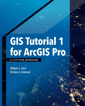
Esri Publishes a Textbook on How to Use ArcGIS Pro
7th December 2017
Esri Publishes a Textbook on How to Use ArcGIS Pro
HERE earns top spot in Strategy Analytics' 2017
6th December 2017
HERE earns top spot in Strategy Analytics' 2017
telent announced as Control Room Awards Platinum Sponsor
6th December 2017
telent announced as Control Room Awards Platinum Sponsor
GeoPlace Recognised As An Investor In People
6th December 2017
GeoPlace Recognised As An Investor In People
Elbit to Provide and Operate Simulators for IAF Transport Aircraft
6th December 2017
Elbit to Provide and Operate Simulators for IAF Transport Aircraft
Monsanto and Boundless Collaborate for Open Source GIS Contributions
6th December 2017
Monsanto and Boundless Collaborate for Open Source GIS Contributions
EUMETSAT ground segment is ready for launch of Copernicus Sentinel-3B
6th December 2017
EUMETSAT ground segment is ready for launch of Copernicus Sentinel-3B
Virtual simulation for river users to navigate the Boston Barrier
6th December 2017
Virtual simulation for river users to navigate the Boston Barrier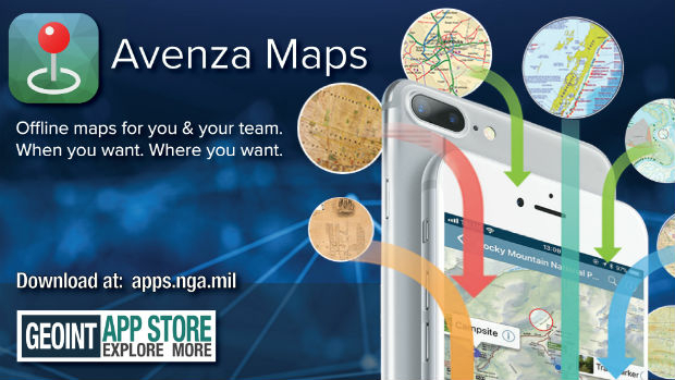
Avenza Maps iOS App Launches In The GEOINT App Store
6th December 2017
Avenza Maps iOS App Launches In The GEOINT App Store
Committed Revenue Backlog for UrtheDailyTM Constellation
6th December 2017
Committed Revenue Backlog for UrtheDailyTM Constellation