
Satellite Positioning, Navigation & Timing (PNT)
Don't miss a beat, sign up to our newsletter

VerifEye Technologies Amovi VOC Camera now available with Geotab
4th May 2016
VerifEye Technologies Amovi VOC Camera now available with Geotab
Airbus and Hexagon Geospatial Sign Content Agreement for Smart M.App
4th May 2016
Airbus and Hexagon Geospatial Sign Content Agreement for Smart M.AppMasternaut launches telematics module that spots vehicle faults
4th May 2016
Masternaut launches telematics module that spots vehicle faultsLeica releases new calibration system for value-added service
4th May 2016
Leica releases new calibration system for value-added service
Partner: Aligned Assets Introduces what3words into Gazetteer Products
4th May 2016
Partner: Aligned Assets Introduces what3words into Gazetteer Products
ABPmer reviews MMO's marine information system
4th May 2016
ABPmer reviews MMO's marine information system
OGC requests comment for Land Administration Domain Working Group
3rd May 2016
OGC requests comment for Land Administration Domain Working Group
Introducing AeryonLive – the SaaS platform for UAS fleet management
3rd May 2016
Introducing AeryonLive – the SaaS platform for UAS fleet managementAirbus Defence and Space signs contract to build Biomass
3rd May 2016
Airbus Defence and Space signs contract to build Biomass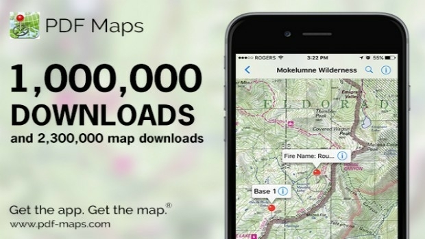
Avenza’s PDF Maps App Surpasses One Million Downloads
3rd May 2016
Avenza’s PDF Maps App Surpasses One Million Downloads
Photos shared on Flickr used to track world's protest hotspots
3rd May 2016
Photos shared on Flickr used to track world's protest hotspots
Leica Captivate Experience continues with self-learning GNSS
3rd May 2016
Leica Captivate Experience continues with self-learning GNSS
Settop CellXtrem: Create your own CORS solution
3rd May 2016
Settop CellXtrem: Create your own CORS solution
Diversified Communications Launches Commercial UAV News Site
3rd May 2016
Diversified Communications Launches Commercial UAV News Site
indoo.rs Named a 2016 Cool Vendor in Mobile and Wireless by Gartner
2nd May 2016
indoo.rs Named a 2016 Cool Vendor in Mobile and Wireless by Gartner
Mallorca hosts the fourteenth day of Smartcities
29th April 2016
Mallorca hosts the fourteenth day of Smartcities
CGG Enters into Agreement for the Sale of its Multi-Physics Business
29th April 2016
CGG Enters into Agreement for the Sale of its Multi-Physics Business
UNITAR and Esri Host Annual Conference in Geneva
29th April 2016
UNITAR and Esri Host Annual Conference in Geneva
Merrick Awarded Contract with Southern Nevada Water Authority
28th April 2016
Merrick Awarded Contract with Southern Nevada Water Authority
Announcing Bentley OpenRoads Navigator App
28th April 2016
Announcing Bentley OpenRoads Navigator App
MICROMINE and Carlson Software Inc. Strengthen Partnership
28th April 2016
MICROMINE and Carlson Software Inc. Strengthen Partnership
DigitalGlobe to Provide WorldView-4 Access for a New Customer
28th April 2016
DigitalGlobe to Provide WorldView-4 Access for a New Customer
DigitalGlobe Reports First Quarter 2016 Results
28th April 2016
DigitalGlobe Reports First Quarter 2016 Results
Aligned Assets are pleased to announce partnership with what3words
27th April 2016
Aligned Assets are pleased to announce partnership with what3words
NCTech and Top Gear USA capture the Rubicon Trail in 360 degrees
27th April 2016
NCTech and Top Gear USA capture the Rubicon Trail in 360 degrees

Local Community in France Selects SuperPad for River Management
27th April 2016
Local Community in France Selects SuperPad for River Management
SuperSurv Assists the Bird Survey in France
27th April 2016
SuperSurv Assists the Bird Survey in France
Call for Speakers for North America’s Largest Commercial Drone Show
27th April 2016
Call for Speakers for North America’s Largest Commercial Drone Show
Esri Announces Winners of the Visualize Your Water Quality Challenge
27th April 2016
Esri Announces Winners of the Visualize Your Water Quality Challenge
RAC’s New Canadian Rail Portal is powered by K2 Geospatial’s JMap
27th April 2016
RAC’s New Canadian Rail Portal is powered by K2 Geospatial’s JMap
New Mexico Chooses Hexagon Safety & Infrastructure
26th April 2016
New Mexico Chooses Hexagon Safety & Infrastructure
HERE Traffic improves ETA in latest Telogis Navigation
26th April 2016
HERE Traffic improves ETA in latest Telogis Navigation
Ordnance Survey staff raise over £25,000 for Holding Little Hands
26th April 2016
Ordnance Survey staff raise over £25,000 for Holding Little Hands
Announcing Euclideon Geoverse 1.4 Including Autocad® Support
26th April 2016
Announcing Euclideon Geoverse 1.4 Including Autocad® Support
Elsevier and Schlumberger Integrate Partnership Further
26th April 2016
Elsevier and Schlumberger Integrate Partnership FurtherLeica Geosystems delivers 10th DMC III aerial camera
26th April 2016
Leica Geosystems delivers 10th DMC III aerial camera
Sentinel-1B on its way to complete Europe´s “Radar Vision”
26th April 2016
Sentinel-1B on its way to complete Europe´s “Radar Vision”
Juniper Unmanned and Pulse Aerospace Announce Business Partnership
26th April 2016
Juniper Unmanned and Pulse Aerospace Announce Business Partnership
SimActive Achieves Breakthrough with Latest Correlator3D™ Release
26th April 2016
SimActive Achieves Breakthrough with Latest Correlator3D™ Release