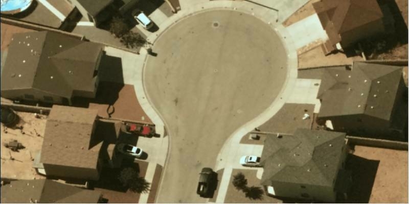
New 10-Centimeter Resolution Now Accessible with Stratospheric Balloons
7th February 2022
New 10-Centimeter Resolution Now Accessible with Stratospheric Balloons
7th February 2022
New 10-Centimeter Resolution Now Accessible with Stratospheric Balloons2nd February 2022
Second Generation COSMO-SkyMed Satellite Successfully Launched28th January 2022
EUSPA to further boost space investments with CASSINI26th January 2022
OGC Publishes Best Practice for Earth Observation Application Packages24th January 2022
The International Space Station connected via the SpaceDataHighway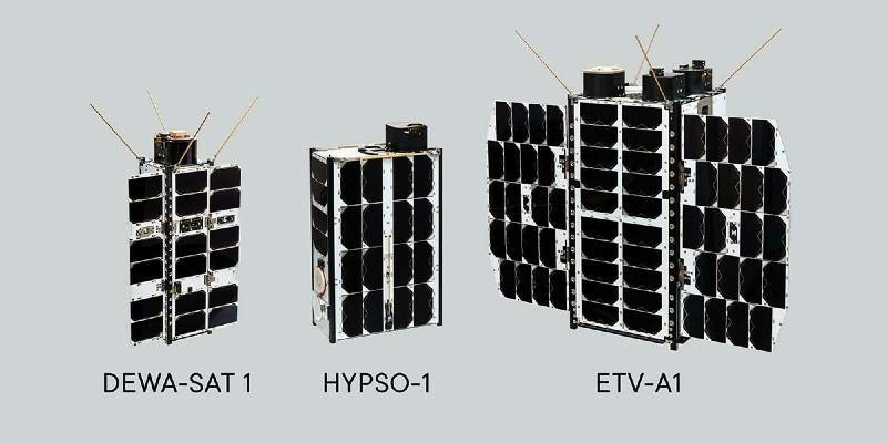
21st January 2022
NanoAvionics launched three satellites, including one of the largest CubeSats ever built, aboard SpaceX Transporter-3 mission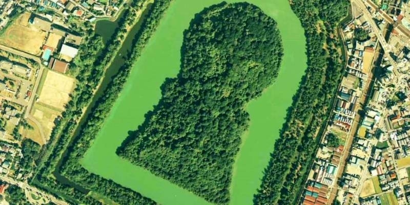
20th January 2022
The secrets of ancient Japanese tombs revealed thanks to satellite images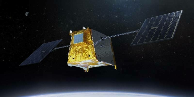
16th January 2022
Industry first: Loft Orbital signs agreement with Airbus to procure more than fifteen Arrow satellite platforms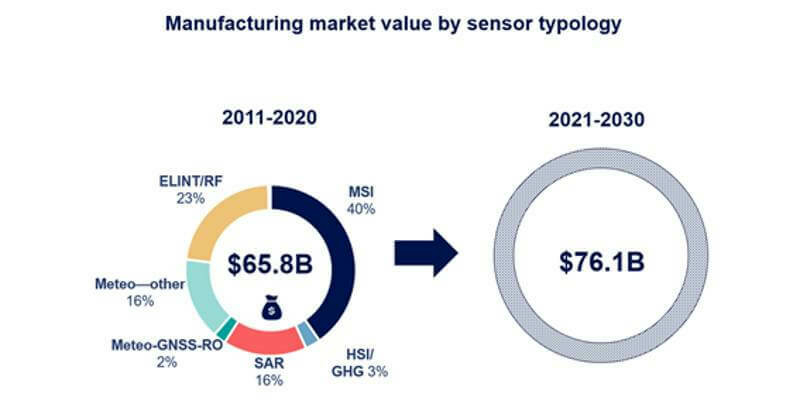
13th January 2022
Manufacturing revenues for Earth observation to grow to $76.1 billion by 203011th January 2022
Airbus to develop the Power Management and Distribution System for key Lunar Gateway module15th December 2021
UP42 Announces Thetaspace as Copernicus Masters Challenge Winner with Solution to Cloud Cover in EO Data14th December 2021
Airbus and OneWeb expand their partnership to connect European defence and security forces10th December 2021
Airbus Imagery and Elevation Data Now Available in Microsoft Azure Maps
10th December 2021
Microsoft and Esri Deliver Centralized Satellite Image Analysis in Azure Orbital
6th December 2021
Airbus completes second ocean satellite Sentinel-6B30th November 2021
Europe’s first polar-orbiting weather satellite successfully deorbited
29th November 2021
European-US satellite mission critical for measuring impact of climate change on oceans24th November 2021
SSC rolls out the world’s first global Ka-band network
18th November 2021
NanoAvionics to launch its 5th satellite rideshare mission with new MP42 bus aboard SpaceX Transporter-416th November 2021
Exolaunch signs new multi-launch agreement with SpaceX, expanding its capacity for rideshare missions16th November 2021
CERES reconnaissance space system designed by Airbus and Thales successfully launched11th November 2021
CSUG & Teledyne e2v Unveil AI-Enabled Smart Nanosatellite with On-Board Imaging Processing at Space Tech Expo 20218th November 2021
NASA, USGS Release First Landsat 9 Images5th November 2021
State-of-the-art software to catalogue space debris for the German Space Agency4th November 2021
UP42 Unveils Very High-Resolution Imagery from Airbus Pléiades Neo Satellites28th October 2021
SSC and Bradford ECAPS sign MoU regarding commercial orbital debris removal services27th October 2021
OneWeb and Tampnet sign agreement to further develop the next generation of offshore connectivity capabilities27th October 2021
Airbus, Air Liquide and ispace Europe launch EURO2MOON, a non-profit European platform to explore future uses of natural lunar resources19th October 2021
Webb space telescope en route to the stars8th October 2021
JICA and Synspective start demonstration for the development of a disaster prevention management system in Guatemala using SAR satellite data8th October 2021
Weather satellite MetOp-SG B rockets ahead8th October 2021
Less than 4 Weeks to SMi’s 23rd Annual Global MilSatCom Confex in London30th September 2021
Space Tech Expo returns to Long Beach in 202129th September 2021
25 years of successful cooperation between GAF AG, DLR and Antrix28th September 2021
Advanced European satellites to benefit African weather and climate forecasting27th September 2021
Challenge of protecting against extreme weather shapes new EUMETSAT strategy17th September 2021
SMi's 23rd Annual Global MilSatCom Confex - day two USA focused expert speakers announced7th September 2021
ScanWorld and ConstellR join forces towards a comprehensive source of high-value satellite imagery for agriculture and vegetation monitoring31st August 2021
International Expert Speakers join SMi's 23rd Annual Global MilSatCom Conference and Exhibition27th August 2021
Astroscale’s ELSA-d Successfully Demonstrates Repeated Magnetic Capture26th August 2021
First-Ever Satellite Capture of Methane Emissions from Trona Mining23rd August 2021
OneWeb Confirms Another Successful Launch, Accelerating Business Momentum20th August 2021
Airbus’ UP42 Partners with Indian Startup HyperVerge for AI-based Satellite Imagery Analytics
19th August 2021
Catherine Jestin joins Airbus’ Executive Committee as EVP Digital and Information Management