
GeoSmart's response to the National Flood Review
9th September 2016
GeoSmart's response to the National Flood Review9th September 2016
GeoSmart's response to the National Flood Review9th September 2016
Airbus Defence and Space’s PerúSAT-1 satellite ready for take-off9th September 2016
East View Announces Availability of Newest LandScan Database6th September 2016
Airbus Defence and Space opens new logistics centre in Bremen6th September 2016
Lockheed Martin Selects Microsemi’s Master Reference Oscillators6th September 2016
Phase One Industrial Innovates Four Band Aerial Imaging6th September 2016
Phase One Industrial Launches iXU-RS Aerial Camera Series6th September 2016
Orbit GT launches QGIS plugin for Mobile Mapping.5th September 2016
Become a Mentor in the Copernicus Accelerator Programme2nd September 2016
Cruise Ship Traversing the Northwest Passage2nd September 2016
Scientists take to the skies to track West African pollution31st August 2016
3D Laser Mapping Unveils New Multi-Platform Mapping System In Africa30th August 2016
Continuously Monitoring the World's Commercial Fleet30th August 2016
How to Legally Operate Drones Under New FAA Regulation29th August 2016
Free on-line course on satellites’ role in monitoring oceans health29th August 2016
VisionMap A3 Edge Innovates Precision Agriculture in North Dakota26th August 2016
European Space Imaging & Planetek Italia support earthquake emergency26th August 2016
UAVAir highlights changes to ANO affecting commercial UAV pilots26th August 2016
East View Geospatial Introduces New Image Analysis Services26th August 2016
M6.2 Earthquake - 10km SE of Norcia, Italy - Impact Summary Map25th August 2016
European Space Imaging earthquake images of Amatrice, Italy24th August 2016
Honeywell Hardware Awarded Final Certification24th August 2016
Pioneering British business uses satellite data analytics23rd August 2016
HERMES® 450 soars during the North Dakota UAS Field Day22nd August 2016
Stesalit Systems Ltd supplies GPS PDA to Odisha Forestry Department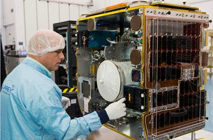
18th August 2016
senseFly & Air Nav Pro join forces to reduce mid-air collisions17th August 2016
exactEarth Announces Small Vessel Tracking Contract16th August 2016
Airbus D&S Celebrates Seven Years of Multispectral Imaging from UK-DMC12th August 2016
European Space Imaging announces new partnership with Vricon12th August 2016
PCI Geomatics Releases Geomatica 2016 Service Pack 1
10th August 2016
Barrow Upon Soar Rail Closure Prompts Monitoring Calls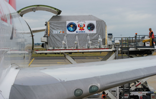
6th August 2016
PerúSAT-1 satellite is now on its way to Kourou launch site
5th August 2016
160 Commercial Drone Companies Showcase UAV Technology at InterDrone2nd August 2016
New senseFly financing and insurance packages for Drone operators2nd August 2016
AirGon LLC Revolutionizes Drone Data Extraction
27th July 2016
Lehmann Aviation redefines mapping drones with brand-new L-A Series27th July 2016
Future of drone use within business set to change_(1).jpg)
27th July 2016
Airbus Defence and Space Launches “One Tasking”20th July 2016
Airbus Defence and Space Launches “One Tasking”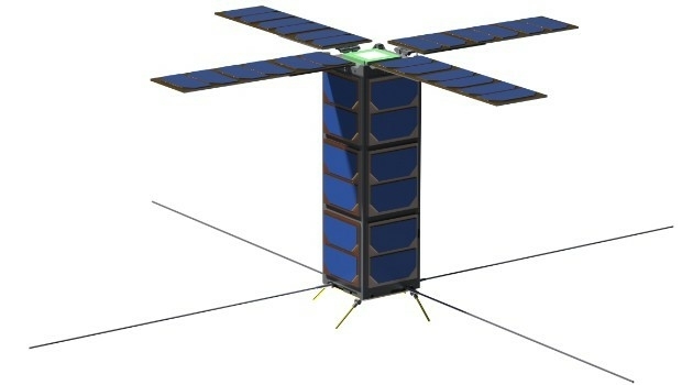
19th July 2016
SSTL expands LEO platform capability with VESTA nanosatellite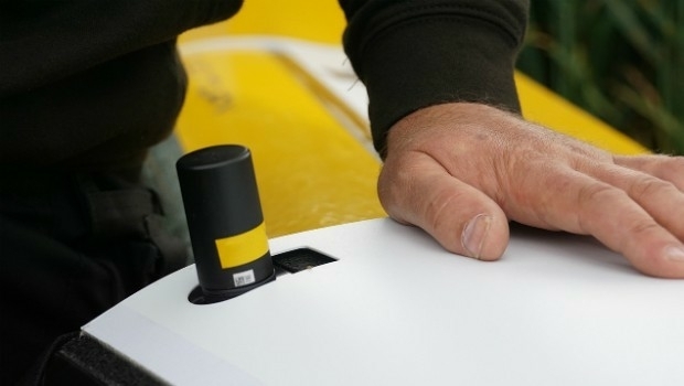
18th July 2016
QuestUAV Provides Own PPK Solution For Q-200 Surveyor UAV