Fugro Announces Partnership With Shell Ocean Discovery XPRIZE
17th February 2017
Fugro Announces Partnership With Shell Ocean Discovery XPRIZE
17th February 2017
Fugro Announces Partnership With Shell Ocean Discovery XPRIZE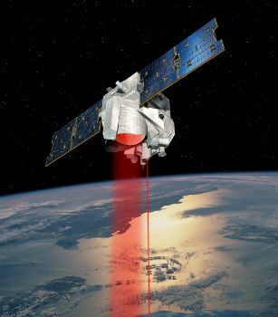
17th February 2017
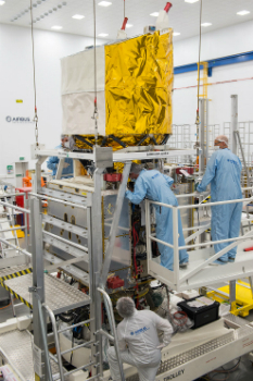
MERLIN – the first Franco-German Earth observation satellite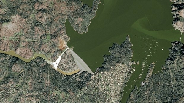
17th February 2017
Oroville Lake Water Elevation seen from Space16th February 2017
Advanced Groundwater Technologies Joins PCI Reseller Partner Network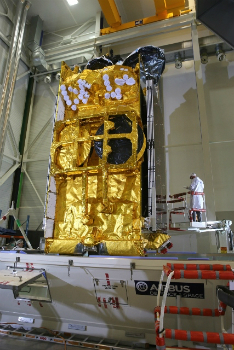
15th February 2017
Airbus-built SKY Brasil-1 satellite successfully launched by Ariane 5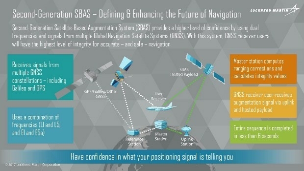
11th February 2017
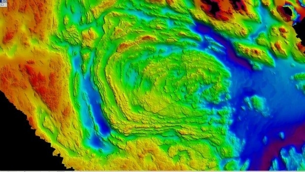
Geoscience Australia and Lockheed Martin Begin Collaborative Research Project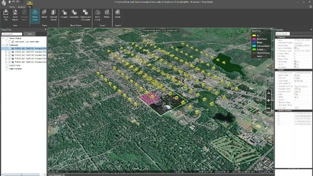
10th February 2017
Skyline Software Systems Releases PhotoMesh 7.1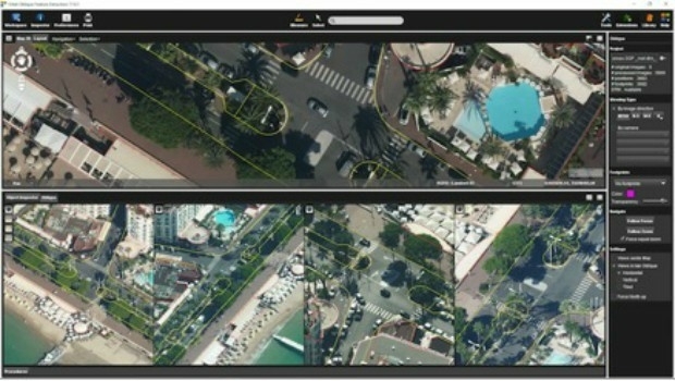
10th February 2017
Orbit GT releases Oblique Mapping and Feature Extraction v179th February 2017
Aeryon and DroneDeploy Partner to Deliver Enterprise UAS Solutions9th February 2017
Blue Marble's Latest Innovations in the Global Mapper LiDAR Module8th February 2017
CSA Presents Advanced Coastal Aerial Image Analysis Techniques
8th February 2017
PCI Joins the Geological Remote Sensing Group
8th February 2017
Elbit awarded contract to upgrade Helicopters for Asia-Pacific Country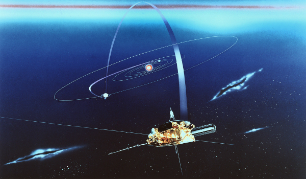
6th February 2017
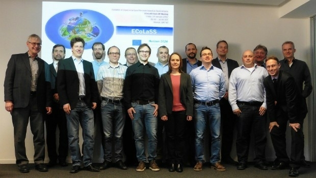
GAF AG and Partners to Investigate the Future Evolution of Copernicus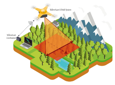
6th February 2017
YellowScan launches YellowScan LiveStation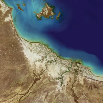

3rd February 2017
Digital Earth & Locate17 Showcases Geospatial‚s Enabling Role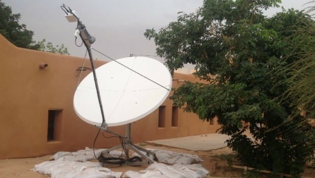
2nd February 2017
Satcom for EU security missions in Mali, Niger and Somalia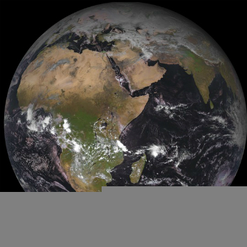
1st February 2017
The 2nd generation Meteosat-8 satellite takes over Meteosat-7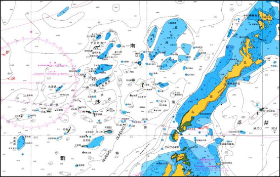
1st February 2017
East View Expands South China Sea Imaging Capabilities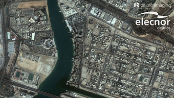
31st January 2017
Ordnance Survey International helps the UAE manage Climate Change
31st January 2017
A Case Study on Long-Term Erosion Mapping in Northeast England

31st January 2017
Successful Ground Trials of Volcanic Ash Detection31st January 2017
Blue Marble Teams Up with Pointerra to Provide Cloud-Based LiDAR Data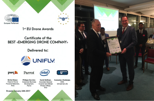
27th January 2017
UNIFLY Winner of Best Emerging EU Drone Company25th January 2017
PCI Selects Sole Authorized Reseller in Ecuador25th January 2017
COSMO-SkyMed data and services for the Japanese government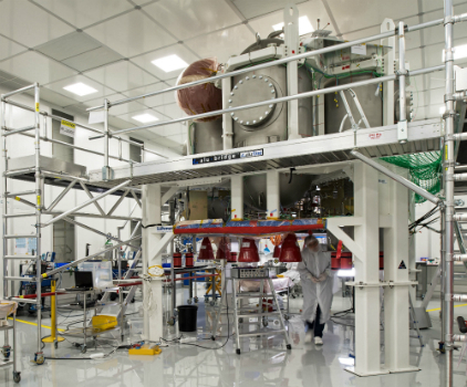
25th January 2017
Propulsion test module for the Orion programme delivered to NASA
24th January 2017
Airport GIS | LiDAR, imagery and feature extraction for airport operations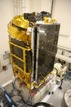
20th January 2017
Airbus ready to ship Aeolus for final testing ahead of launch18th January 2017
RICS Geomatics Evening Lectures 2016-17 sessions17th January 2017
SimActive Used for Coastal Erosion Assessment with UAVs
16th January 2017
exactEarth Adds 4 Payloads to Second Generation Constellation16th January 2017
Successful Initial Launch for Second Generation Real-Time Constellation
16th January 2017
Airbus Defence and Space ships SES-10 telecom satellite to launch site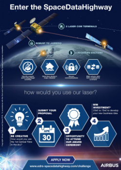
12th January 2017
Airbus Launches “Enter the SpaceDataHighway” Challenge11th January 2017
Collaboration with Deimos Imaging to Support the PanGeo Alliance10th January 2017
Whitepaper - The Future of Geospatial Imagery Collection Analysis Exploitation & Exchange
9th January 2017
Ecometrica secures breakthrough £14.2m UK Space Agency contract9th January 2017
BARSC Welcomes the Satellite Applications Catapult as New Member6th January 2017
Southern Hemisphere Space Program to tackle the final frontier5th January 2017
Earth-i has Quality at the Heart of Operations