WorldView-4 satellite imagery in 30cm resolution
31st May 2017
WorldView-4 satellite imagery in 30cm resolution31st May 2017
WorldView-4 satellite imagery in 30cm resolution31st May 2017
exactEarth Launches Global Real-Time Vessel Tracking Service30th May 2017
Airbus Defence and Space launches “Global Earth Observation Challenge”30th May 2017
Plans For Europe’s First Commercial Video Satellite Constellation26th May 2017
Airbus and Scanex to feed Russia’s most popular search engine Yandex24th May 2017
Airbus further extends channel partner programme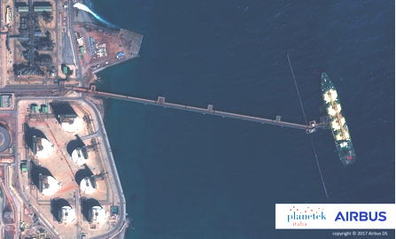
17th May 2017
Eni to utilize Earth Observation satellite data and services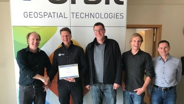
17th May 2017
Orbit GT and Vexcel Imaging, Austria update Gold Reseller status17th May 2017
Space Flight Laboratory (SFL) Signs Contract with Dubai Space Centre17th May 2017
Further Democratize GeoData and GeoServices Use for R&D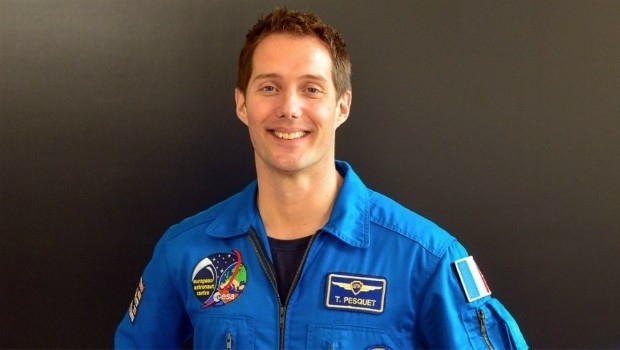
17th May 2017
Thomas Pesquet's return to Earth after 6 months in space
16th May 2017
EUMETSAT to host information day on crucial data access procurement
15th May 2017
New satellite hub lays groundwork for the future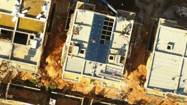
15th May 2017
Icaros Releases Ver 5.0 of OneButton™ Drone Image Processing Software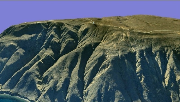
15th May 2017
AeroScientific Picture of the Month May 2017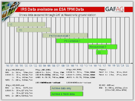
15th May 2017
IRS data now available free of charge to scientific users12th May 2017
Mobile Friendly Version of the GeoCalc Geodetic Registry Released11th May 2017
Inmarsat and Actility deploy city-wide Internet of Things network10th May 2017
Duke of Edinburgh's Award Entrusts SPOT and Mapyx10th May 2017
Eni to utilize Earth Observation satellite data and services9th May 2017
European satellite technology maps storms, pollution and marine safety9th May 2017
PCI Geomatics Now a Planet Ecosystem Partner8th May 2017
exactEarth Announce Two-Year $1.45 Million Commercial Customer Renewal5th May 2017
PCI Geomatics to Present OBIA and InSAR Papers at ISRSE-373rd May 2017
A Triumph of Keynote Lectures to delve into Space Exploration3rd May 2017
Global Mapper and Geographic Calculator Free Academic License Program2nd May 2017
Kepler Award Nominations Now Being Accepted by ION Satellite Division2nd May 2017
Satellite Fleet Owner Joins The Geological Remote Sensing Group28th April 2017
Scientists look to the Moon to better understand Earth’s climate27th April 2017
GAF and partners awarded contract to map European riparian zones27th April 2017
PlanetObserver announces release of PlanetSAT Global imagery basemap
19th April 2017
Space Flight Laboratory (SFL) at IAA Berlin19th April 2017
EarthCARE: Japanese Cloud Radar meets its spacecraft for first time19th April 2017
MNSAT: IFGICT to work with KSF Space Mapping to protect environment18th April 2017
Distribution of WorldView-4 satellite imagery in Europe begins18th April 2017
Trumbull Unmanned Using SimActive for Emergency Response13th April 2017
Global push for Earth observations continues
12th April 2017
Ecometrica lands on FT1000 list of Europe's fastest growing companies7th April 2017
Cambridge Conference 2017 - Mapping Nations: The Next Decade