Col-East Taps Extensive Image Archive to Create Multi-Function Maps
6th October 2017
Col-East Taps Extensive Image Archive to Create Multi-Function Maps
6th October 2017
Col-East Taps Extensive Image Archive to Create Multi-Function Maps5th October 2017
Commercial UAV Expo to include Workshops/Demos/Training5th October 2017
Turn your great idea into a great business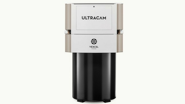
4th October 2017
Vexcel Imaging introduces the new UltraCam Eagle Mark 3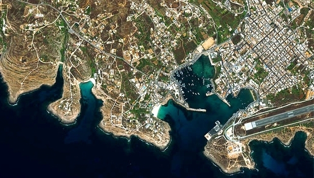
3rd October 2017
Satellite Images show Europe's diversity in new book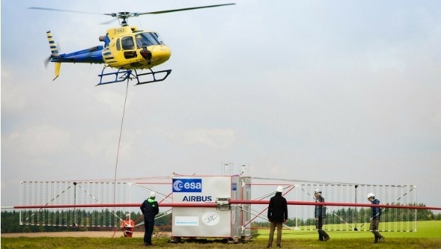
27th September 2017
JUICE radar antenna tested in helicopter flight campaign26th September 2017
Partnership Offers Analysis Software for Scholarship Winners26th September 2017
New extras added to Global Mapper V.19 - Now Availale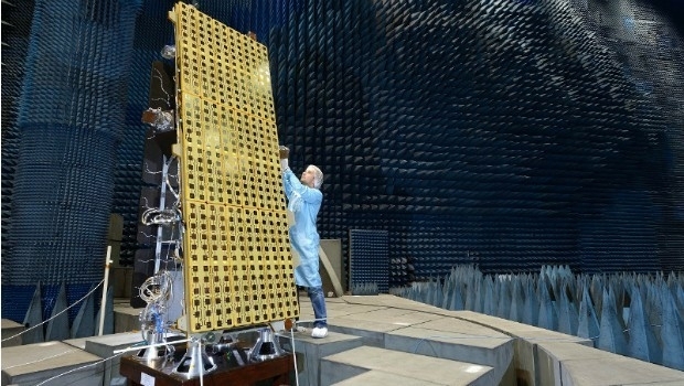
26th September 2017
SSTL announces NovaSAR-S data deal with Australia’s CSIRO
21st September 2017
senseFly to launch industry-specific solutions at INTERGEO 201721st September 2017
LizardTech Awarded U.S. Patent for LiDAR Point Cloud Compression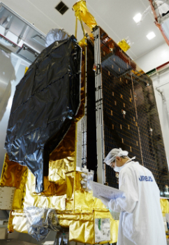
21st September 2017
Airbus ships EchoStar 105/SES-11 telecom satellite to launch base20th September 2017
Presentations at Airborne ISR Conference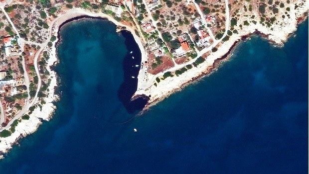
20th September 2017
Phase One Industrial Introduces 190MP Aerial System18th September 2017
Northern Ireland’s SMEs look to Space for new business opportunities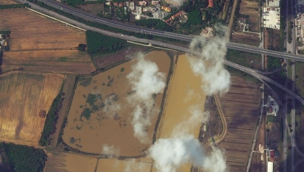
15th September 2017
Italy: Satellite Images of Flooding in Livorno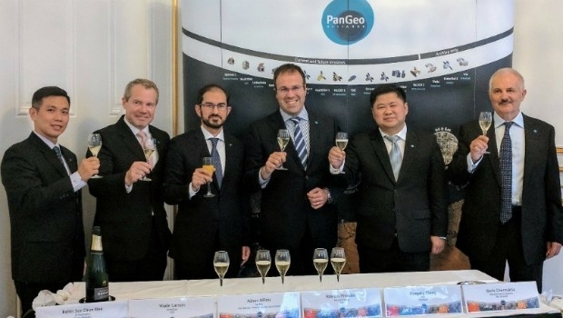
14th September 2017
The PanGeo Alliance welcomes a new member13th September 2017
PCI Geomatics Releases Geomatica 2017, Service Pack 1_Airbus_DS.jpg)
12th September 2017
Airbus to reshape Earth observation market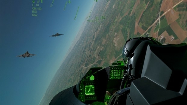
12th September 2017
Elbit Systems and CAE Team to Pursue UK Defence Training Capability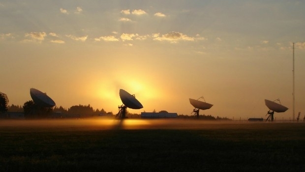
11th September 2017
The future European Governmental Satellite Communications programme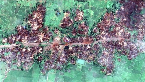
7th September 2017
Myanmar: Satellite Images Show Massive Fire Destruction7th September 2017
Globalstar Brings the Power of the Sun to IoT Asset Management7th September 2017
Agenda for 19th Global MilSatCom Conference and Exhibition Released
5th September 2017
100% success rate in European Commission’s 2017 CwRS Program5th September 2017
Second Lockheed Martin GPS III Satellite Successfully Completes Test
2nd September 2017
Qelzal Starts Flight Safety Testing of Autonomous Vision Sensor System1st September 2017
Free Global Mapper to Organizations Responding to Hurricane Harvey
1st September 2017
National agency will double Australia's space industry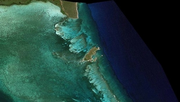
31st August 2017
Optimizing Maritime Safety and Efficiency
30th August 2017
Sentinel-5 Precursor begins final journey to launch site
29th August 2017
Advancing our Real-Time Global Vessel Tracking Service28th August 2017
SPOT 6/7 imagery for improved efficiency of US agriculture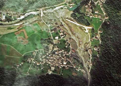
28th August 2017
Seen From Space: Landslide in the Swiss Alps
21st August 2017
Solar Orbiter on track to launch before next total solar eclipse18th August 2017
The Great Barrier Reef: Assessing its Health from SpaceAirbus2017.jpg)
17th August 2017
Airbus successfully tests Dispenser Structure for GRACE-FO satellites16th August 2017
Global Mapper Certification Classes in Atlanta and Ottawa Announced
15th August 2017
World’s polluters escape detection with outdated approach15th August 2017
Gold Sponsor of 17th International Scientific and Technical Conference11th August 2017
Drone based LiDAR for Aberystwyth University global research_Copyright_Airbus_2017.jpg)
10th August 2017
Airbus completes MetOp-C platform/payload coupling9th August 2017
Strategic Education Alliance Agreement with Stellenbosch University8th August 2017
Skyline Software Systems Releases Photomesh 7.2
8th August 2017
TCarta Marine Changes the Way Dynamic Environments are Managed
8th August 2017
Shingle B: the online tool helping protect and monitor shingle beaches