
DGI 18-The Premier Annual Meeting for Geospatial Intelligence Leaders
29th November 2017
DGI 18-The Premier Annual Meeting for Geospatial Intelligence Leaders
29th November 2017
DGI 18-The Premier Annual Meeting for Geospatial Intelligence Leaders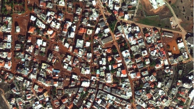
28th November 2017
Satellite Images of West Attica Flood Help Government Response28th November 2017
SimActive Introduces New Technology for True Orthos27th November 2017
SSTL confirms Sarah Parker’s appointment as MD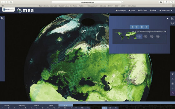
25th November 2017
EarthServer: 1+ Petabyte Analysis-Ready Datacubes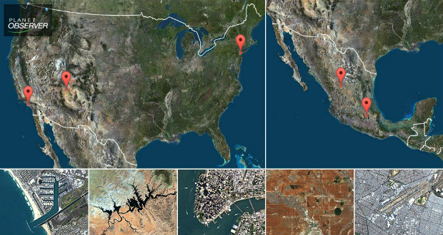
23rd November 2017
PlanetObserver presents new PlanetSAT Updates23rd November 2017
SSTL ships CARBONITE-2 and Telesat’s LEO-1 for PSLV launch
22nd November 2017
The PAZ satellite heads towards its launch base22nd November 2017
Active digital map for French Armed Forces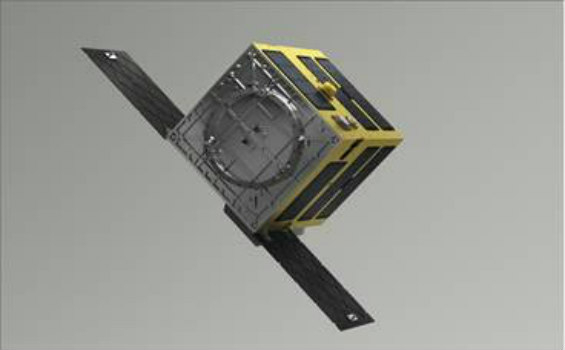
22nd November 2017
SSTL and ASTROSCALE team up for Orbital Debris Removal missions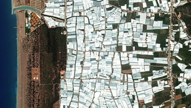
21st November 2017
Satellite Images of Turkey Show Whirlwind Damage20th November 2017
Announcement EuroSDR 2018 series of e-learning
16th November 2017
Utilities Management System wins Satellite Navigation Competition 2017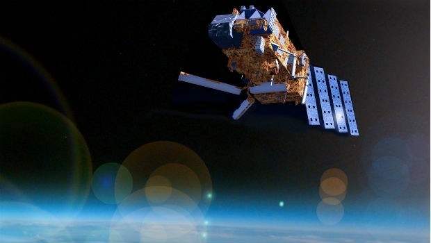
16th November 2017
“What will the weather be like?” – “Like this!”15th November 2017
SSTL to build UrtheCast’s UrtheDailyTM Constellation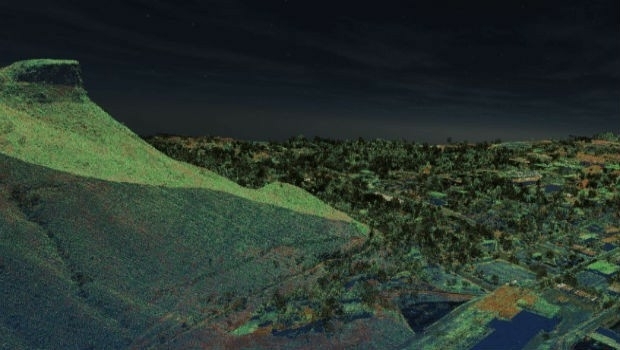
14th November 2017
Golden Software Releases Surfer® 2D and 3D14th November 2017
SSTL confirms sale of SST-US assets to General Atomics
13th November 2017
European Space Imaging celebrates 15 years of success13th November 2017
CDP wins secure Ecometrica's position for emissions reporting13th November 2017
Inmarsat and Pessl Instruments to deliver IoT solutions10th November 2017
Airbus receives go-ahead for twin GRACE-FO satellites10th November 2017
East View Geospatial Signs Reseller Contract with UrtheCast9th November 2017
Airbus signs in orbit demonstration contract with ESA9th November 2017
Airbus to build Türksat 5A and 5B satellites8th November 2017
OGC invites you to its Testbed 13 Demonstration Event
3rd November 2017
Phase One Industrial partners with Drone Nerds2nd November 2017
Airbus-built EchoStar 105/SES-11 satellite now in geostationary orbit1st November 2017
2018 ISPRS Call for Educational and Capacity Building Initiative31st October 2017
SimActive Automates Direct Georeferencing
28th October 2017
WorldView Global Alliance User Conference 2017 Report26th October 2017
PCI Geomatics Signs MOU with AGH University, in Krakow, Poland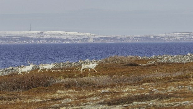
24th October 2017
Globalstar IoT Solution Protects Norway Reindeer from Train Collisions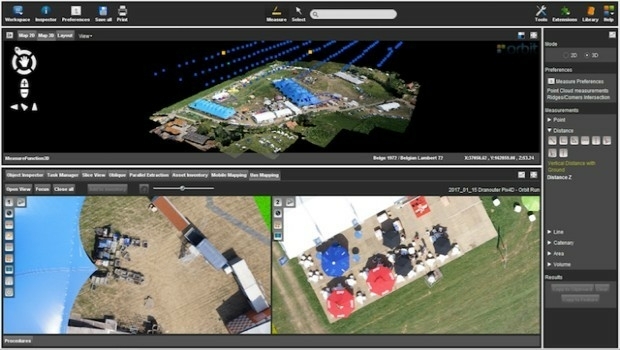
24th October 2017
Orbit GT launches new Feature Extraction product for Drones
23rd October 2017
Jack Dangermond to Discuss Earth Observations at GEO Week23rd October 2017
Orbital Witness wins Airbus’ Global Earth Observation Challenge23rd October 2017
Commercial UAV Expo Announces Highlights of Upcoming 2017 Event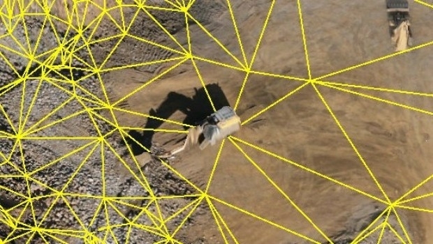
21st October 2017
Virtual Surveyor Unveils Productivity Tools at Commercial UAV Expo18th October 2017
Enhanced and Improved Functionalities for New Release of Global Mapper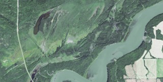
17th October 2017
Earth-i’s satellite imagery chosen to monitor tree logging in Canada14th October 2017
NavVis partners with PrecisionPoint to bring American indoors online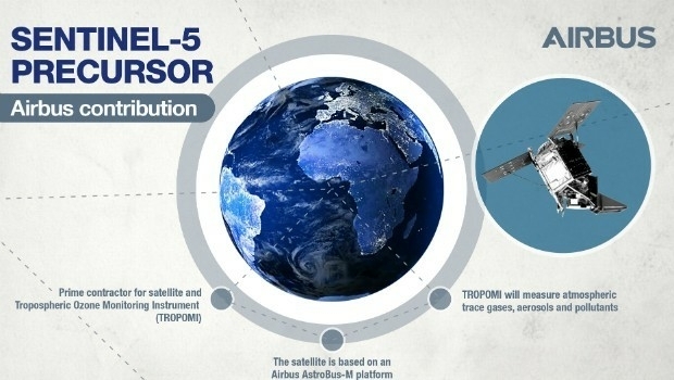
14th October 2017
Sentinel-5P successfully launched to monitor world’s pollution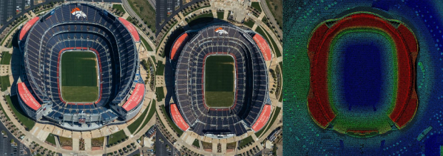
13th October 2017
Airborne LiDAR production fully integrated with Leica HxMap workflow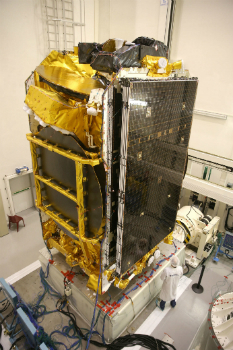
11th October 2017
EUTELSAT 172B satellite reaches geostationary orbit in record time11th October 2017
First Lockheed Martin GPS III Satellite “Available for Launch6th October 2017
European Consortium Demonstrates new Internet-of-Things Platform