
ILMF Announces First Keynote of 2020 Conference Program
16th January 2020
ILMF Announces First Keynote of 2020 Conference Program
16th January 2020
ILMF Announces First Keynote of 2020 Conference Program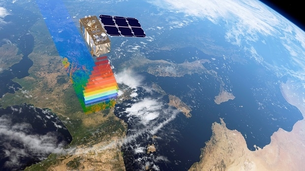
13th January 2020
New Satellite Services Company 4 Earth Intelligence Launches10th January 2020
New doctoral training centre for Earth Observation11th December 2019
Rezatec provides Tolko with its innovative satellite-based forest inventory6th December 2019
Astronaut assistant CIMON-2 to International Space Station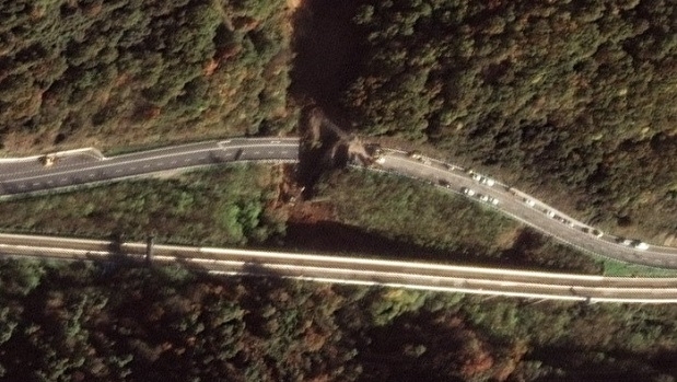
2nd December 2019
Satellite Images of Bridge Collapse on A6 Torino Highway25th November 2019
Airbus’ Golden Jubilee for Skynet secure satellite communications
25th November 2019
DIN Innovators Award for Datacube Inventor Peter Baumann20th November 2019
Airbus-built telescope for ESA’s Euclid mission takes shape18th November 2019
Airbus checking ocean satellite Sentinel-6A’s operational fitness11th November 2019
Ecometrica to lead extension to Forests 2020 Project8th November 2019
SSTL Announces NovaSAR-1 Data Deal with the Philippines28th October 2019
ESA and Airbus to cooperate on the Bartolomeo platform22nd October 2019
Ecometrica sings up to UK Sprint Programme for International Space Data Project18th October 2019
Airbus built Solar Orbiter heads for the Sun in Florida15th October 2019
Ecometrica wins Pan-American prize for Geospatial Innovation3rd October 2019
European Space Imaging continues to deliver 100% success rate of European Commission’s CwRS Program2nd October 2019
Stratollite Mission Reaches Key Milestone1st October 2019
EUMETSAT prepares for launching next-gen satellites1st October 2019
DSEI Japan – A Landmark Event for Asia-Pacific25th September 2019
21st Annual Global MilSatCom conference and exhibition18th September 2019
EOMAP wins funding for next-generation technology for Satellite-Derived Bathymetry12th September 2019
Airbus to develop technology for ultra-high-resolution satellites for UK MOD11th September 2019
Airbus and Telespazio join forces to sell military telecom services on Syracuse IV satellites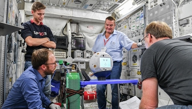
29th August 2019
CIMON is back on Earth after 14 months on the ISS
28th August 2019
France and India to develop first space-based continuous ship tracking system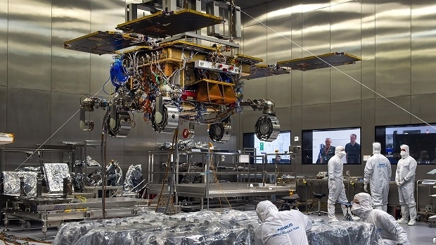
27th August 2019
Airbus built ExoMars rover leaves UK for testing ahead of launch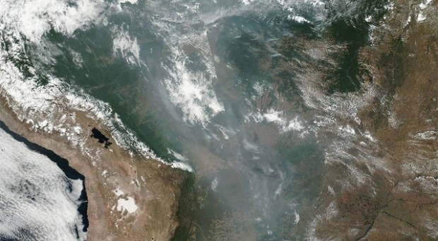
23rd August 2019
Wildfires in Brazilian Rainforest creating cross country smoke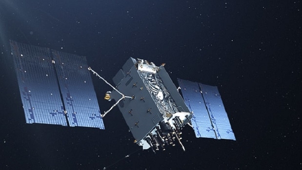
23rd August 2019
Second Lockheed Martin-Built Next Generation GPS III Satellite Responding to Commands23rd August 2019
Indonesian space agency cements plans to work with Ecometrica on deforestation data20th August 2019
ICEYE releases world's first sub-1m radar imagery from SAR microsats14th August 2019
Satellite Imagery: Chinese Military in Shenzen8th August 2019
DEFRA Streamlines Processing of Earth Observation Data with SCISYS Software and Services7th August 2019
Successful launch of the second SpaceDataHighway satellite on Ariane 51st August 2019
Highlight Lecture 1 MARSIS: the Successful Search for Liquid Water on Mars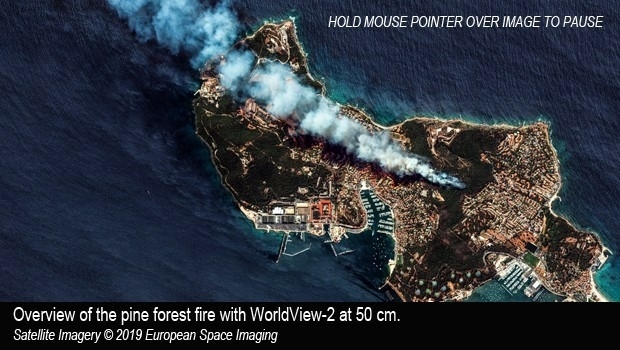
30th July 2019
Satellite imagery of pine forest fire in the Var, Southern France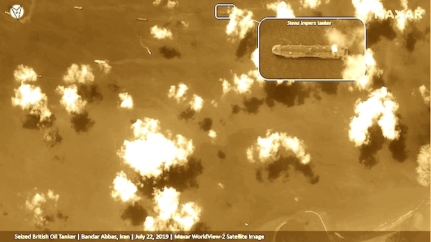
23rd July 2019
Satellite Imagery: Captured British Oil Tanker15th July 2019
Goonhilly opens new data centre with green HPC platform for AI and ML-Airbus-2019.jpg)
8th July 2019
Airbus to develop CO3D Earth Observation programme for CNES8th July 2019
Second Lockheed Martin-Built GPS III Satellite Ready for July 25 Liftoff