RIEGL VUX-120 UAV Wins the Geospatial World Innovation Award in Amsterdam
22nd October 2021
RIEGL VUX-120 UAV Wins the Geospatial World Innovation Award in AmsterdamTerrestrial and airborne laser (LiDAR) scanners for the collection of 3D point cloud data; software for processing and visualising point clouds and creating 3D models, and use cases for laser scanning
This topic covers the science, the hardware, and the software used to capture, process and apply 3D point cloud data. As well as airborne and terrestrial (tripod-based, vehicle-mounted and handheld) laser (LiDAR) scanners, the topic includes the proprietary and Open Source software employed to process point clouds and create 3D models. It also covers the many and varied uses for 3D laser scanning: topographic mapping, bathymetric mapping, utility mapping, engineering surveying, agriculture, forestry, geology, architecture, industrial facilities, cultural heritage, asset management and construction, collision avoidance in autonomous and semi-autonomous vehicles, and environmental modelling
22nd October 2021
RIEGL VUX-120 UAV Wins the Geospatial World Innovation Award in Amsterdam
20th October 2021
Geo Week Conference Program and Speaker Lineup Announced20th October 2021
Creaform Introduces Three New Solutions to the R-Series Suite of Automated Dimensional Quality Control Solutions
15th October 2021
SimActive Releases Version 9.0 with Distributed Processing15th October 2021
New RIEGL VQ-1560 II-S for RPS in Australia14th October 2021
Dewberry Acquires the Latest RIEGL VQ-1560 II-S Airborne LiDAR System
6th October 2021
SimActive Releases Version 9.0 with Distributed Processing5th October 2021
Bluesky LiDAR Benchmarks Carbon Neutral Farming in Northern Ireland1st October 2021
Surrey Police and Sussex Police invest in Trimble X7 Laser Scanning technology27th September 2021
RIEGL VUX-120 wins the Wichmann INTERGEO Innovation Award 202121st September 2021
New GeoSLAM Hardware and Software Revolutionises SLAM accuracy and automation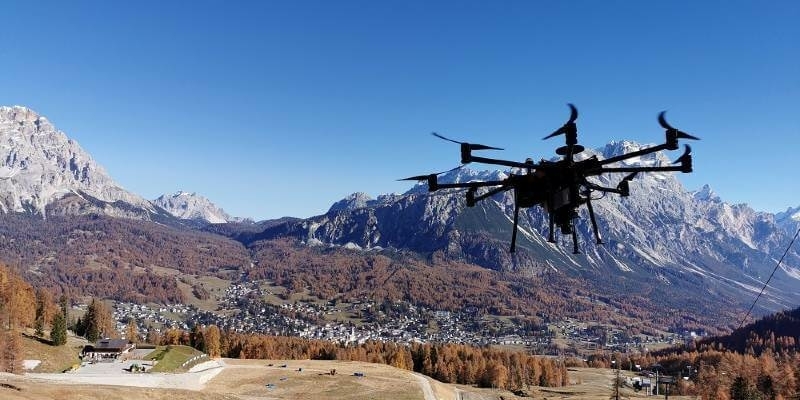
16th September 2021
Intergeo 2021 Live + Digital, September 21-23, 2021: Join RIEGL at booth 20C.22, Hall 20 or digitally
16th September 2021
Hexagon to showcase groundbreaking autonomous solutions and smart digital realities at INTERGEO 2021 Live+Digital
8th September 2021
SimActive Develops Workflow for New DJI L1 LiDAR System8th September 2021
Hexagon revolutionises autonomous reality capture with the launch of the Leica BLK ARC and Leica BLK2FLY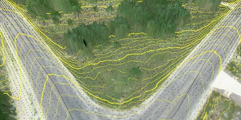
8th September 2021
Virtual Surveyor Improves Point Cloud Workflow to Fully Leverage Drone LiDAR Payloads7th September 2021
Bluesky National Tree Map at the Root of Birmingham’s Urban Forest Master Plan6th September 2021
GeoSLAM maps ST. Elisabeth Hospital ahead of historic restoration
1st September 2021
RIEGL to Exhibit and Present at Commercial UAV Expo Americas 2021
31st August 2021
RIEGL RiCAST: Driving Into the Unknown- Tunnel Surveying and Early Adventures in Mobile Mapping30th August 2021
Using UAV LiDAR to obtain and analyse key metrics for operational forest management26th August 2021
London Borough of Harrow creates digital twin with new street imagery and LiDAR data
19th August 2021
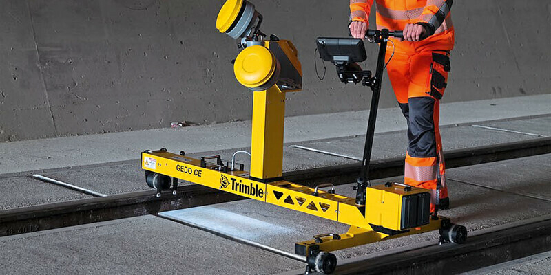
New Trimble GEDO GX50 Laser Scanning System Introduced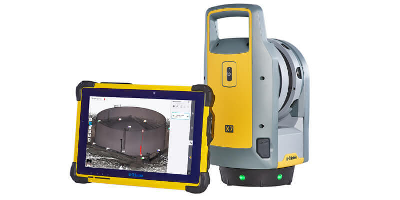
19th August 2021
Trimble X7 and Perspective 3D Scanning Solution Garners Three International Design Awards
19th August 2021
North Dakota Department of Transportation Selects GeoCue True View LIDAR/Imaging Technology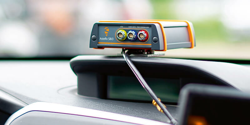
19th August 2021
Septentrio announces partnership with XenomatiX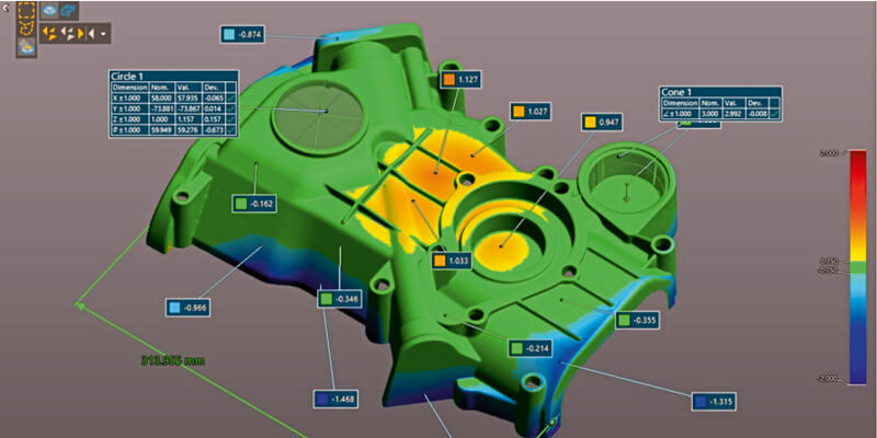
19th August 2021
Creaform Announces the Release of VXelements 9.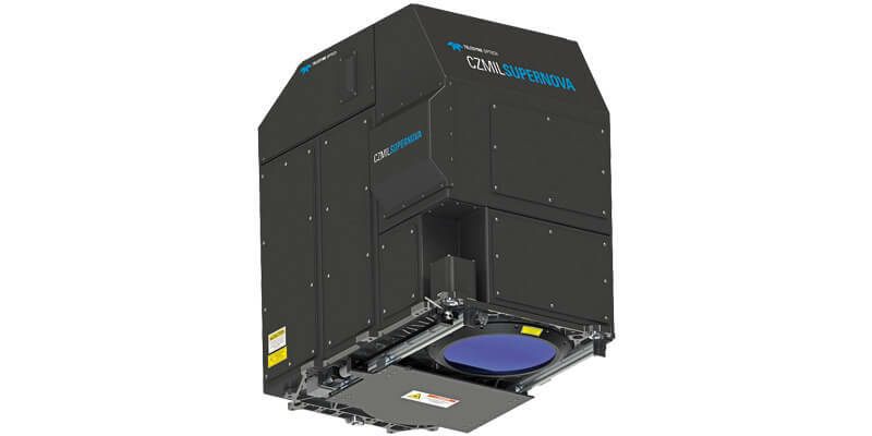
19th August 2021
GeoSLAM Launches New Underground Mining Solutions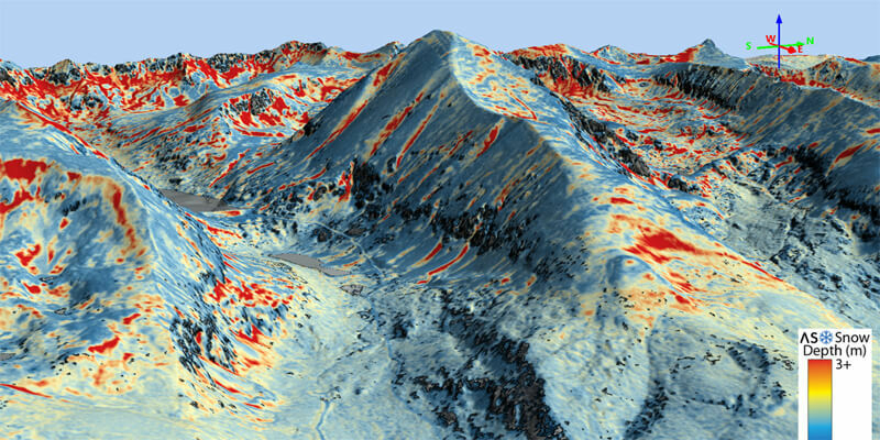
19th August 2021
Airborne Snow Observatories takes delivery of the RIEGL VQ-1560 II-S LiDAR System
19th August 2021
HERE announces mobile LiDAR data and more accessible within Bentley’s Orbit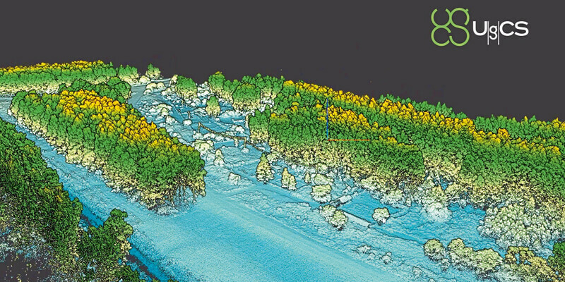
19th August 2021
SPH Engineering announces the update of UgCS for UAV-based LIDAR mapping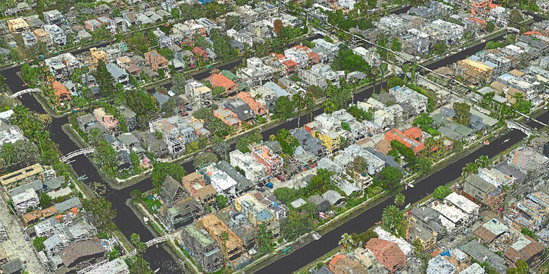
19th August 2021
SimActive Software Used with both LiDAR and Imagery to Map Venice Beach18th August 2021
NV5 Geospatial Expands Mobile Mapping Fleet with State-of-the-Art RIEGL VMX-2HA Platform
9th August 2021
Riegl’s Ultimate Lidar Webinar Series: August 2021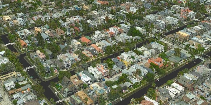
3rd August 2021
SimActive Software Used with both LiDAR and Imagery to Map Venice Beach, California during the Pandemic30th July 2021
GeoSLAM launches new underground mining solutions15th July 2021
Maptek consolidates on field benefits for high accuracy survey-grade sensors14th July 2021
Bluesky and BlackSky Join Forces to Bring Satellite Imagery to the U.K.13th July 2021
Trimble Mx50 Lidar System Expands Mobile Mapping Portfolio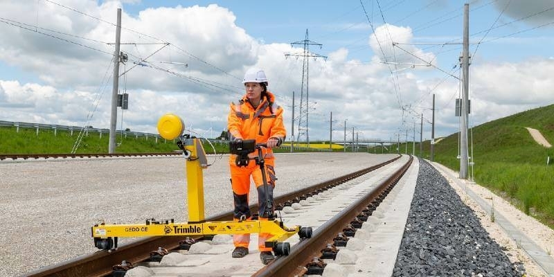
13th July 2021
New Trimble GEDO GX50 Laser Scanning System Introduced for Clearance Analysis and Asset Data Collection for Railway Applications
12th July 2021
Riegl Ricast: Forest Inventory By Means Of Laser Scanning Technology
8th July 2021
Recordings Are Now Available For The Riegl Ultimate Lidar June 2021 Webinars7th July 2021
GeoSLAM launches new solution to optimise construction progress tracking