Laser Scanning
Terrestrial and airborne laser (LiDAR) scanners for the collection of 3D point cloud data; software for processing and visualising point clouds and creating 3D models, and use cases for laser scanning
This topic covers the science, the hardware, and the software used to capture, process and apply 3D point cloud data. As well as airborne and terrestrial (tripod-based, vehicle-mounted and handheld) laser (LiDAR) scanners, the topic includes the proprietary and Open Source software employed to process point clouds and create 3D models. It also covers the many and varied uses for 3D laser scanning: topographic mapping, bathymetric mapping, utility mapping, engineering surveying, agriculture, forestry, geology, architecture, industrial facilities, cultural heritage, asset management and construction, collision avoidance in autonomous and semi-autonomous vehicles, and environmental modelling

Drone based LiDAR for Aberystwyth University global research
11th August 2017
Drone based LiDAR for Aberystwyth University global researchTeledyne CARIS Releases New Version of Bathy DataBASE
10th August 2017
Teledyne CARIS Releases New Version of Bathy DataBASEBluesky LiDAR Helps ArcHeritage Reveal Hidden Treasures
9th August 2017
Bluesky LiDAR Helps ArcHeritage Reveal Hidden TreasuresBluesky Launches Nationwide Map of Building Heights
13th July 2017
Bluesky Launches Nationwide Map of Building HeightsObstacle Obstruction Survey at Massachusetts Airport
10th July 2017
Obstacle Obstruction Survey at Massachusetts AirportCarbomap Ready to Map the World with Advanced LiDAR on Fixed-Wing UAV
7th July 2017
Carbomap Ready to Map the World with Advanced LiDAR on Fixed-Wing UAV
DAT/EM Systems International Updates Landscape Software
6th July 2017
DAT/EM Systems International Updates Landscape SoftwarePDF3D V2.14 Meets Demands of Drones, Scanners and 3D Design Apps
21st June 2017
PDF3D V2.14 Meets Demands of Drones, Scanners and 3D Design Apps
Blue Marble LiDAR Workshop at the Esri UC in San Diego
14th June 2017
Blue Marble LiDAR Workshop at the Esri UC in San Diego
Driving into the future at simulated The Oxford Science Park
2nd June 2017
Driving into the future at simulated The Oxford Science ParkBluesky Laser Mapping Helps Create Flood Alleviation Model for Yorkshire Water
1st June 2017
Bluesky Laser Mapping Helps Create Flood Alleviation Model for Yorkshire WaterPortable UltraCam Panther Offers High-Quality Imagery, Video and LiDAR
30th May 2017
Portable UltraCam Panther Offers High-Quality Imagery, Video and LiDARPointfuse Point Cloud Conversion in Arena4D at GEO Business 2017
18th May 2017
Pointfuse Point Cloud Conversion in Arena4D at GEO Business 2017NM Group assist Hydro One to develop LiDAR strate
16th May 2017
NM Group assist Hydro One to develop LiDAR strate
Responding to Emerging Environmental Threats
15th May 2017
Responding to Emerging Environmental Threats
1Spatial releases dates for exciting FME World Tour, courses, webinars
15th May 2017
1Spatial releases dates for exciting FME World Tour, courses, webinarsBluesky National Tree Map Helps Daventry Plan Ground Maintenance
15th May 2017
Bluesky National Tree Map Helps Daventry Plan Ground MaintenanceEssential Energy use innovative technology to manage vegetation
8th May 2017
Essential Energy use innovative technology to manage vegetation3D Modeling Innovator Arithmetica Expands with Appointment of European Resellers for Pointfuse
2nd May 2017
3D Modeling Innovator Arithmetica Expands with Appointment of European Resellers for Pointfuse
Pointfuse Transforms Design of Construction in London
18th April 2017
Pointfuse Transforms Design of Construction in LondonNational Trust Deploys Laser Survey Aircraft from Bluesky to Map in 3D
11th April 2017
National Trust Deploys Laser Survey Aircraft from Bluesky to Map in 3DArithmetica Reveals New Pointfuse Point Cloud 3D Modelling Software
7th April 2017
Arithmetica Reveals New Pointfuse Point Cloud 3D Modelling SoftwareBluesky LiDAR Maps Used to Monitor the Spread of Deadly Tree Disease
6th April 2017
Bluesky LiDAR Maps Used to Monitor the Spread of Deadly Tree Disease
Bluesky 3D maps help protect coastal heritage sites in new EU Project
29th March 2017
Bluesky 3D maps help protect coastal heritage sites in new EU ProjectArithmetica and point3D Partnership Promises Digital Transformation in 3D Modelling
29th March 2017
Arithmetica and point3D Partnership Promises Digital Transformation in 3D ModellingSign up for a free Trimble Scanning Workshop
27th March 2017
Sign up for a free Trimble Scanning Workshop
Bluesky Launches New Online Resource for Geographic Information of Ireland
27th March 2017
Bluesky Launches New Online Resource for Geographic Information of Ireland3D Repo Brings Cloud Expertise to Government Funded Smart Infrastructure Project
22nd March 2017
3D Repo Brings Cloud Expertise to Government Funded Smart Infrastructure Project
Avalanche Photodiode Arrays from LASER COMPONENTS
22nd March 2017
Avalanche Photodiode Arrays from LASER COMPONENTS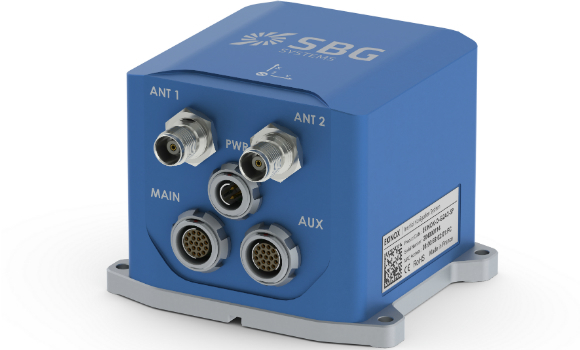
New generation of the Ekinox Series inertial sensors from SBG Systems
20th March 2017
New generation of the Ekinox Series inertial sensors from SBG SystemsBluesky to 3D Laser Map Environmental Features in Ireland
20th March 2017
Bluesky to 3D Laser Map Environmental Features in Ireland
Global Mapper SDK and LiDAR Module SDK v18.1 Released
16th March 2017
Global Mapper SDK and LiDAR Module SDK v18.1 Released
Bluesky Acquires US Aerial Survey Company Col-East
15th March 2017
Bluesky Acquires US Aerial Survey Company Col-EastOrbit GT and LiDAR USA upgrade ScanLook and Snoopy interoperability
13th March 2017
Orbit GT and LiDAR USA upgrade ScanLook and Snoopy interoperabilityFast LiDAR data viewer streamlines work of local governments
10th March 2017
Fast LiDAR data viewer streamlines work of local governmentsNew Bathy DataBASE™, HIPS and SIPS™ released by Teledyne CARIS
3rd March 2017
New Bathy DataBASE™, HIPS and SIPS™ released by Teledyne CARIS
Global Mapper LiDAR Module v18.1 Now Available
1st March 2017
Global Mapper LiDAR Module v18.1 Now Available
MERLIN – the first Franco-German Earth observation satellite
17th February 2017
MERLIN – the first Franco-German Earth observation satellite
Int’l Lidar Mapping Forum & ASPRS Conference to Take Place Together
16th February 2017
Int’l Lidar Mapping Forum & ASPRS Conference to Take Place Together3D Repo Appoints Andrew Norrie as Commercial Director
14th February 2017
3D Repo Appoints Andrew Norrie as Commercial DirectorNew Leica SPL100 brings up to 10x more efficiency to airborne LiDAR mapping
13th February 2017
New Leica SPL100 brings up to 10x more efficiency to airborne LiDAR mapping