Laser Scanning
Terrestrial and airborne laser (LiDAR) scanners for the collection of 3D point cloud data; software for processing and visualising point clouds and creating 3D models, and use cases for laser scanning
This topic covers the science, the hardware, and the software used to capture, process and apply 3D point cloud data. As well as airborne and terrestrial (tripod-based, vehicle-mounted and handheld) laser (LiDAR) scanners, the topic includes the proprietary and Open Source software employed to process point clouds and create 3D models. It also covers the many and varied uses for 3D laser scanning: topographic mapping, bathymetric mapping, utility mapping, engineering surveying, agriculture, forestry, geology, architecture, industrial facilities, cultural heritage, asset management and construction, collision avoidance in autonomous and semi-autonomous vehicles, and environmental modelling
-Airbus-DS-2019-.jpg)
Airbus and ZF to develop high precise end-to-end autonomous driving solution
15th April 2019
Airbus and ZF to develop high precise end-to-end autonomous driving solution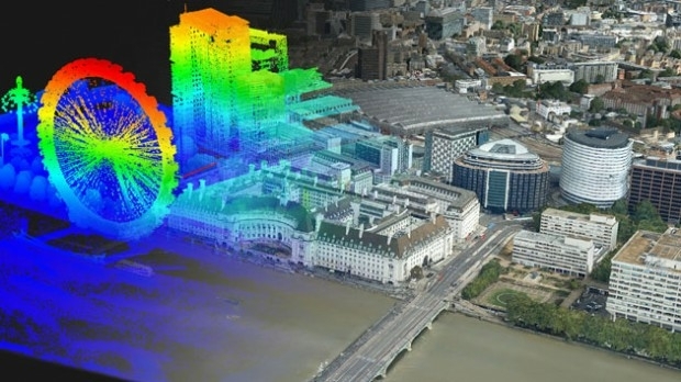
Bluesky Purchases UK’s First CityMapper Camera
4th April 2019
Bluesky Purchases UK’s First CityMapper Camera
Teledyne CARIS Onboard 2.1 to be featured at Ocean Business 2019
2nd April 2019
Teledyne CARIS Onboard 2.1 to be featured at Ocean Business 2019
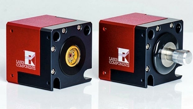
Fibre Laser Process Heads - Modular Design
1st April 2019
Fibre Laser Process Heads - Modular Design
Colorado State University Expands Curriculum
28th March 2019
Colorado State University Expands Curriculum
Kaarta announces $6.5M in Series A Financing
25th March 2019
Kaarta announces $6.5M in Series A Financing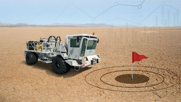
Sercel Optimizes Vibroseis Productivity with Launch of Vibrator Auto-Guidance
20th March 2019
Sercel Optimizes Vibroseis Productivity with Launch of Vibrator Auto-Guidance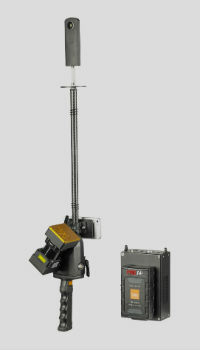
New GeoSLAM Scanner Combines Detailed Data Points With Hi-Res Imagery
19th March 2019
New GeoSLAM Scanner Combines Detailed Data Points With Hi-Res Imagery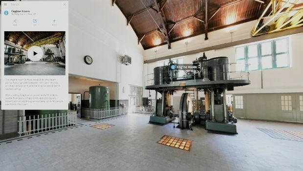
Interactive, fully immersive 3D buildings online
19th March 2019
Interactive, fully immersive 3D buildings online
Palatiello Promotes USGS 3DEP Before Congress
27th February 2019
Palatiello Promotes USGS 3DEP Before Congress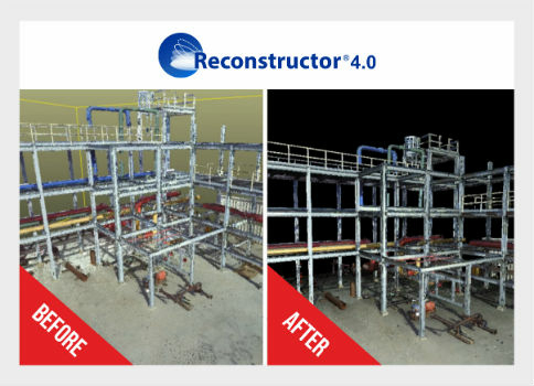
Global Mapper v.20.1 Now Available with Path Profile Zooming
26th February 2019
Global Mapper v.20.1 Now Available with Path Profile Zooming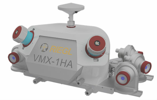
COMPLETE MOBILE SURVEYING OF AMTRAK’S NEW YORK PENN STATION
19th February 2019
COMPLETE MOBILE SURVEYING OF AMTRAK’S NEW YORK PENN STATION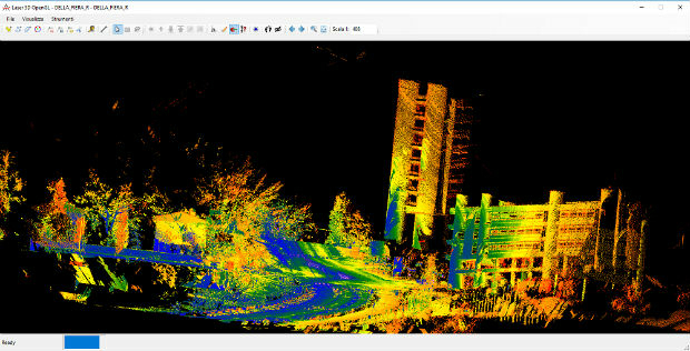
Mobile Mapping System Road-Scanner for the first tram line in Bologna
13th February 2019
Mobile Mapping System Road-Scanner for the first tram line in Bologna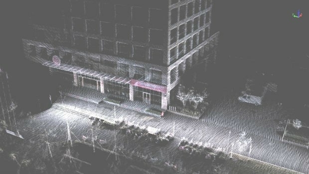
Greenvalley International Launches Premium Handheld Mobile Mapping
2nd February 2019
Greenvalley International Launches Premium Handheld Mobile Mapping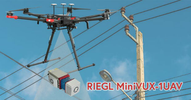
CompassDrone, Newest Division Of CompassData,
1st February 2019
CompassDrone, Newest Division Of CompassData,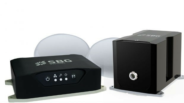
Routescene and Caddis Aerial launch UAV LiDAR surveys
17th January 2019
Routescene and Caddis Aerial launch UAV LiDAR surveysA seamless integration of LiDAR sensors behind vehicles’ windshield
4th January 2019
A seamless integration of LiDAR sensors behind vehicles’ windshieldAEP’s Extra High Voltage Electricity Transmission Assets In Oklahoma, USA
14th December 2018
AEP’s Extra High Voltage Electricity Transmission Assets In Oklahoma, USA
Fugro’s Surveys To Improve Coastal Resilience In Pacific Island Nation, Tuvalu
5th December 2018
Fugro’s Surveys To Improve Coastal Resilience In Pacific Island Nation, Tuvalu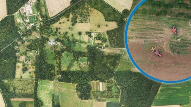
Bluesky Aerial Images Help Reveal Secrets of Farm Management
4th December 2018
Bluesky Aerial Images Help Reveal Secrets of Farm Management
Add Geographic Intelligence to your Software Projects
28th November 2018
Add Geographic Intelligence to your Software Projects
EuroSDR One-Day Workshop on Single Photon and Geiger-Mode LiDAR
27th November 2018
EuroSDR One-Day Workshop on Single Photon and Geiger-Mode LiDAR
Getmapping appoints Geosolutions Consultant
26th November 2018
Getmapping appoints Geosolutions Consultant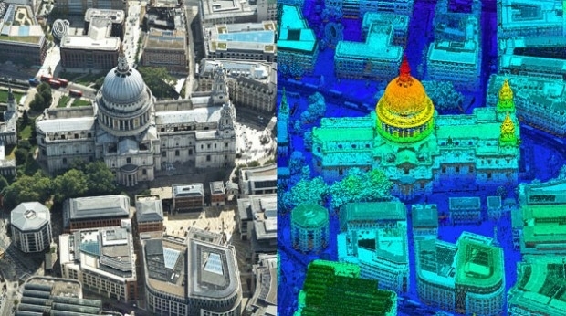
Bluesky first to use Leica CityMapper to capture UK cities in 3D
21st November 2018
Bluesky first to use Leica CityMapper to capture UK cities in 3D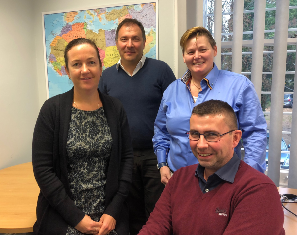
Getmapping Announces New European Management Team Structure
20th November 2018
Getmapping Announces New European Management Team Structure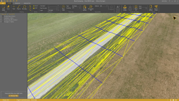
Virtual Surveyor 6.1 Handles More Than Drone Data
13th November 2018
Virtual Surveyor 6.1 Handles More Than Drone DataGreenvalley International launches updated software LiDAR360 Suite 3.0
8th November 2018
Greenvalley International launches updated software LiDAR360 Suite 3.0CGG’s Mozambique Multi-Client Survey Now Available
8th November 2018
CGG’s Mozambique Multi-Client Survey Now AvailablePointStudio - New name and platform for Maptek spatial data application
8th November 2018
PointStudio - New name and platform for Maptek spatial data application
Pointfuse Launches New Point Cloud Software at Intergeo
18th October 2018
Pointfuse Launches New Point Cloud Software at Intergeo
Geomni Forms Strategic Alliance with Skyline Software Systems
17th October 2018
Geomni Forms Strategic Alliance with Skyline Software Systems
GeoSLAM Welcomes New Member Of ZEB Family For Indoor + Outdoor Use
16th October 2018
GeoSLAM Welcomes New Member Of ZEB Family For Indoor + Outdoor Use
International LiDAR Mapping Forum Announces 2019 Education Program
16th October 2018
International LiDAR Mapping Forum Announces 2019 Education Program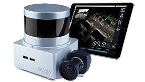
Kaarta Announces Stencil 2 Mobile Mapping System
16th October 2018
Kaarta Announces Stencil 2 Mobile Mapping System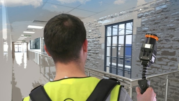
Pointfuse Launches New Laser Scanning Software Suite
15th October 2018
Pointfuse Launches New Laser Scanning Software Suite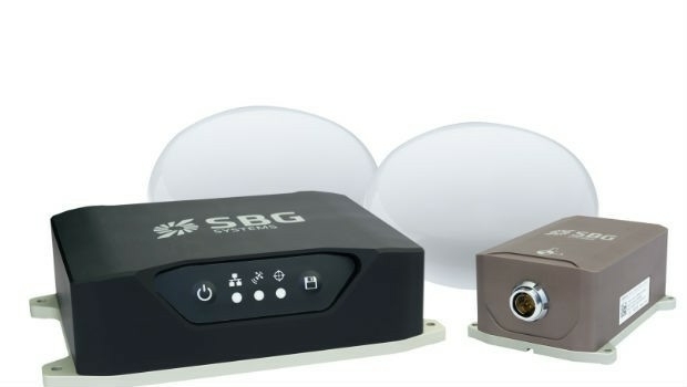
Navsight Land/Air Solution: Powerful New Inertial Navigation Solution
11th October 2018
Navsight Land/Air Solution: Powerful New Inertial Navigation Solution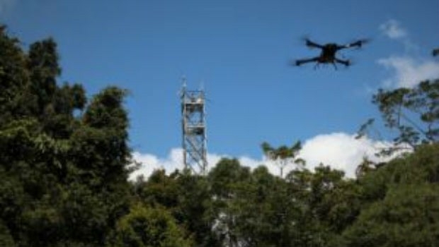
Novel LIDAR Data Improves Our Understanding Of Tropical Forests
11th October 2018
Novel LIDAR Data Improves Our Understanding Of Tropical Forests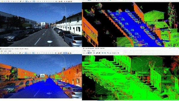
SITECO's NEW Road-SIT Survey v. 7.0 AT INTERGEO 2018
10th October 2018
SITECO's NEW Road-SIT Survey v. 7.0 AT INTERGEO 2018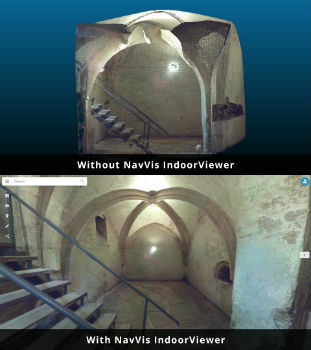
NavVis IndoorViewer converts static scans into immersive 360° imagery
8th October 2018
NavVis IndoorViewer converts static scans into immersive 360° imagery
Dowe Gallagher Adds Textron Cessna Caravan EX To Lidar Offerings
25th September 2018
Dowe Gallagher Adds Textron Cessna Caravan EX To Lidar Offerings
NM Group undertake Machine Learning research project
25th September 2018
NM Group undertake Machine Learning research project
Mirasense and XenomatiX Win Technology Showcase
22nd September 2018
Mirasense and XenomatiX Win Technology ShowcaseezMetr Provides Transportation Platform for Smarter Cities
15th September 2018
ezMetr Provides Transportation Platform for Smarter Cities