Orbit GT to exhibit and showcase v20 at INTERGEO, Stuttgart, Germany
27th August 2019
Orbit GT to exhibit and showcase v20 at INTERGEO, Stuttgart, GermanyTerrestrial and airborne laser (LiDAR) scanners for the collection of 3D point cloud data; software for processing and visualising point clouds and creating 3D models, and use cases for laser scanning
This topic covers the science, the hardware, and the software used to capture, process and apply 3D point cloud data. As well as airborne and terrestrial (tripod-based, vehicle-mounted and handheld) laser (LiDAR) scanners, the topic includes the proprietary and Open Source software employed to process point clouds and create 3D models. It also covers the many and varied uses for 3D laser scanning: topographic mapping, bathymetric mapping, utility mapping, engineering surveying, agriculture, forestry, geology, architecture, industrial facilities, cultural heritage, asset management and construction, collision avoidance in autonomous and semi-autonomous vehicles, and environmental modelling
27th August 2019
Orbit GT to exhibit and showcase v20 at INTERGEO, Stuttgart, Germany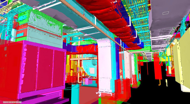
22nd August 2019
Pointfuse Laser Scanning Software Transforms Digital Construction Workflows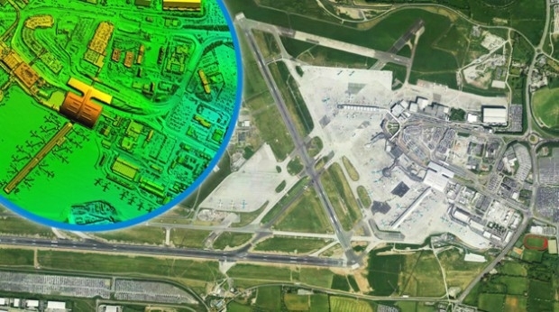
22nd August 2019
Bluesky LiDAR Survey Helps Dublin Airport Reduce Risk of Flooding21st August 2019
Orbit GT and Harmony Instruments, Hong Kong, sign Reseller Agreement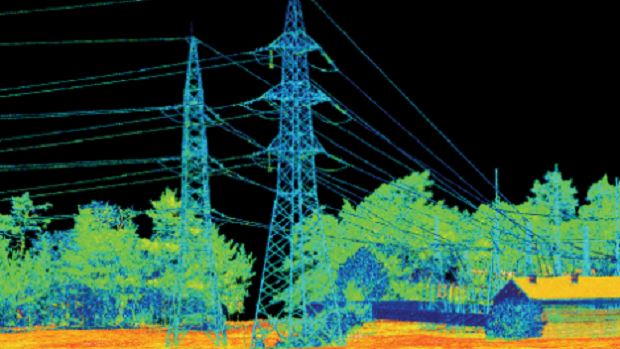
19th August 2019
LIDAR AND BVLOS UAVS: ENABLING THE ULTIMATE SOLUTION FOR HIGHLY EFFICIENT MAPPING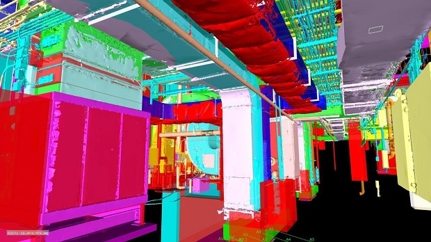
15th August 2019
Pointfuse Laser Scanning Software Transforms Digital Construction Workflows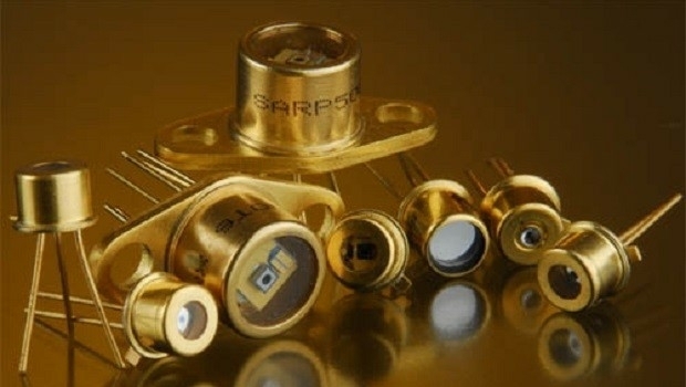
14th August 2019
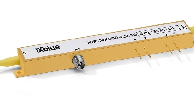
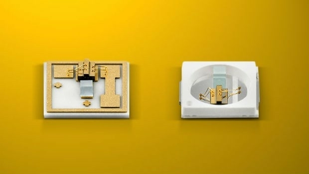
Laser Components releases new near-infra-red modulators
23rd July 2019
QuickSwitch® Recognised for Excellence in Sensors Innovation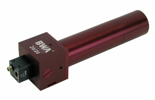
19th July 2019
BWA-CAM 20/20 - The World‘s First ‘Plug-and-Play‘ Solution
13th July 2019
GSSI Receives Presidential Award for Exports11th July 2019
Save the Date ! Webinar July 18 at 6 PM CET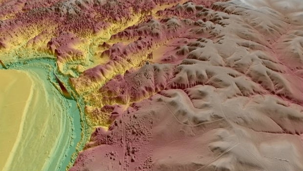
8th July 2019
Virtual Surveyor Enhances LiDAR Point Cloud Handling
1st July 2019
Viametris is launching the second-generation version of the vMS30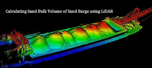
1st July 2019
Calculating Sand Bulk Volume of Sand Barge using LiDAR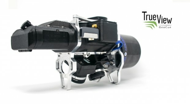
28th June 2019
Geocue introduces industry’s first drone lidar/imagery fusion sensor
27th June 2019
Geospatial solutions company Getmapping announces its new partnership with Hexagon’s Geospatial divi18th June 2019
Undet for Revit – forget the loading of heavy RCP / RCS point cloud files18th June 2019
New domain-centric reality capture software from Leica Geosystems13th June 2019
New handheld imaging laser scanner offers unprecedented efficiency to surveyors
30th May 2019
Ancient Landforms of the Australian Rainforest Revealed by Airborne LiDAR
28th May 2019
New Production Facility for Detectors in the USA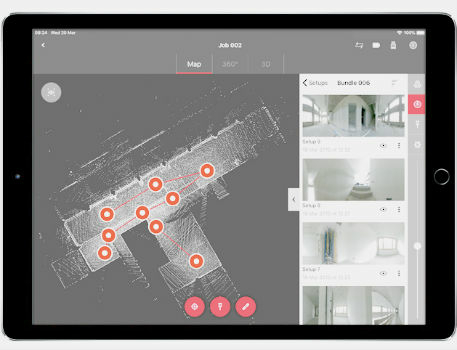
22nd May 2019
Leica BLK360 software integration announcement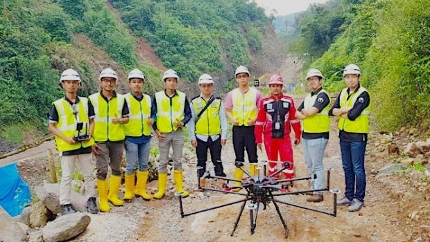
22nd May 2019
Terra Drone Indonesia shows construction companies benefits


16th May 2019
SITECO's System for the Emilia Romagna Railways Inspection
16th May 2019
Terra Drone India and Vignan University set up drone lab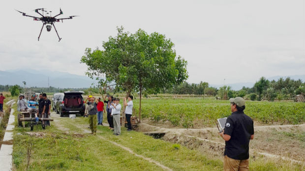

13th May 2019
Bluesky and Skyline Create Dynamic 3D City Models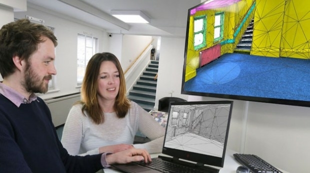
1st May 2019
ISG Transforms BIM Delivery Using Pointfuse Laser Scanning Software1st May 2019
Bench-Guard™ and Table-Guard™ - Laser Barriers24th April 2019
RIEGL to Attend and Exhibit at AEC BuildTech 2019!
23rd April 2019
Micro Optical Power Meter - Compatible with Single-Mode and Multi-Mode Networks22nd April 2019
GeoCue Releases New and Improved Way to Access Public LIDAR and Image Data17th April 2019
News from new autonomy and sensor distributor
17th April 2019
Optical Filters for Machine Vision Applications17th April 2019
“New technology vital to the future protection of our forests”17th April 2019
LEADING EDGE GEOMATICS LEVERAGES LiDAR TECHNOLOGY
16th April 2019
Fugro supports targeted maintenance of Dutch roads

16th April 2019
Space Flight Laboratory Reaches Century Milestone in Microspace Operations