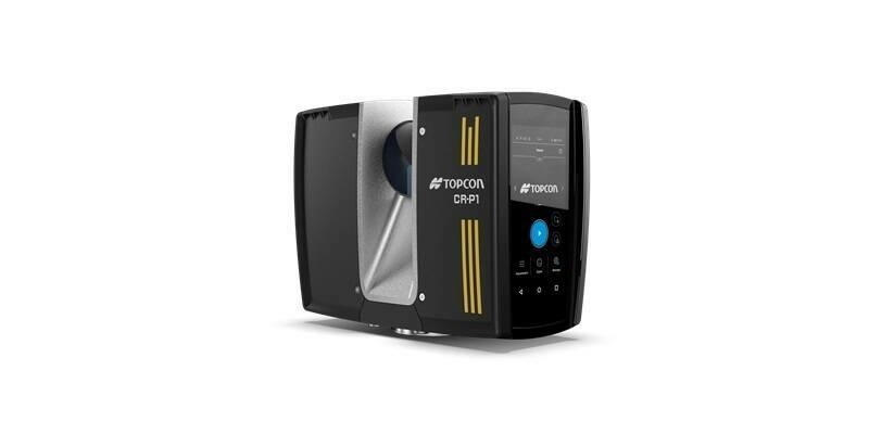
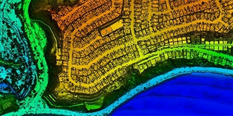
Topcon introduces solutions for 3D mass data workflows
9th April 2025
Topcon introduces solutions for 3D mass data workflowsTerrestrial and airborne laser (LiDAR) scanners for the collection of 3D point cloud data; software for processing and visualising point clouds and creating 3D models, and use cases for laser scanning
This topic covers the science, the hardware, and the software used to capture, process and apply 3D point cloud data. As well as airborne and terrestrial (tripod-based, vehicle-mounted and handheld) laser (LiDAR) scanners, the topic includes the proprietary and Open Source software employed to process point clouds and create 3D models. It also covers the many and varied uses for 3D laser scanning: topographic mapping, bathymetric mapping, utility mapping, engineering surveying, agriculture, forestry, geology, architecture, industrial facilities, cultural heritage, asset management and construction, collision avoidance in autonomous and semi-autonomous vehicles, and environmental modelling
14th April 2025
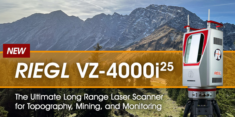
RIEGL VZ-4000i-25: The Ultimate Long Range Scanner for Topography, Mining & Monitoring
9th April 2025
Topcon introduces solutions for 3D mass data workflows
9th April 2025
Seyond and Reykjafell Partner to Bring Seyond’s ITS Management Platform to Iceland
04-05
Jun
Hilton Astana, Astana Kazakhstan
International Astana Mining & Metallurgy Congress 4-5 June 2025
7th April 2025
Visimind AB Becomes Official Distributor of Hesai’s Cutting-Edge LiDAR Sensors in Europe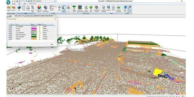
7th April 2025
Topocad 25 – Packed with innovation and exciting new features
26th March 2025
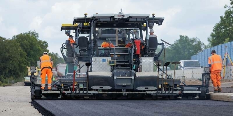
Topcon expands road construction technology portfolio with new workflow solutions for scanning, paving, and compaction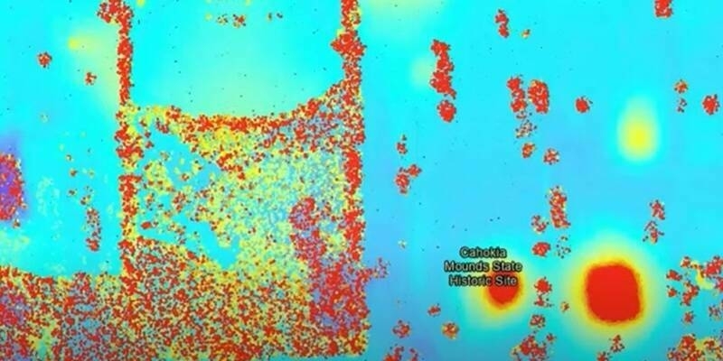
24th March 2025
RIEGL’s Cutting-Edge Technology Unveils Ancient Secrets at Cahokia Mounds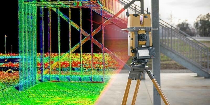
21st March 2025
Topcon to showcase new construction technology solutions at Bauma 2025 in Munich
20th March 2025
AISPECO and Teledyne Geospatial present an innovative airborne asset management solution
03-05
Nov
10th March 2025
NV5 Geospatial and USGS Release High-Resolution LiDAR Data of Palisades and Eaton Fire Burn Areas Collected with RIEGL Technology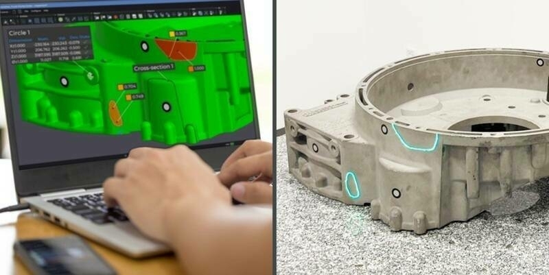
6th March 2025
Creaform Introduces the Laser Projection Add-on to Its Dimensional Inspection Solutions
5th March 2025
Unlocking the secrets of ancient trees with RIEGL Terrestrial LiDAR
28th February 2025
Creaform Introduces the Pro version of its Scan-to-CAD Application Module
27th February 2025
Eagle Mapping Celebrates 40 Years in Business and Acquires 10th RIEGL Sensor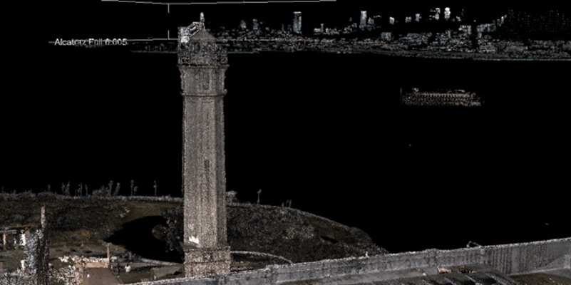
23rd February 2025
RIEGL Technology Unveils Stunning LiDAR Expedition of Alcatraz at Geo Week 2025
21st February 2025
Aero-Graphics Enhances Capabilities with Acquisition of RIEGL’s Latest VQ-1560 III-S Airborne Laser Scanner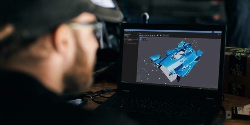
21st February 2025
Creaform Releases Creaform.OS and the Creaform Metrology Suite for the Ultimate User Experience (UX)
19th February 2025
Topcon and FARO Technologies announce strategic agreement in laser scanning technology
13th February 2025
RIEGL @ AUVSI XPONENTIAL Europe in Düsseldorf, Germany
11th February 2025
RIEGL UK to host Heritage Geospatial Symposium in York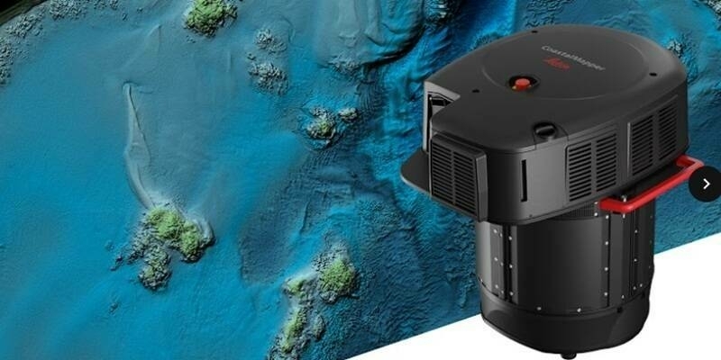
5th February 2025
New Leica CoastalMapper LiDAR sensor significantly speeds up airborne bathymetric mapping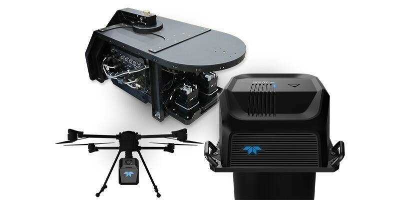
28th January 2025
Teledyne Geospatial to showcase extensive range of lidar solutions at Geo Week
14th January 2025
RIEGL USA to Participate in a Plenary Panel at GeoBuiz 2025
9th January 2025
RIEGL USA to Exhibit Cutting-Edge LiDAR Technology at CES 2025
9th January 2025
Creaform Redefines Online Experience with a New Website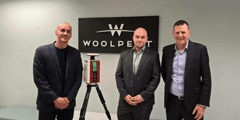
12th December 2024
Woolpert Australia Enhances Their Survey Suite with RIEGL’s VZ-600i Laser Scanning Technology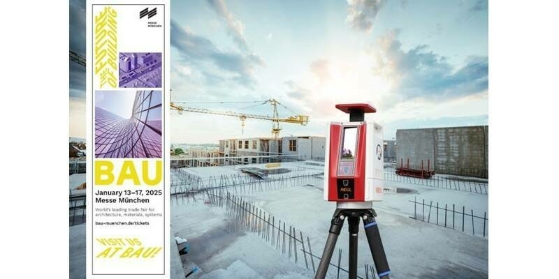
6th December 2024
RIEGL LiDAR Technology for BIM and AEC Applications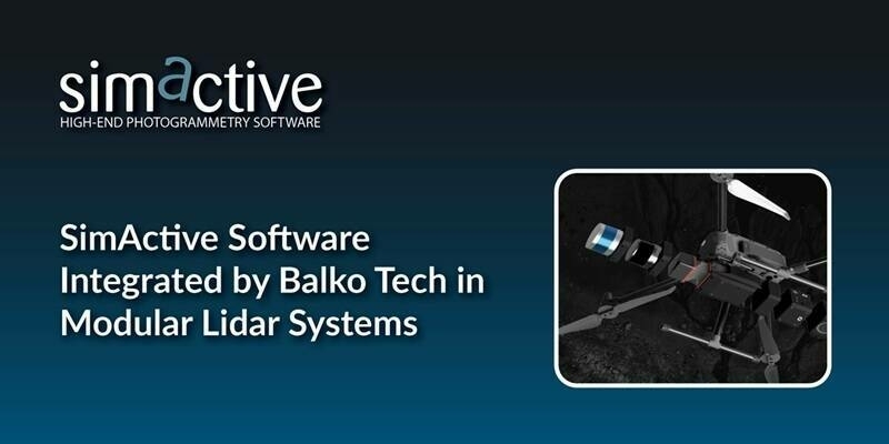
3rd December 2024
SimActive Software Integrated by Balko Tech in Modular Lidar Systems
2nd December 2024
Using LIDAR to study the impact of contrails on climate
22nd November 2024
Webinar Topic – What Are the Advantages of Lidar With Drones?
20th November 2024
Avior Geospatial Enhances Capabilities with the Addition of A RIEGL VQ-1560 II-S
18th November 2024
Recording Available Now for the RIEGL Ultimate LiDAR November Webinar
8th November 2024
CompassData Welcomes a New Senior Account Executive, Joshua Voelker, as They Celebrate 30 Years of Innovation
7th November 2024
NV5 Awarded $26 Million to Support Utility Grid Efficiency and Reliability Through Tech-Enabled Geospatial Services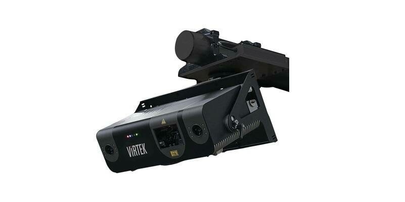
4th November 2024
AMETEK Acquires Virtek Vision International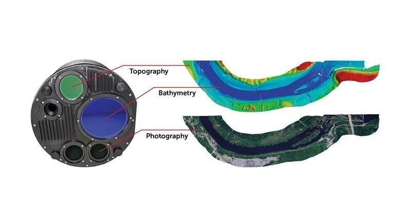
31st October 2024
Teledyne Geospatial to present an exclusive preview of its new coastal mapping solution at HYDRO 2024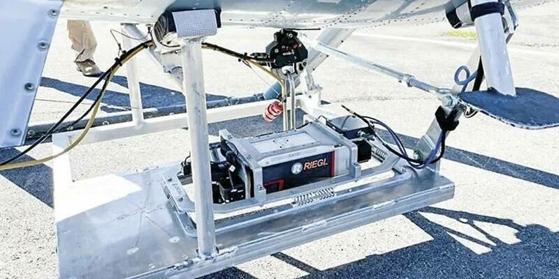
28th October 2024
Volcano Watch – First light and flight for the Hawaiian Volcano Observatory’s (HVO) new RIEGL airborne LiDAR system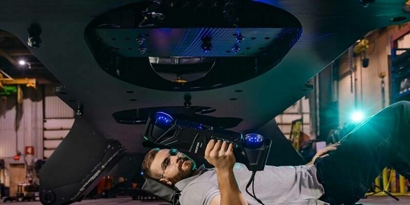
23rd October 2024
New Enhanced Specifications for the HandySCAN 3D|MAX Series
17th October 2024
October Webinar with Highlights from INTERGEO 2024 is Now Available
11th October 2024
VXintegrity 3.0: A Moderns Approach to Infrastructures Fitness-For-Service (FFS) Analyses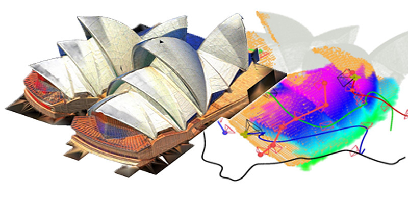
27th September 2024
LiDAR-based system allows unmanned aerial vehicle team to rapidly reconstruct environments
25th September 2024
Digitize the World - Fast. Precise. Efficient.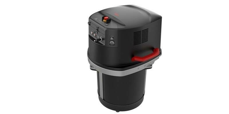
24th September 2024
New single photon LiDAR technology boosts the efficiency of large-area airborne mapping projects
23rd September 2024
RIEGL Presentations & Co-Exhibitors During INTERGEO 2024 – See you in Stuttgart!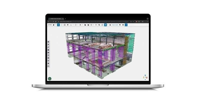
16th September 2024
New Reality Capture Platform Service Leverages Trimble Connect to Maximize the Value of Geospatial Data for Millions of Users