
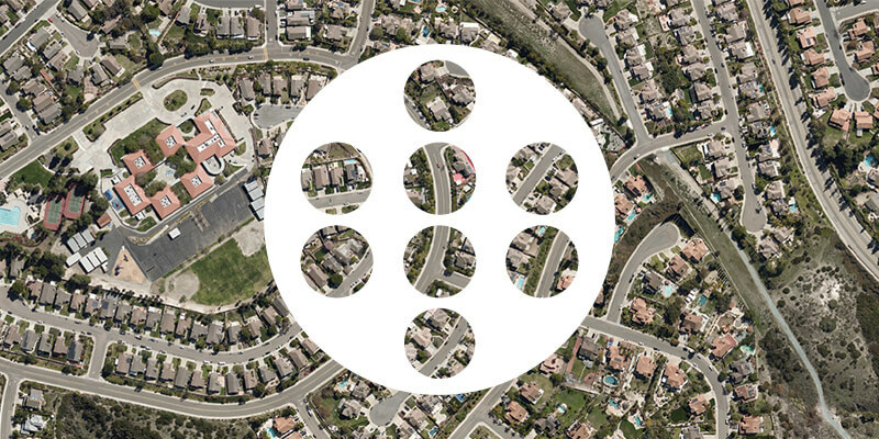
Novel application of AI provides the most accurate model of the Earth’s surface publicly available
11th February 2025
Novel application of AI provides the most accurate model of the Earth’s surface publicly available
11th February 2025
Novel application of AI provides the most accurate model of the Earth’s surface publicly available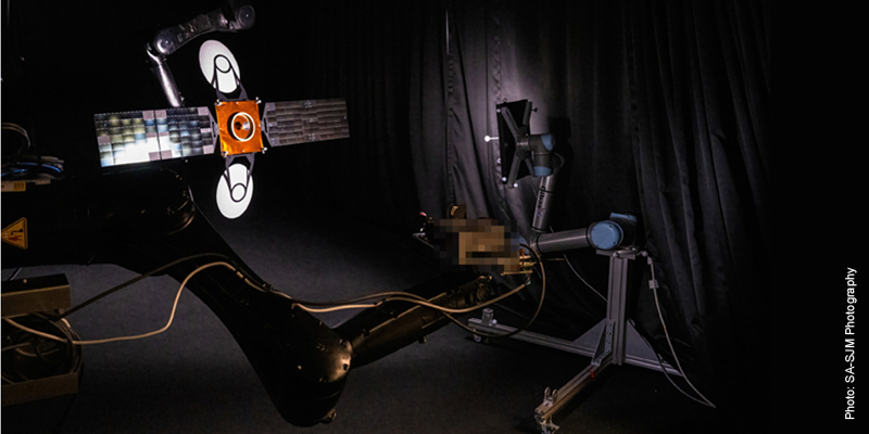
28th January 2025
Vision-based navigation system enables satellites to approach or avoid other objects in space
5th August 2024
Machine learning helps predict diversity of forest tree species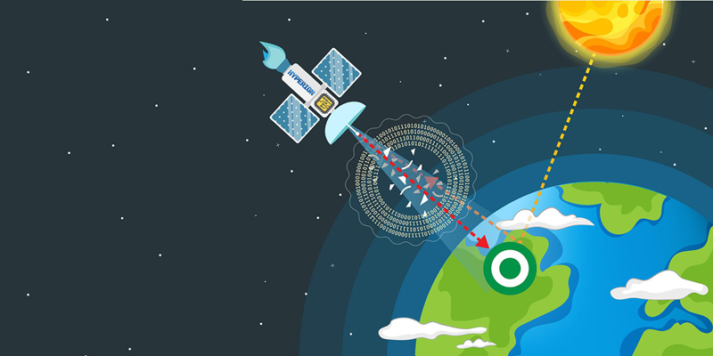
15th July 2024
AI model harnesses physics to autocorrect remote sensing data
3rd July 2024
New imaging technique uses Earth's warped surface to reveal rocky interior
21st March 2024
AI-powered system maps corals in 3D in record time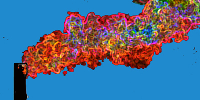
27th November 2023
AI detects methane plumes from space, could be powerful tool in combating climate change

10th August 2023
Thermal imaging innovation allows AI to see through pitch darkness like broad daylight
28th July 2023
Streamlining a nuclear power plant construction project

4th May 2023
Researchers detect and classify multiple objects without images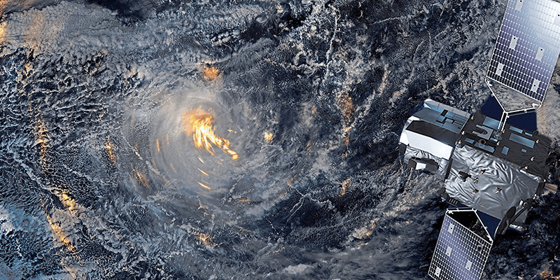
16th April 2023
A new service to address the climate emergency13th March 2023
Defence Geospatial Intelligence (DGI) 2023 Conference
5th November 2021
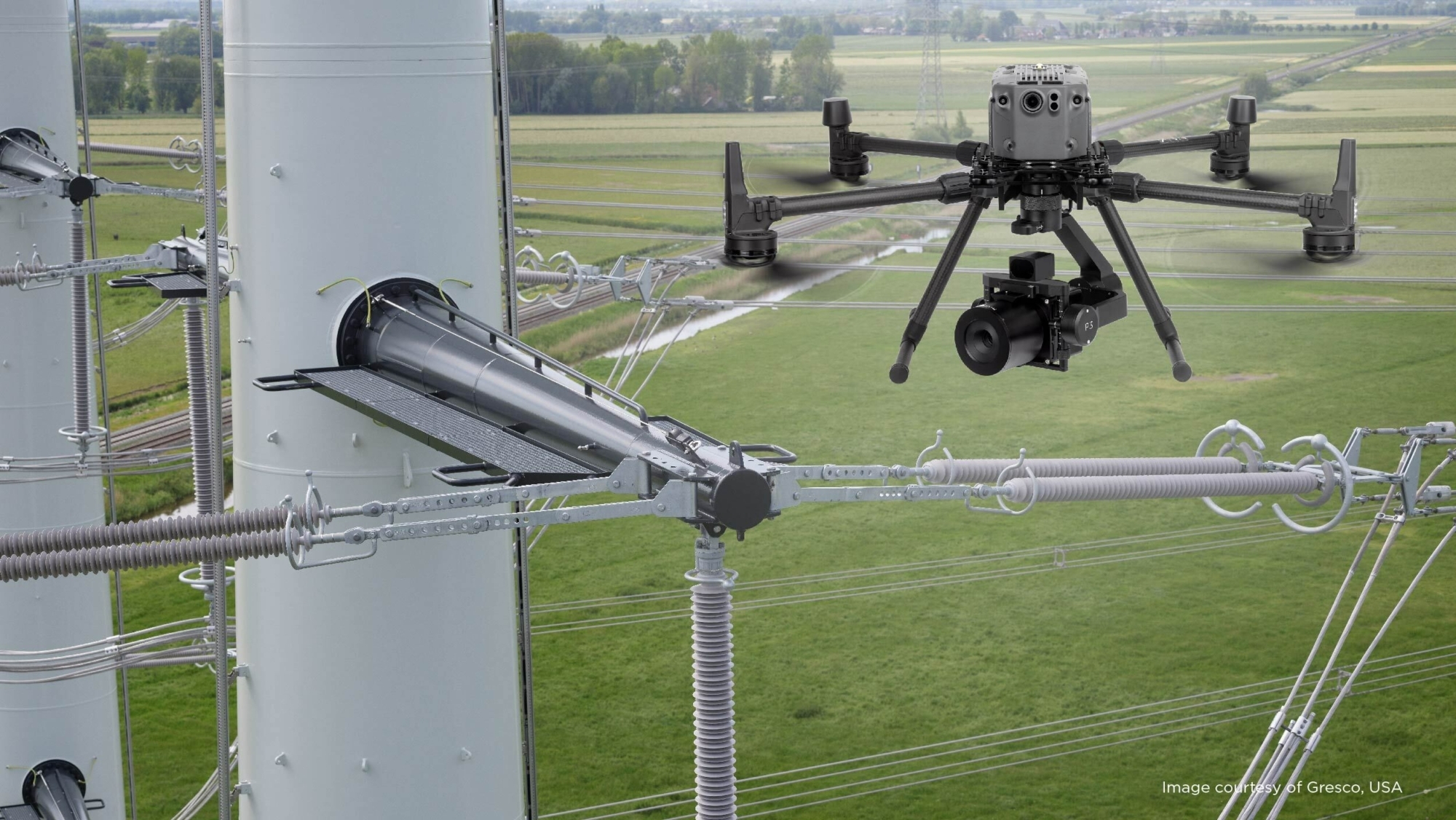
Phase One - P3 Payload Power Line Inspection Test Flight
5th November 2021
Phase One - P3 Payload Bridge Inspection Test Flight
5th November 2021
Phase One - P3 Payload Cellphone Tower Inspection Flight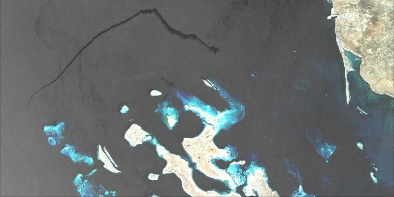
11th May 2021
CGG Launches SeaScope as part of expanding environmental monitoring portfolio

26th March 2021
SimActive Increases Drone Productivity with New Tools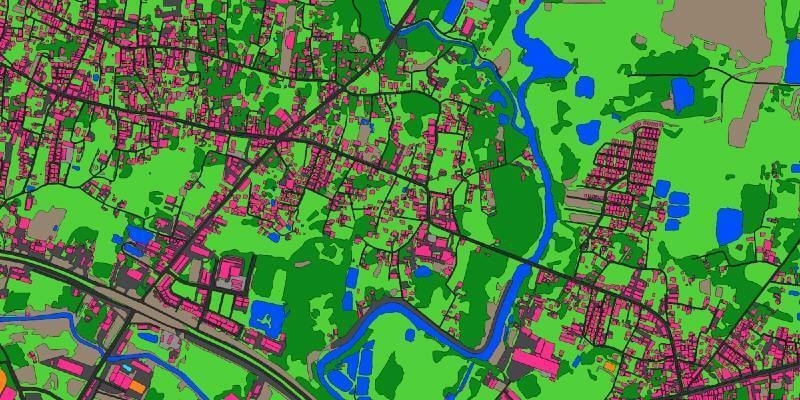
5th March 2021
Ecopia AI and Airbus partnership will provide next-generation digital maps on a global scale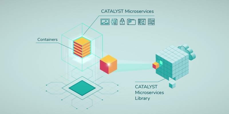
25th February 2021
CATALYST Announces Cost-Effective, Fully Scalable Processing of Earth Observation Imagery on the Cloud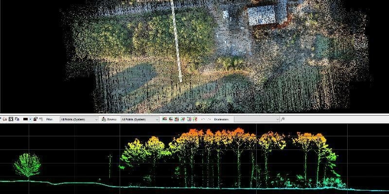
11th February 2021
GeoCue Group Releases New Addition to 3D Imaging Systems Series: True View 515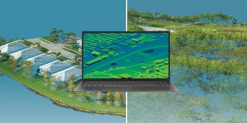


18th January 2021
A Pragmatic Approach to Entering the Drone LIDAR Business

2nd December 2020
CGG Wins Three-Year Contract Extension for Oman Dedicated Processing Center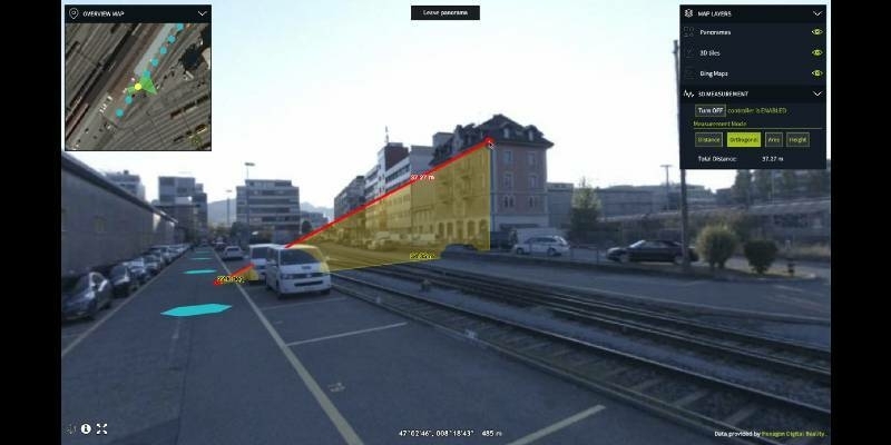
23rd October 2020
Hexagon Releases Luciad 2020.1, Featuring Unique Dynamic Panoramic Imagery Capabilities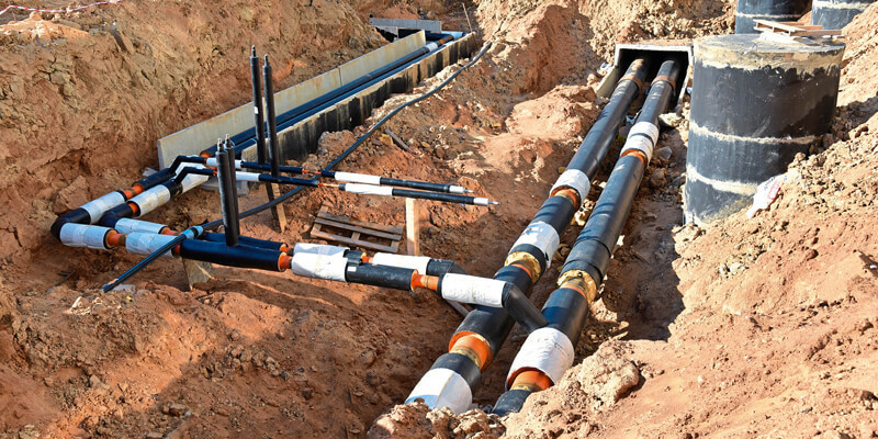

9th September 2020
Save time and speed up image processing & analysis


26th August 2020
PCI Geomatics Announces Partnership with GeoCloud
2nd July 2020
4 Earth Intelligence Publishes Heat Hazard Data as Vulnerable Population Remains in Lockdown
16th June 2020
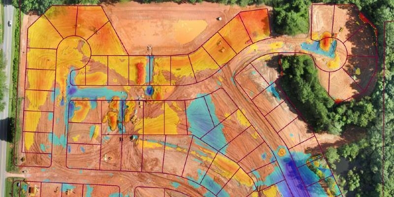
Virtual Surveyor Drone Surveying Software Simplifies Workflow for Earthworks Monitoring at Construction Sites

12th May 2020
RIEGL ultimate LiDAR webinar series - May 2020
11th May 2020
SimActive Webinar on 'How to Efficiently Process Satellite Imagery'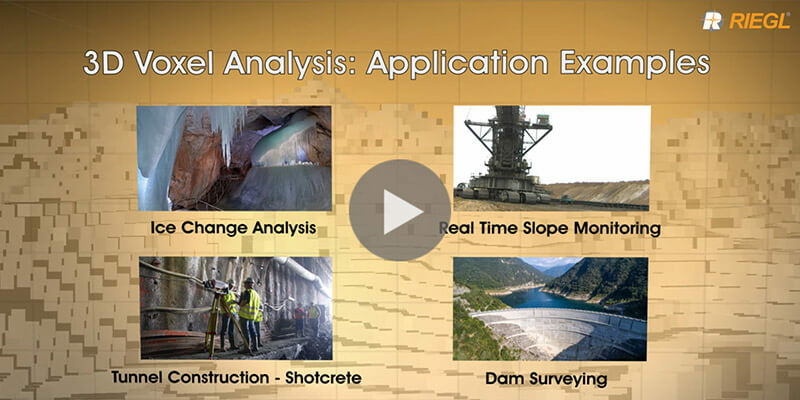
8th May 2020
Riegl's new 3D Voxel Analysis Tool within RiSCAN Pro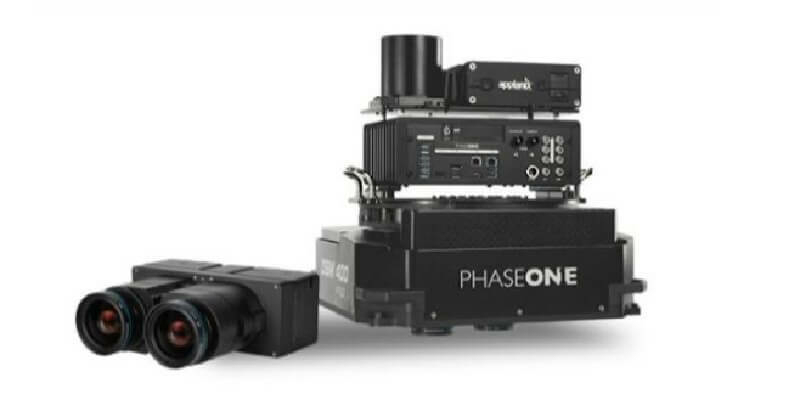
5th May 2020
Introducing the Phase One 280MP Aerial Solution