


As demands on land use increase, thinkWhere Launches Latest Version of location portal groundMapper
14th January 2021
As demands on land use increase, thinkWhere Launches Latest Version of location portal groundMapper
Esri Ireland partners with Bluesky to enhance its digital mapping offering in Ireland
14th January 2021
Esri Ireland partners with Bluesky to enhance its digital mapping offering in IrelandUSGIF Board of Directors Appoints New CEO
13th January 2021
USGIF Board of Directors Appoints New CEO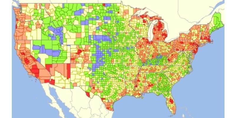
GIS Analytics Server of U.S. Federal Statistical Data
12th January 2021
GIS Analytics Server of U.S. Federal Statistical Data
Ecobot Joins Trimble’s GIS Partner Program to Empower Environmental Regulatory Reporting
5th January 2021
Ecobot Joins Trimble’s GIS Partner Program to Empower Environmental Regulatory Reporting
Explore the Latest in Geospatial and GIS Technology During the AAG 2021 Annual Meeting
28th December 2020
Explore the Latest in Geospatial and GIS Technology During the AAG 2021 Annual Meeting
Innovation in a Year Where Everything Changed
15th December 2020
Innovation in a Year Where Everything Changed
thinkWhere’s groundMapper Underpins GIS Transformation at Tilhil
4th December 2020
thinkWhere’s groundMapper Underpins GIS Transformation at Tilhil
Free Webinar | Solve Geospatial Problems with Deep Learning
2nd December 2020
Free Webinar | Solve Geospatial Problems with Deep Learning
The 3D PluraView stereo monitor family – Meeting the highest requirements for Geospatial applications
2nd December 2020
The 3D PluraView stereo monitor family – Meeting the highest requirements for Geospatial applications

As demands on land use increase, thinkWhere Launches Latest Version of location portal groundMapper
22nd November 2020
As demands on land use increase, thinkWhere Launches Latest Version of location portal groundMapper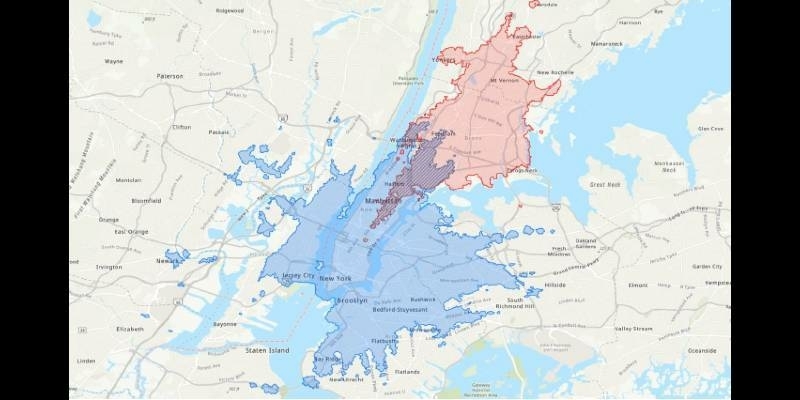
TravelTime Hosts ArcGIS Network Analysis Workshop For GIS Day
13th November 2020
TravelTime Hosts ArcGIS Network Analysis Workshop For GIS Day

Esri Announces Launch of ArcGIS Field Maps
11th November 2020
Esri Announces Launch of ArcGIS Field Maps
Move to Virtual Environment Ensures EDINA Digimap Meets Demand for its Map Delivery Service
29th October 2020
Move to Virtual Environment Ensures EDINA Digimap Meets Demand for its Map Delivery ServicethinkWhere Supports GIS Innovation at Scotland’s Rural College
29th October 2020
thinkWhere Supports GIS Innovation at Scotland’s Rural College
Japanese City Using GIS on iPads for Field Survey
29th October 2020
Japanese City Using GIS on iPads for Field SurveySchneider Electric Releases ArcFM Mobile 11.2.1
29th October 2020
Schneider Electric Releases ArcFM Mobile 11.2.1
Novara GeoSolutions Awarded the Esri Release Ready Specialty Designation
29th October 2020
Novara GeoSolutions Awarded the Esri Release Ready Specialty DesignationGolden Software Improves Surfer File Handling for Faster Mapping
29th October 2020
Golden Software Improves Surfer File Handling for Faster Mapping
East View Geospatial Partners with AllSource Analysis
29th October 2020
East View Geospatial Partners with AllSource Analysis
Esri Acquires nFrames to Enhance Its 3D Capabilities
29th October 2020
Esri Acquires nFrames to Enhance Its 3D Capabilities
Esri Ireland partners with Bluesky to enhance its digital mapping offering in Ireland
23rd October 2020
Esri Ireland partners with Bluesky to enhance its digital mapping offering in Ireland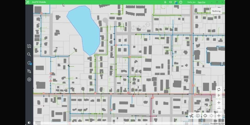
Schneider Electric Releases ArcFM Mobile 11.2.1
20th October 2020
Schneider Electric Releases ArcFM Mobile 11.2.1
Bluesky Creates National Tree Map for Ireland
1st October 2020
Bluesky Creates National Tree Map for Ireland
Cadcorp offers substantial additions to online GIS and web mapping capability in G-Cloud 12
28th September 2020
Cadcorp offers substantial additions to online GIS and web mapping capability in G-Cloud 12
thinkWhere Supports GIS Innovation at Scotland’s Rural College
25th September 2020
thinkWhere Supports GIS Innovation at Scotland’s Rural College
Hexagon Unveils HxGN Smart Census 2020 for Enhanced Citizen Data Collection
16th September 2020
Hexagon Unveils HxGN Smart Census 2020 for Enhanced Citizen Data Collection
Save time and speed up image processing & analysis
9th September 2020
Save time and speed up image processing & analysis
2020 GIS Software Technology Conference Invitation
9th September 2020
2020 GIS Software Technology Conference Invitation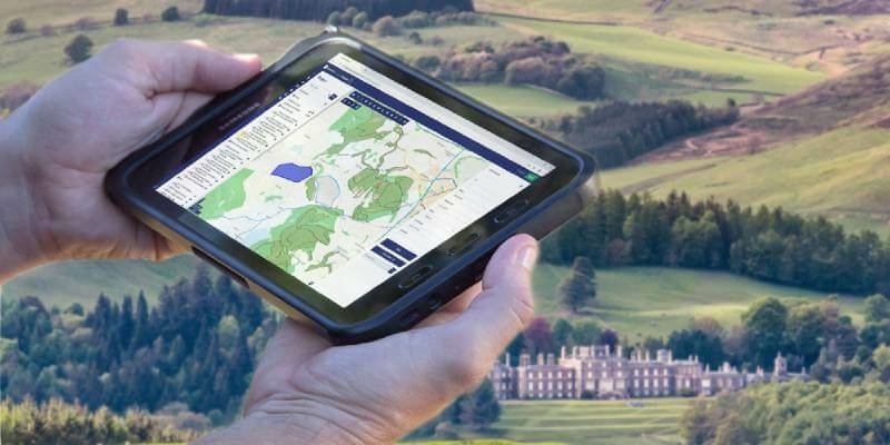
Buccleuch Improves Property and Land Asset Management with thinkWhere
3rd September 2020
Buccleuch Improves Property and Land Asset Management with thinkWhere
How to Generate a 3D Model with Correlator3D
28th August 2020
How to Generate a 3D Model with Correlator3D


The 2020 Recipient of the Arthur C. Lundahl-Thomas C. Finnie Lifetime Achievement Award
26th August 2020
The 2020 Recipient of the Arthur C. Lundahl-Thomas C. Finnie Lifetime Achievement Award
Schneider Electric Announces The New Geodatabase Manager Xi
26th August 2020
Schneider Electric Announces The New Geodatabase Manager Xi
Global forest restoration and the importance of empowering local communities
25th August 2020
Global forest restoration and the importance of empowering local communities