
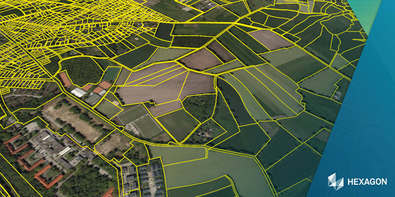
Integrated GIS, web mapping and spatial data for Peel L&P
9th February 2023
Integrated GIS, web mapping and spatial data for Peel L&P
9th February 2023
Integrated GIS, web mapping and spatial data for Peel L&P
9th February 2023
Geo Week features sold-out exhibit floor and 2,500+ registrants

26th January 2023
Esri UK appoints Pete Wilkinson as new managing director

23rd January 2023
Europa Technologies reappointed by Scottish Government for premium PSGA services

16th January 2023
Northern Ireland Fire & Rescue Service awards contract to Cadcorp
3rd January 2023
Esri India launches Carbon Footprint Awareness App
2nd January 2023
AI enables more effective humanitarian action by estimating population density
26th December 2022
New analysis maps out impacts of marine chokepoint closures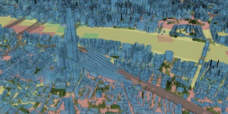
15th December 2022
Vodafone’s mobile network has a digital twin
30th November 2022
Presagis and Airbus Partner to Provide VELOCITY 5D Users Direct Access to OneAtlas Satellite Imagery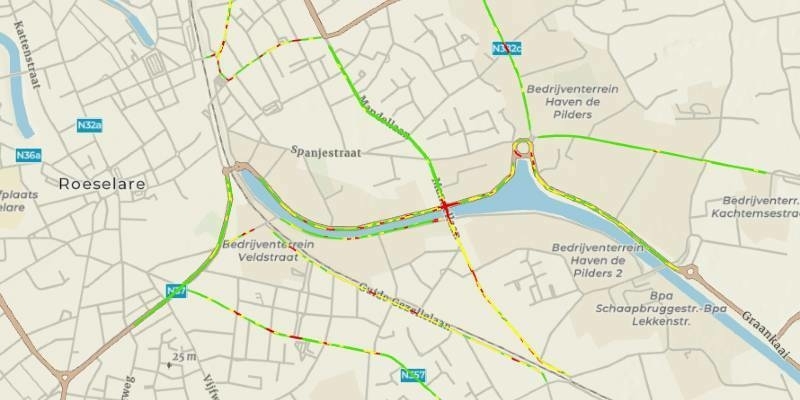
28th November 2022
ArcGIS now hosts Road LiDAR data for public and private road management
24th November 2022
Angus Council selects Cadcorp cloud hosted web GIS
24th November 2022
Esri UK provides mapping expertise for Department for Education’s major new climate project

2nd November 2022
Build geospatial apps faster with hexagon’s M.App Enterprise 20232nd November 2022
Schneider Electric announces IEEE 2030.5 certification of EcoStruxure DERMS2nd November 2022
Esri collaborates with RB rail as to build sustainable rail infrastructure in EU
2nd November 2022
Presagis extends 3D tiles next workflow into Esri ArcGIS Pro
2nd November 2022
Surrey Heath improves public engagement with XMAP mapping portal2nd November 2022
Geograma selects Otonomo to help advance road safety in Spain2nd November 2022
Hexagon announces HxGN NetWorks, rebrands utilities and communications offerings
2nd November 2022
Maxar’s high-resolution Vivid basemaps enhances Esri ArcGIS Living Atlas of the world
2nd November 2022
Esri UK announces new Teach with GIS resources
2nd November 2022
Secure data supply chains with 1Data Gateway 2.7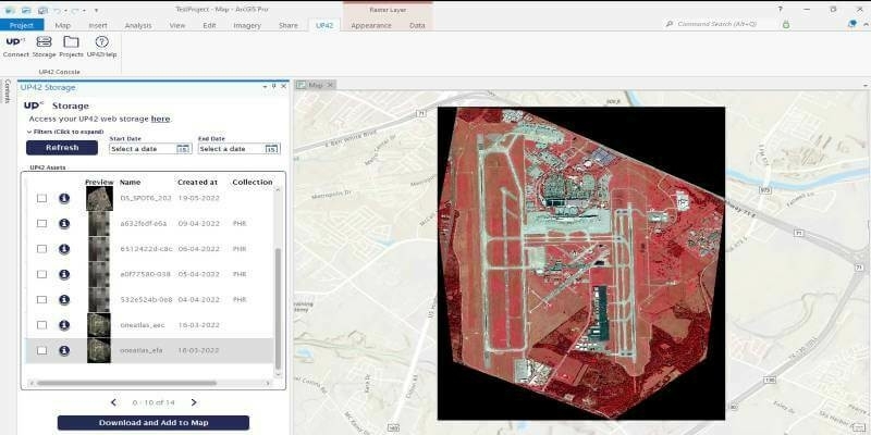
19th October 2022
UP42 Launches ArcGIS Pro Add-in as Part of Esri Partner Network
17th October 2022
Cadcorp expands cloud options for desktop GIS, web mapping and spatial data in G-Cloud 13
13th October 2022
New 1Integrate rules engine project with Environment Agency
5th October 2022
Earth Blox announces no-code SaaS offering for data analysts at Google’s Geo for Good Summit 2022
28th September 2022
Esri UK announces new Teach with GIS resources
14th September 2022
1Spatial enhances data format support and FME integration in rules engine
5th September 2022
1Spatial Two Significant Contract Wins Continuing US Growth and Momentum
1st September 2022
1Spatial Awarded VertiGIS Products Call-Off Contract with Defra
25th August 2022
Geograma Selects Otonomo to Help Advance Road Safety in Spain
22nd August 2022
Esri Collaborates with RB Rail AS to Build Sustainable Rail Infrastructure in EU
16th August 2022
Schneider Electric Announces IEEE 2030.5 Certification of EcoStruxure DERMS
2nd August 2022
CGG Licenses Geothermal Multi-Client Studies Supporting Energy Transition to US Energy Company
2nd August 2022
1Spatial enhances survey capabilities in 1Edit
28th July 2022
Finding the optimum locations for EV charging stations
25th July 2022
Maxar’s High-Resolution Vivid Basemaps Enhances Esri ArcGIS Living Atlas of the World
20th July 2022
1Spatial Awarded 1integrate Call-Off Contract with Defra
19th July 2022
New International Sales Manager at BARTHAUER
19th July 2022
Winners of Geovation’s Diffuse Coastal Pollution Challenge scoop £5,000 each