
Bluesky Tree Map Helps Dudley Protect Urban Trees
29th September 2017
Bluesky Tree Map Helps Dudley Protect Urban Trees
29th September 2017
Bluesky Tree Map Helps Dudley Protect Urban Trees
28th September 2017
Successfully launching the 3rd Annual Smart Parking UAE Conference
28th September 2017
Astun Technology Supports Ordnance Survey27th September 2017
INTERGEO 2017 Berlin: Geo-IT-event officially opened26th September 2017
Partnership Offers Analysis Software for Scholarship Winners26th September 2017
ArcGIS Pro Users 'Finding the Best Place for a Public Park'26th September 2017
Commercial UAV Expo Europe Moves to Amsterdam in April, 201826th September 2017
New extras added to Global Mapper V.19 - Now Availale
26th September 2017
3D Repo and Bryden Wood to develop 4D Virtual Reality Models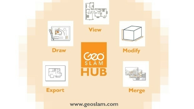
25th September 2017
New Product Launches At Intergeo From GeoSLAM25th September 2017
OS to support Singapore as a smart technology world leader25th September 2017
Skyline Software Systems Opens Another European Office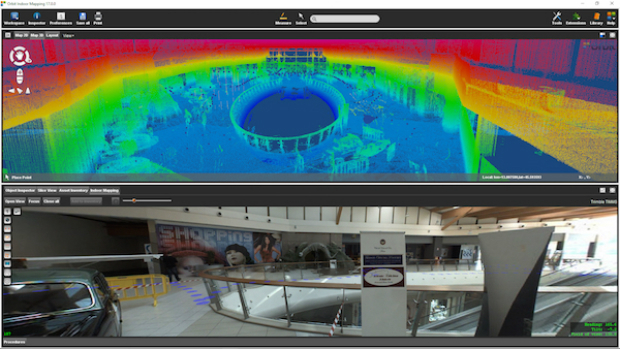
25th September 2017
Orbit GT and Applanix, Canada, sign Reseller Agreement
22nd September 2017
Real-Time Construction Quality Management, Advanced
22nd September 2017
Orbit GT to showcase new 3D Mapping Cloud features at Intergeo, Berlin
22nd September 2017
5 ways in which councils are to celebrate Gazetteers@GIS Day21st September 2017
2017 URISA Exemplary Systems in Government Award Recipients Announced21st September 2017
LizardTech Awarded U.S. Patent for LiDAR Point Cloud Compression21st September 2017
Three Swedish neighbouring municipalities choose Digpro19th September 2017
GeoCue Group Provides Free Lidar Data For Hurricane Impact Areas
19th September 2017
Esri Podcast Series Explores How Location Technology Helps Businesses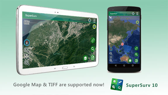
19th September 2017
SuperSurv 10.1 Supports New Raster Formats and Online Maps
19th September 2017
Bentley’s AECOsim Building Designer CONNECT Edition18th September 2017
Northern Ireland’s SMEs look to Space for new business opportunities
18th September 2017
ENA’s Open Networks will be hosting a free webinar on September 21
16th September 2017
Esri to Present at TechCrunch Disrupt SF 2017
16th September 2017
Maptitude Supports High School Course in Geographic Technology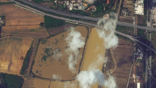
15th September 2017
Italy: Satellite Images of Flooding in Livorno15th September 2017
7th International Conference on Cartography & GIS15th September 2017
Second Annual PrecisionAg® Vision Conference15th September 2017
RENEXPO® BiH 2017 open the doors for the 4th time.15th September 2017
VolkerWessels to Use Yotta’s Horizons on Dutch Infrastructure Project13th September 2017
PCI Geomatics Releases Geomatica 2017, Service Pack 112th September 2017
Drone Software Donation for Hurricane Recovery12th September 2017
GEO Business 2018: Over 75% of space already booked11th September 2017
AND aims to redefine map making & change the mapping industry
8th September 2017
Hexagon Receives Recognition from Huawei for Safe City Solution8th September 2017
MapAction sends two more teams to reinforce Hurricane Irma response7th September 2017
Faster, More Expansive Carlson Point Cloud for 2018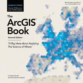
7th September 2017
Put the Science of Where into Practice with The ArcGIS Book7th September 2017
Locating Bahrain’s Underground Utilities
7th September 2017
Customer-Driven Improvements Highlight Carlson Survey 2018
6th September 2017
Several Improvements Made in the Latest Version of SuperGIS Desktop 10
6th September 2017
SuperSurv Assists Ecological Research in France
6th September 2017
Airborne mapping system from 3D Laser Mapping takes off