Avenza Map Store Now Offers More Than 36,000 Maps

11th January 2018

Avenza Map Store Now Offers More Than 36,000 Maps

GSI Certified by the Women’s Business Enterprise National Council

10th January 2018

GSI Certified by the Women’s Business Enterprise National Council
Developing Data Ecosystems with the 1Spatial FME World Tour (from import)

Developing Data Ecosystems with the 1Spatial FME World Tour

9th January 2018

Developing Data Ecosystems with the 1Spatial FME World Tour
Novara GeoSolutions Unveils a New Website (from import)
Novara GeoSolutions Unveils a New Website

9th January 2018

Novara GeoSolutions Unveils a New Website
Fire Services Analysis Workshop (from import)

Fire Services Analysis Workshop

8th January 2018

Fire Services Analysis Workshop

TatukGIS SDK for ActiveX Upgrade

5th January 2018

TatukGIS SDK for ActiveX Upgrade
East View Geospatial Offers New Formats (from import)

East View Geospatial Offers New Formats

5th January 2018

East View Geospatial Offers New Formats

9th IGRSM International Conference and Exhibition

5th January 2018

9th IGRSM International Conference and Exhibition

Avenza Releases Geographic Imager 5.3 for Adobe Photoshop

5th January 2018

Avenza Releases Geographic Imager 5.3 for Adobe Photoshop
Kara Utter Named URISA Young Professional of the Year (from import)

Kara Utter Named URISA Young Professional of the Year

5th January 2018

Kara Utter Named URISA Young Professional of the Year
Yotta strengthens marketing function to accelerate global growth (from import)

Yotta strengthens marketing function to accelerate global growth

4th January 2018

Yotta strengthens marketing function to accelerate global growth
New horizons for Warrington (from import)

New horizons for Warrington

2nd January 2018

New horizons for Warrington
Orbit GT showcases Automated Pole and Bridge Clearance Detection (from import)

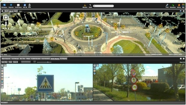
Orbit GT showcases Automated Pole and Bridge Clearance Detection

2nd January 2018

Orbit GT showcases Automated Pole and Bridge Clearance Detection
Supergeo Teams up with DataGNSS to Provide a Cost-effective RTK Solution (from import)

Supergeo Teams up with DataGNSS to Provide a Cost-effective RTK Solution

23rd December 2017

Supergeo Teams up with DataGNSS to Provide a Cost-effective RTK Solution
Supergeo’s New Website Brings a More Pleasant Browsing Experience (from import)

Supergeo’s New Website Brings a More Pleasant Browsing Experience

23rd December 2017

Supergeo’s New Website Brings a More Pleasant Browsing Experience
Unlock Information from Imagery for Use in Maps and Analysis (from import)
Unlock Information from Imagery for Use in Maps and Analysis

22nd December 2017

Unlock Information from Imagery for Use in Maps and Analysis
UrtheCast and SIIS sign agreement (from import)

UrtheCast and SIIS sign agreement

21st December 2017

UrtheCast and SIIS sign agreement

Blue Marble Adds Chinese Reseller to its Worldwide Network of Partners

20th December 2017

Blue Marble Adds Chinese Reseller to its Worldwide Network of Partners

Topcon and Bentley announce kick-off of Constructioneering Academy

20th December 2017

Topcon and Bentley announce kick-off of Constructioneering Academy

Linear Draft - 3D BIM Overhead Line Electrification Designer
20th December 2017

Linear Draft - 3D BIM Overhead Line Electrification Designer
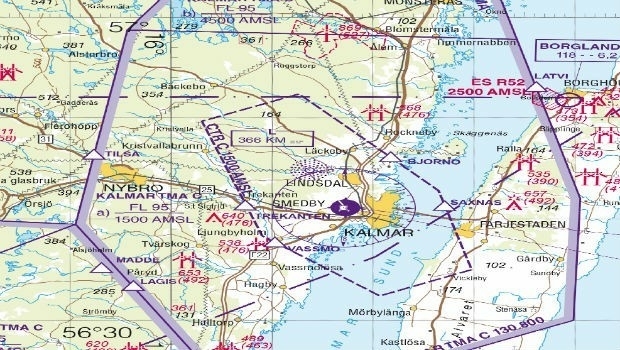
East View Geospatial Now Offering Swedish Aeronautical Charts (from import)

East View Geospatial Now Offering Swedish Aeronautical Charts

20th December 2017

East View Geospatial Now Offering Swedish Aeronautical Charts
U.S. Embassy officially on the map (from import)

U.S. Embassy officially on the map

19th December 2017

U.S. Embassy officially on the map
Esri Maps Highlight Holiday Traffic around Major Airports (from import)

Esri Maps Highlight Holiday Traffic around Major Airports

19th December 2017

Esri Maps Highlight Holiday Traffic around Major Airports

Landmark Information secures Met Office digital contract

19th December 2017

Landmark Information secures Met Office digital contract

New BIM Publication: Plain Language BIM

16th December 2017

New BIM Publication: Plain Language BIM

Big Data Analytics for Geospatial Solutions Accelerated

16th December 2017

Big Data Analytics for Geospatial Solutions Accelerated
GeoSLAM Celebrates 5 Years In Business With New HQ & Record Growth (from import)

GeoSLAM Celebrates 5 Years In Business With New HQ & Record Growth

15th December 2017

GeoSLAM Celebrates 5 Years In Business With New HQ & Record Growth
Anholt-GfK Nation Brands Index study, 2017 (from import)
Anholt-GfK Nation Brands Index study, 2017

14th December 2017

Anholt-GfK Nation Brands Index study, 2017
Esri Maps Highlight Net Neutrality Implications (from import)

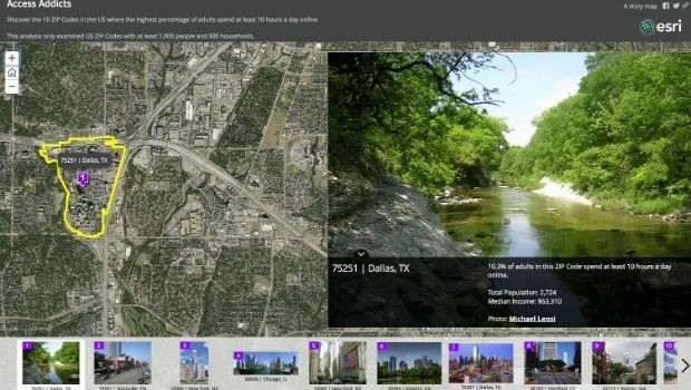
Esri Maps Highlight Net Neutrality Implications

14th December 2017

Esri Maps Highlight Net Neutrality Implications

Caliper Corporation (Maptitude, TransCAD) Joins the USGS Coalition

14th December 2017

Caliper Corporation (Maptitude, TransCAD) Joins the USGS Coalition

Orbit GT and Mena 3D, Germany, sign Reseller Agreement

14th December 2017

Orbit GT and Mena 3D, Germany, sign Reseller Agreement
NGA, NATO and the UK MoD Headline DGI 2018 Speaker Lineup (from import)

NGA, NATO and the UK MoD Headline DGI 2018 Speaker Lineup

14th December 2017

NGA, NATO and the UK MoD Headline DGI 2018 Speaker Lineup
DGI 18-The Premier Annual Meeting for Geospatial Intelligence Leaders (from import)

Peering into the future of Geospatial Intelligence

14th December 2017

Peering into the future of Geospatial Intelligence

3D at Depth Partners with iQ3Connect

13th December 2017

3D at Depth Partners with iQ3Connect
Bluesky Aerial Photos Help Darlington Council Map out Economic Growth (from import)

Bluesky Aerial Photos Help Darlington Council Map out Economic Growth

13th December 2017

Bluesky Aerial Photos Help Darlington Council Map out Economic Growth
Maptitude Mapping Software Donated to USGIF Academic Partners (from import)

Maptitude Mapping Software Donated to USGIF Academic Partners

13th December 2017

Maptitude Mapping Software Donated to USGIF Academic Partners
New Version of Trimble eCognition Suite available (from import)

New Version of Trimble eCognition Suite available

12th December 2017

New Version of Trimble eCognition Suite available

Esri Technology Will Help Power United Nations' New Global Data Hub

12th December 2017

Esri Technology Will Help Power United Nations' New Global Data Hub

Finding data ranks as top challenge for geoscience data management

8th December 2017

Finding data ranks as top challenge for geoscience data management
Pix4D is expanding globally (from import)

Pix4D is expanding globally

7th December 2017

Pix4D is expanding globally
CGG Releases Multi-Client Airborne GravMag Survey (from import)

CGG Releases Multi-Client Airborne GravMag Survey

7th December 2017

CGG Releases Multi-Client Airborne GravMag Survey
Esri Publishes a Textbook on How to Use ArcGIS Pro (from import)

Esri Publishes a Textbook on How to Use ArcGIS Pro

7th December 2017

Esri Publishes a Textbook on How to Use ArcGIS Pro

OGC seeks public comment on CDB Multi-spectral Imagery Extension

6th December 2017

OGC seeks public comment on CDB Multi-spectral Imagery Extension
Severn Partnership: We have moved! (from import)

Severn Partnership: We have moved!

6th December 2017

Severn Partnership: We have moved!

GeoPlace Recognised As An Investor In People

6th December 2017

GeoPlace Recognised As An Investor In People

Monsanto and Boundless Collaborate for Open Source GIS Contributions

6th December 2017

Monsanto and Boundless Collaborate for Open Source GIS Contributions
Avenza Maps iOS App Launches In The GEOINT App Store (from import)

Avenza Maps iOS App Launches In The GEOINT App Store

6th December 2017

Avenza Maps iOS App Launches In The GEOINT App Store

UrtheCast and Twenty First Aerospace Technology Partnership

6th December 2017

UrtheCast and Twenty First Aerospace Technology Partnership