
Havebury Housing introduces GIS to meet corporate strategy objectives
28th July 2023
Havebury Housing introduces GIS to meet corporate strategy objectives
28th July 2023
Havebury Housing introduces GIS to meet corporate strategy objectives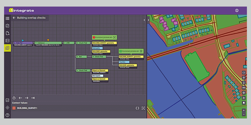

25th July 2023
Torus gains clear and compelling insights with Cloud GIS and web mapping
18th July 2023
Geospatial Intelligence Drives the Future of GIS
17th July 2023
New Trimble Terra Office Workflow Delivers Integration with Esri ArcGIS Pro
14th July 2023
Schneider Electric and ROK Technologies Partner to Help Utilities Migrate ArcFM and ArcGIS Systems to the Cloud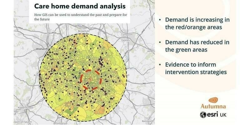
13th July 2023
Autumna increases enquiries for care homes using GIS from Esri UK
12th July 2023
Building a green supply chain for a sustainable future with the Supply Chain Data Partnership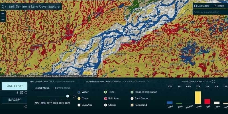
11th July 2023
Esri Releases Latest Land Cover Map with Improved AI Modeling
10th July 2023
1Spatial launches 1Capture, the configurable GIS mobile app delivering ‘right first time’ surveys
6th July 2023
Esri Partners with Databricks to Bring Spatial Analytics Functionality to the Lakehouse Platform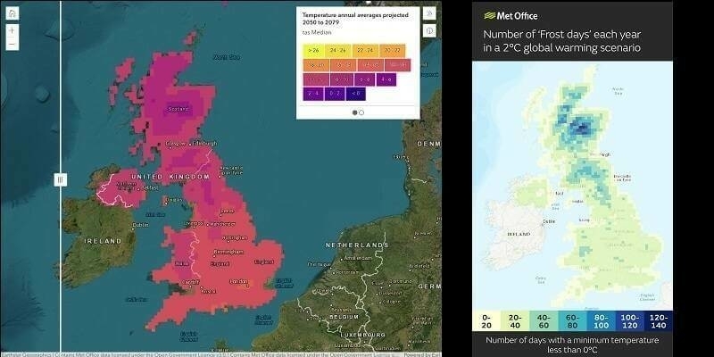
3rd July 2023
Met Office makes climate data more accessible with Esri GIS

31st May 2023
Havebury Housing introduces GIS to meet corporate strategy objectives
25th May 2023
Esri Releases New Desktop Software to Easily Synthesize All Sources of Information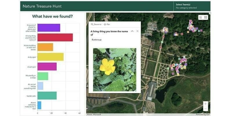
23rd May 2023
Children test mapping apps for Department for Education’s climate project
19th May 2023
Esri Book Demonstrates How Natural Resource Organizations Can Improve Sustainability, Profits
3rd May 2023
Association for Geographic Information Headlines at GEO Business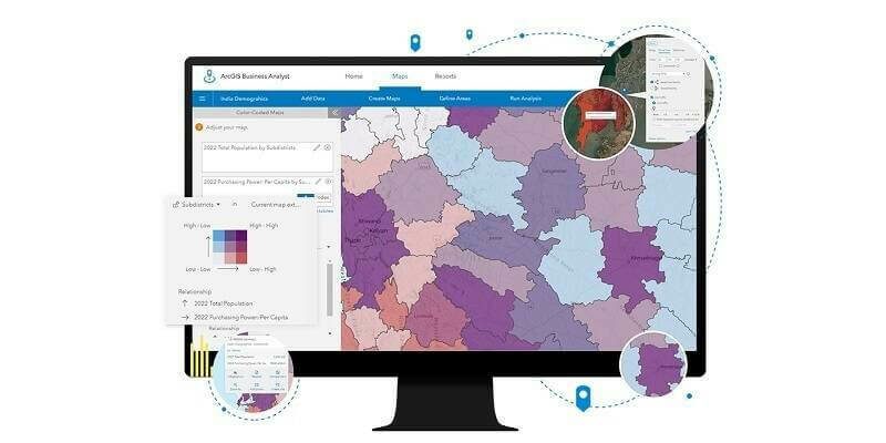
24th April 2023
Esri India Launches ArcGIS Business Analyst

18th April 2023
KOREC Group unveils new customer-centric Mission Statement

16th April 2023
GIS software release designed to help organisations gain deeper insight into data
16th April 2023
David Eagle joins Tensing as Director of Service Delivery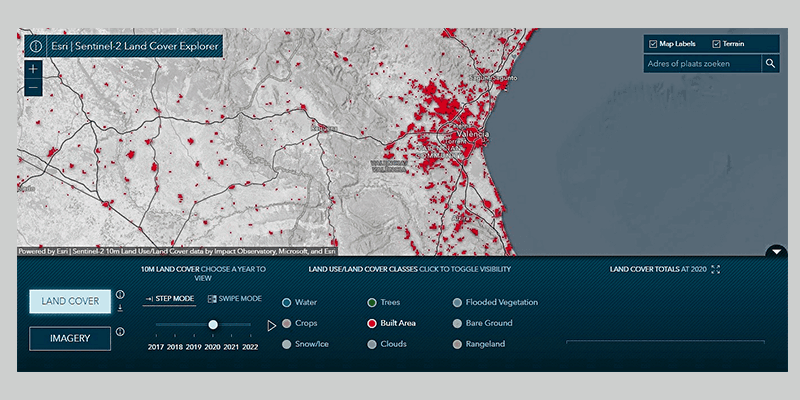
14th April 2023
Esri Releases New App to Easily View and Analyze Global Land-Cover Changes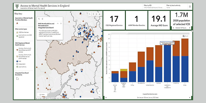
14th April 2023
First national picture of mental health service provision launched by Association of Mental Health Providers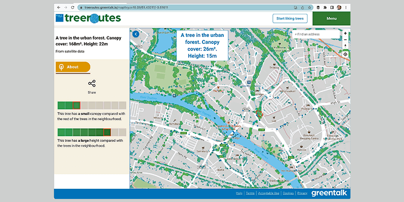
14th April 2023
Bluesky Tree Map Enhances Online Urban Forest Mapping Platform
14th April 2023
MGISS partners with Leica Geosystems to drive a data-centric approach for Asset Managers
5th April 2023
CompassCom Unveils Next-Gen CompassLDE Connectors for Real-Time Asset Tracking in Esri ArcGIS Solutions
4th April 2023
Esri Book Demonstrates How to Create Map Apps with User Experience in Mind
31st March 2023
Esri UK appoints Mark Wells as Chief Technology Officer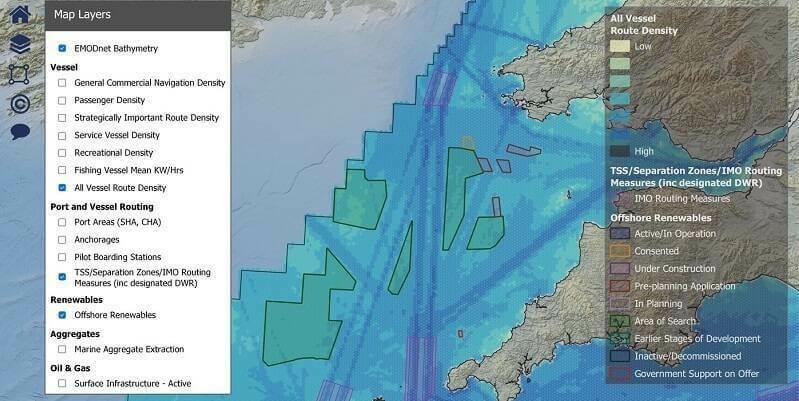
23rd March 2023
NASH Maritime launches shipping constraints tool for offshore developers
23rd March 2023
David Eagle joins Tensing as Director of Service Delivery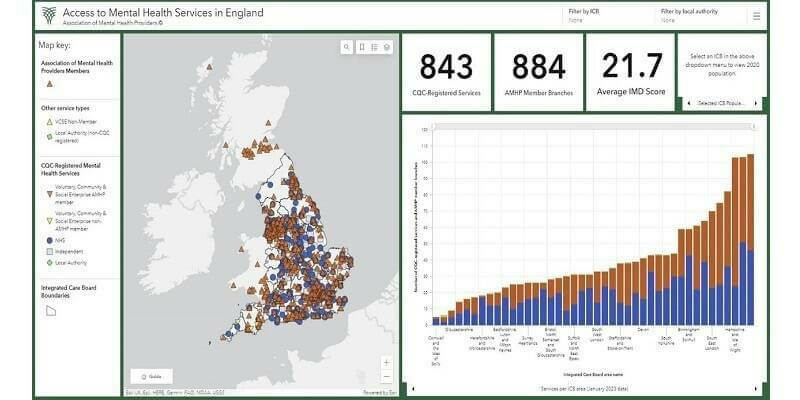
15th March 2023
First national picture of mental health service provision launched by Association of Mental Health Providers13th March 2023
Defence Geospatial Intelligence (DGI) 2023 Conference

1st March 2023
Esri Enters into Agreement with United Nations Population Fund to Help Modernize National Statistics Programs
1st March 2023
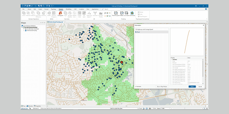
Cadcorp Expands Cloud Options for Desktop GIS, Web Mapping and Spatial Data in G-Cloud 13
1st March 2023
Esri UK Provides Mapping Expertise for Department for Education’s Major New Climate Project
1st March 2023
UP42 Launches Arcgis Pro Add-in as Part of Esri Partner Network
1st March 2023
New Trimble TerraFlex Software Edition Simplifies GIS Data Capture

1st March 2023
Integrated GIS, Web Mapping and Spatial Data for Peel L&P

1st March 2023
Intermap Announces $3.1 Million Contract with Multiple European Insurers
20th February 2023
Share your knowledge and expertise at GEO Business – call for speakers now open!
16th February 2023
EDF improves collaboration at Hinkley Point C with GIS portal