
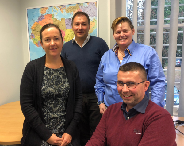
Getmapping Announces New European Management Team Structure
20th November 2018
Getmapping Announces New European Management Team Structure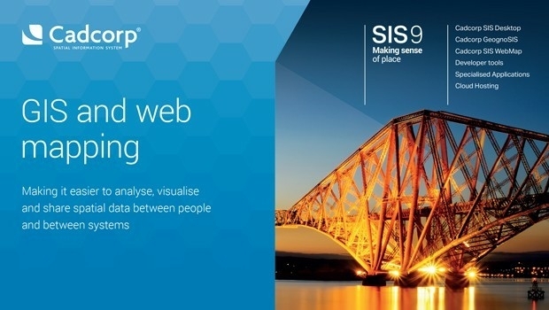
SCISYS Launches Location-Based services toolkit
20th November 2018
SCISYS Launches Location-Based services toolkit
SimActive Releases Version 8.0 with 3D Modeling
19th November 2018
SimActive Releases Version 8.0 with 3D Modeling
Schneider Electric Announces Partnership With RMSI
16th November 2018
Schneider Electric Announces Partnership With RMSI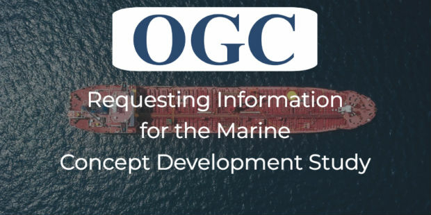
OGC announces a Request for Information on Marine Concept Development Study
16th November 2018
OGC announces a Request for Information on Marine Concept Development Study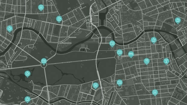
Tencent selects HERE as global provider of map and places data
15th November 2018
Tencent selects HERE as global provider of map and places data
OGC seeks public comment on Hierarchical Data Format Version 5 (HDF5)
14th November 2018
OGC seeks public comment on Hierarchical Data Format Version 5 (HDF5)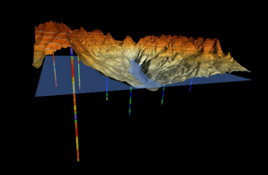
Golden Software Enhances 3D Data Visualization in Surfer 16
13th November 2018
Golden Software Enhances 3D Data Visualization in Surfer 16
Bentley Systems Announces the Acquisition of ACE enterprise Slovakia
13th November 2018
Bentley Systems Announces the Acquisition of ACE enterprise Slovakia
Bentley Systems Announces Agreement to Acquire AIworx,
13th November 2018
Bentley Systems Announces Agreement to Acquire AIworx,
Maptitude Team Supports UTDallas GIS Day Events
13th November 2018
Maptitude Team Supports UTDallas GIS Day Events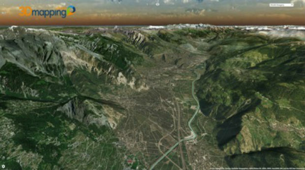
Orbit GT upgrades 3D Mapping Cloud to support Meshes, DEMs
13th November 2018
Orbit GT upgrades 3D Mapping Cloud to support Meshes, DEMs
Anis Saad is the new owner of the BARTHAUER GROUP
13th November 2018
Anis Saad is the new owner of the BARTHAUER GROUP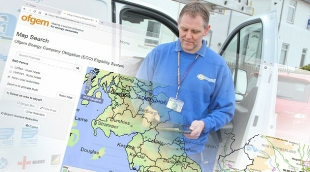
thinkWhere Online App Helps Regulator Tackle Fuel Poverty
13th November 2018
thinkWhere Online App Helps Regulator Tackle Fuel Poverty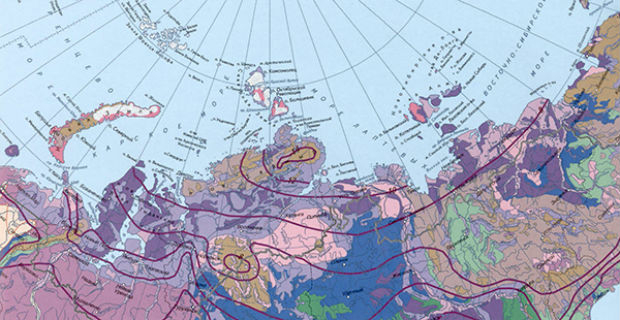
The National Atlas of the Arctic — Limited Copies Now Available
10th November 2018
The National Atlas of the Arctic — Limited Copies Now Available
GEO Business 2019 – Call for Abstracts Announced
9th November 2018
GEO Business 2019 – Call for Abstracts Announced
Teledyne CARIS Sponsoring GEBCO Symposium 2018
8th November 2018
Teledyne CARIS Sponsoring GEBCO Symposium 2018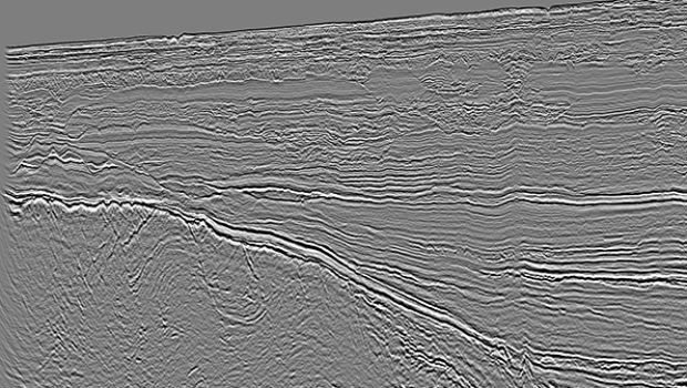
CGG’s Mozambique Multi-Client Survey Now Available
8th November 2018
CGG’s Mozambique Multi-Client Survey Now Available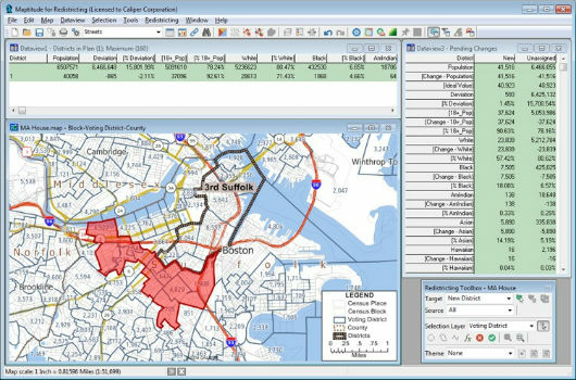
Learn More About Maptitude for Redistricting
8th November 2018
Learn More About Maptitude for Redistricting
Boundless to Sponsor AGS Geography Teacher Fellows Program at Geography 2050
8th November 2018
Boundless to Sponsor AGS Geography Teacher Fellows Program at Geography 2050
Map Maker AND joins the Esri Partner Network
7th November 2018
Map Maker AND joins the Esri Partner Network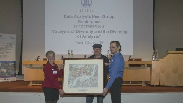
MapAction wins Data Analysts User Group award
7th November 2018
MapAction wins Data Analysts User Group award
Esri announces 20th annual GIS Day to be held on Nov 14
7th November 2018
Esri announces 20th annual GIS Day to be held on Nov 14
TPC Desktop 2018 Release 2 is Now Available!
7th November 2018
TPC Desktop 2018 Release 2 is Now Available!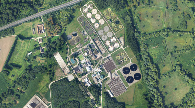
Bluesky 3D Models Help Anglian Water Improve Infrastructure
7th November 2018
Bluesky 3D Models Help Anglian Water Improve Infrastructure
Saber Online Surveys Aid Forward Planning for West Sussex Highways
30th October 2018
Saber Online Surveys Aid Forward Planning for West Sussex Highways
GfK releases updated maps for all of Europe
29th October 2018
GfK releases updated maps for all of Europe
SAFIR consortium chosen to carry out U-space drone demonstrations
29th October 2018
SAFIR consortium chosen to carry out U-space drone demonstrations
Eos Supports Haiti Outreach in its Sustainable Water Initiative
27th October 2018
Eos Supports Haiti Outreach in its Sustainable Water Initiative
Pakistan’s Bahria University Benefits from CGG GeoSoftware’s Donation
25th October 2018
Pakistan’s Bahria University Benefits from CGG GeoSoftware’s Donation
thinkWhere’s theMapCloud Powers New Online Data Services
25th October 2018
thinkWhere’s theMapCloud Powers New Online Data Services
Esri enters into MOU with UAE Statistics Authority
24th October 2018
Esri enters into MOU with UAE Statistics Authority
Remember Remember QGIS 3 Training in November
24th October 2018
Remember Remember QGIS 3 Training in November
GeoSpock Wins Liverpool Mayor’s ‘Smart Cities Realised’
24th October 2018
GeoSpock Wins Liverpool Mayor’s ‘Smart Cities Realised’
MAPPS Announces Passage of the Geospatial Data Act
24th October 2018
MAPPS Announces Passage of the Geospatial Data Act
Schneider Electric Expands Electric, Gas And Water Features
23rd October 2018
Schneider Electric Expands Electric, Gas And Water Features
Bentley Systems Announces Winners of Year in Infrastructure 2018 Awards
23rd October 2018
Bentley Systems Announces Winners of Year in Infrastructure 2018 Awards
Esri Announces Student Poster Competition
22nd October 2018
Esri Announces Student Poster Competition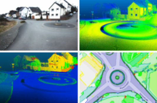
Fraunhofer IPM supports route planning for fiber-optic networks
22nd October 2018
Fraunhofer IPM supports route planning for fiber-optic networks
OGC seeks public comment on Symbology Conceptual Core Model
22nd October 2018
OGC seeks public comment on Symbology Conceptual Core Model
Ordnance Survey appoints John Clarke as Non-Executive Director
22nd October 2018
Ordnance Survey appoints John Clarke as Non-Executive Director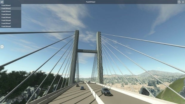
Comprehensive Modeling Environment for Multidiscipline Collaboration
22nd October 2018
Comprehensive Modeling Environment for Multidiscipline Collaboration
Spectra Precision Announces Name Change and a New Brand Identity
19th October 2018
Spectra Precision Announces Name Change and a New Brand Identity
Government of Canada to Invest $7.2 Million in exactEarth
19th October 2018
Government of Canada to Invest $7.2 Million in exactEarth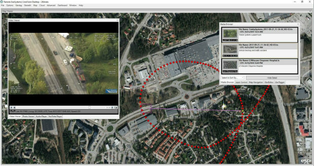
Remote GeoSystems Releases New MISB FMV Module
19th October 2018
Remote GeoSystems Releases New MISB FMV Module
Apps from Avineon Now Available in the ArcGIS Marketplace
18th October 2018
Apps from Avineon Now Available in the ArcGIS Marketplace