
Vegetation Assessment Along Waterbodies Completed with SimActive
7th November 2024
Vegetation Assessment Along Waterbodies Completed with SimActive
03-05
Nov
7th November 2024
Vegetation Assessment Along Waterbodies Completed with SimActive

19th March 2024
SimActive Used to Control Accuracy Through Different Types of GCPs
14th March 2024
GCPs for Photogrammetry: How Many Do You Need?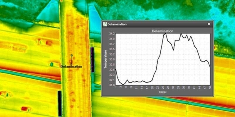
4th January 2024
NV5 Geospatial’s Thermal Infrared Solutions Gain Traction for U.S. Infrastructure Challenges

16th October 2023
SimActive Accelerates Point Cloud Generation with Version 10.1
11th September 2023
Fathom revolutionizes flood risk intelligence with new US Flood Map
11th September 2023
DataSight Releases Breakline Builder 4.0
11th September 2023
SimActive Used with Phase One cameras Cameras for Precise Photogrammetry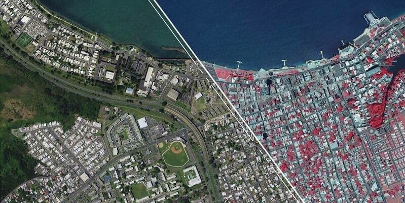
23rd August 2023
Hexagon announces refresh of Puerto Rico’s and U.S. Virgin Islands’ aerial imagery and elevation mapping data
19th July 2023
SimActive Announces New Pricing for Larger Drone Cameras
24th May 2023
SimActive Software Used for Meeting Accuracy Standards
15th May 2023
How To Meet Photogrammetric Accuracy Standards
18th April 2023
Intermap Announces New Contract for Agriculture Management in Southeast Asia

22nd March 2023
SimActive Software Used to Accelerate Corridor Mapping
1st March 2023
AirWorks and Datasight Announce Strategic Partnership for More Efficient Map Production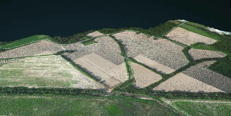
22nd February 2023
SimActive Software Used to Colorize Lidar
17th February 2023
CompassData Appoints Kate Schlatter as New CEO
26th October 2022
Malaysian Government's JUPEM Selects SimActive's Correlator3D Software for Data Processing
6th October 2022
Virtual Surveyor Unveils Innovative Method of Generating Topographic Surfaces from Drone Survey Data
6th September 2022
Intermap Partners with Generali Romania for Advanced Flood Risk Assessment Solution
31st August 2022
3D Stereo visualization with 3D PluraView improves Hexagon ImageStation photogrammetry workflow
27th June 2022
Presagis Extends 3D Tiles Next Workflow into Esri ArcGIS Pro
21st June 2022
SimActive Releases Version 9.2 with Phase One IIQ Integration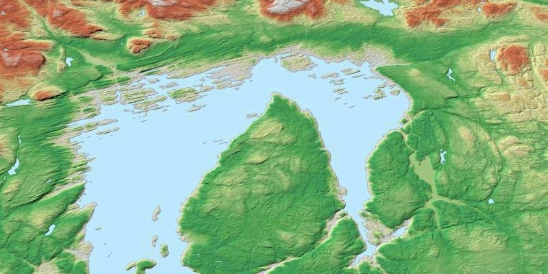
8th June 2022
OneAtlas now allows tasking of Airbus’ radar satellites, access to archive radar and WorldDEM data
20th May 2022
Global market overview of stereoscopic software solutions

12th April 2022
MAPPS presents the 2021 Geospatial Products and Services Excellence Awards
30th March 2022
SimActive Releases Correlator3D Version 9.1 with Productivity Enhancements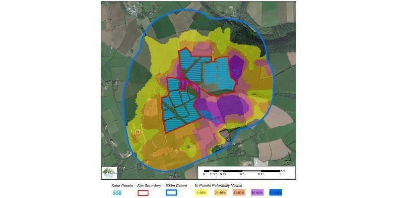
23rd March 2022
Bluesky 3D Models Help Macro Works Plan Milestone Solar Farm in Ireland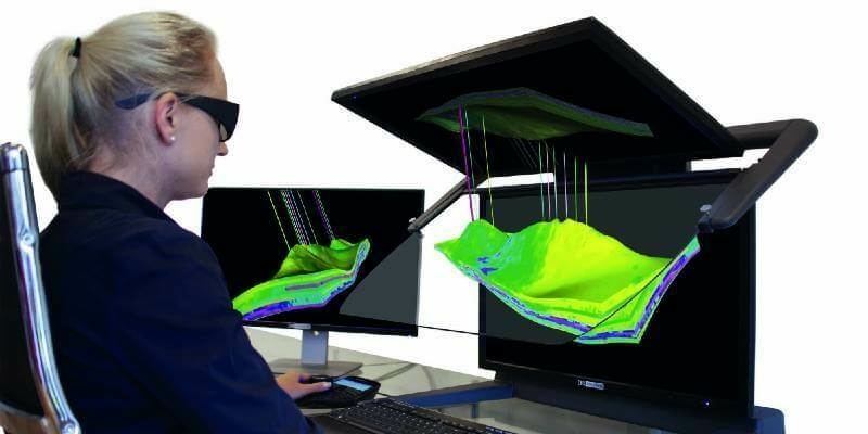
7th March 2022
3D PluraView – stereoscopic 3D-visualisation for the oil- and gas industry
7th February 2022
MAPPS Presents the 2021 Geospatial Products and Services Excellence Awards
23rd December 2021
Terrasolid maps the world in 3D – 3D PluraView monitors visualize in Stereo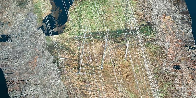
22nd December 2021
Exelon Clearsight Acquires GeoCue’s True View 615 LIDAR/Imagery Mapping Sensor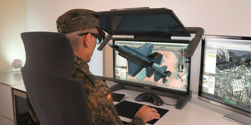
19th November 2021
3D PluraView – stereoscopic desktop monitors for military use – shielded and zoned according to NATO standards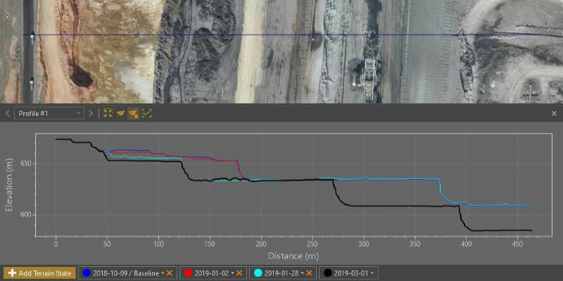
18th November 2021
Virtual Surveyor Provides Comprehensive Insights into Drone Survey Data with Addition of Profile View
16th November 2021
PlanetDEM – A Highly Reliable Digital Elevation Model
2nd September 2021
Bluesky Aerial Photomaps Feature in International Arts Festival
19th August 2021
Esri ArcGIS Pro certified for 3D stereo visualization with 3D PluraView monitors
11th August 2021
Agisoft Metashape Pro and 3D PluraView monitors enable 3D-stereo photogrammetry at its best
12th July 2021
Esri ArcGIS Pro certified for 3D stereo visualization with 3D PluraView monitors
11th June 2021
Global partnership announced between Schneider Digital and DAT/EM Systems International
28th April 2021
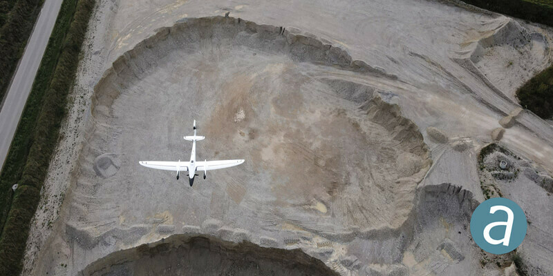
Processing of Quantum-Systems Drone Data Integrated in SimActive Software