.jpg)
6 major construction companies adopt new BIM monitoring solution
9th April 2017
6 major construction companies adopt new BIM monitoring solution
9th April 2017
6 major construction companies adopt new BIM monitoring solution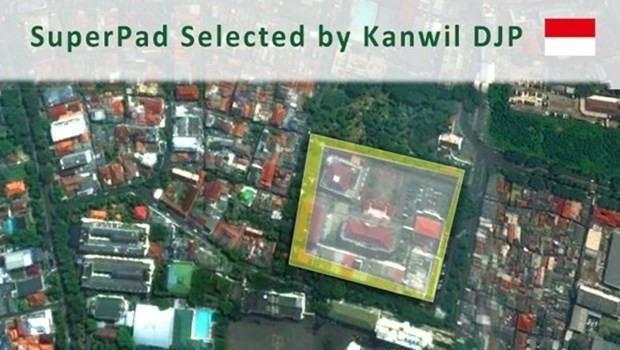
8th April 2017
Taxation Authority in Indonesia Selects SuperPad 3.3 to Collect Data.jpg)
7th April 2017
Compact, High-Performance OEM GNSS Sensor for System Integrators
6th April 2017
New Leica Zeno GG04 smart antenna enhances tracking performance3rd April 2017
TCarta Marine to Introduce Gulf of Mexico Streaming Basemap Service
30th March 2017
Leica Geosystems opens nominations for Carl Pulfrich Award 201729th March 2017
Trimble Incorporates Galileo Support in New Version of GNSS Software27th March 2017
PrecisionPoint Hires sUAS Pilot to Enhance 3D Reality Capture Services.jpg)
27th March 2017
Lovell Johns, wins new GIS contract with European Commission
24th March 2017
Every Emerging Technology. One Digital Transformation Journey24th March 2017
Driver App to Improve Driver Behavior and Save Additional Costs
24th March 2017
Next SuperSurv 10 Release Will Add Powerful Features23rd March 2017
Public comment on proposed Indexed 3D Scene Layers (I3S) Community
23rd March 2017
Ctrack Introduces Driver App To Improve Driver Behaviour
22nd March 2017
Hexagon Mining selects downtown Tucson, AZ for headquarters
22nd March 2017
High-resolution satellite images made accessible to anyone
22nd March 2017
Avalanche Photodiode Arrays from LASER COMPONENTS
21st March 2017
5 GOOD REASONS to follow Pix4D on Social Media21st March 2017
The ‘control room of the future’ is here to help police keep you safe
21st March 2017
Terrabotics Joins the Geological Remote Sensing Group
21st March 2017
Optimised Transport Plans with Paragon Waypoint Mapping21st March 2017
SimActive and Tianlifa Launch Integrated UAV Solution
20th March 2017
Northumbrian Water's Transferred Drains and Sewers Project Boosted20th March 2017
4 Ways Maptitude 2017 Saves You Time & Money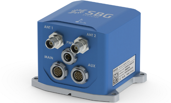
20th March 2017
New generation of the Ekinox Series inertial sensors from SBG Systems
20th March 2017
Michael Gerhards is new Head of CyberSecurity Germany
17th March 2017
Fugro hunts for more Hydrocarbon Seeps in US Gulf of Mexico17th March 2017
Telit Introduces New Family of Industry’s Smallest GNSS Modules
16th March 2017
Why desktop is essential for drone mapping in agriculture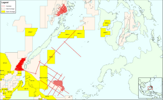
15th March 2017
CGG Completes Processing of Carabao Regional Multi-Client Study
15th March 2017
Drones Save Almost One Life Per Week on Average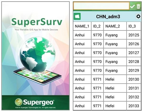
15th March 2017
The Cutting-edge Mobile GIS SuperSurv 10 Is Released!14th March 2017
On-the-Fly Earth Observation Imagery Analytics in Your Browser14th March 2017
RICS unveils plans to get tough on conflicts of interest:14th March 2017
OS and Trimble collaborate to aid geospatial industry innovation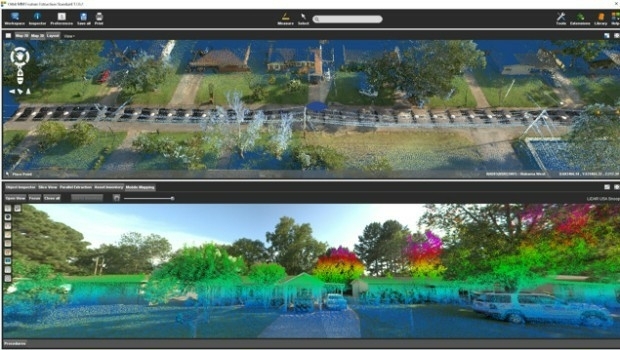
13th March 2017
Orbit GT and LiDAR USA upgrade ScanLook and Snoopy interoperability
13th March 2017
InterDrone Acquired by Emerald Expositions LLC
13th March 2017
Highways England renews Trimble VRS Now license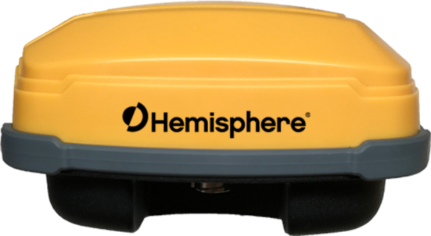
10th March 2017
Rugged GNSS Smart Antenna for Machine Control Applications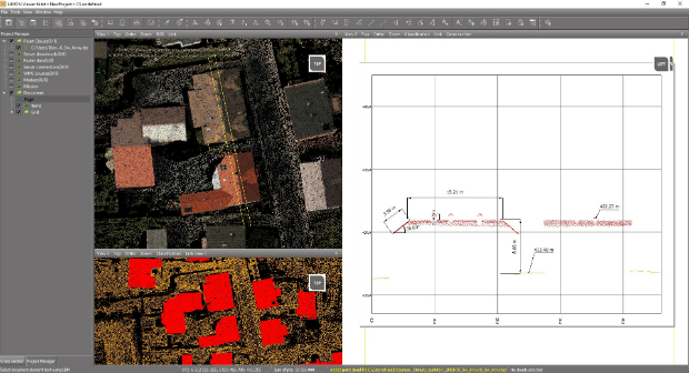
10th March 2017
Fast LiDAR data viewer streamlines work of local governments10th March 2017
DFS and Unifly cooperate on the development of drone app10th March 2017
Topcon announces update to 2D indicate system for excavation10th March 2017
Topcon announces new Wi-Fi capability for imaging station10th March 2017
Oak Ridge National Laboratory Selects Esri
10th March 2017
Esri President Jack Dangermond to Talk at ASPRS IGTF 2017