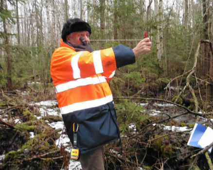
Globalstar’s SPOT Gen3 to Protect Forest Workers Across France
2nd November 2017
Globalstar’s SPOT Gen3 to Protect Forest Workers Across France
2nd November 2017
Globalstar’s SPOT Gen3 to Protect Forest Workers Across France
2nd November 2017
Fugro Features Innovative Solutions at ADIPEC 20171st November 2017
Swift Enhances its Centimeter-Accurate GNSS Technology
1st November 2017
Impressions from the SCADA Security Conference1st November 2017
2018 ISPRS Call for Educational and Capacity Building Initiative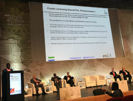
31st October 2017
Sierra Leone Makes Fourth Licensing Round Pre-Announcement31st October 2017
SimActive Automates Direct Georeferencing31st October 2017
Slovenia and HERE partner to improve highway safety
30th October 2017
Smart Cities Will Not Thrive Without National Policy Support
30th October 2017
Helping Councils get the Most from Infrastructure Asset Management
28th October 2017
WorldView Global Alliance User Conference 2017 Report27th October 2017
OGC supports American Geographical Society’s 2017 Fall Symposium
27th October 2017
Topcon helps DEC! develop maths skills that are fit for site.jpg)
26th October 2017
Fugro Applies Seeps Expertise To Canada’s Growing Offshore Industry26th October 2017
Commercial UAV Expo and Drone World Expo Come Together in 201826th October 2017
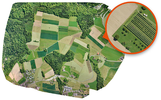
GfK releases updated maps for all of Europe26th October 2017
OS International partners with Tanzania and the World Bank
26th October 2017
Orbit GT updates 3D Mapping Cloud with great new UAV support26th October 2017
PCI Geomatics Signs MOU with AGH University, in Krakow, Poland26th October 2017
Tulloch Mapping Purchases the FIRST RIEGL VMX-2HA!26th October 2017
New OGC standard improves the reference for Earth Information
25th October 2017
New Supply-Chain Accessories for the NAUTIZ X2
24th October 2017
VSTEP provide CAE with bridge simulators for UAE Naval Training Centre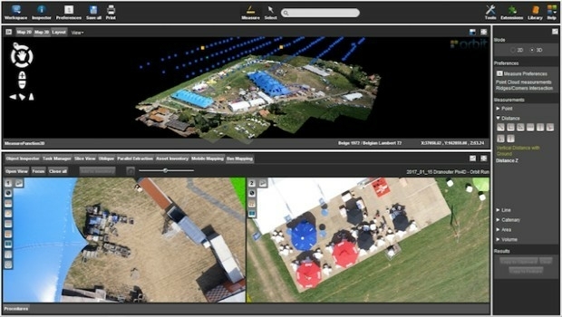
24th October 2017
Orbit GT launches new Feature Extraction product for Drones
23rd October 2017
Jack Dangermond to Discuss Earth Observations at GEO Week23rd October 2017
Orbital Witness wins Airbus’ Global Earth Observation Challenge23rd October 2017
Commercial UAV Expo Announces Highlights of Upcoming 2017 Event
23rd October 2017
UrtheCast and e-GEOS together offer unique optical and SAR products23rd October 2017
Call for Proposals to develop NSDI Metadata Handbook in Namibia23rd October 2017
A new generation of disruptive property and location data businesses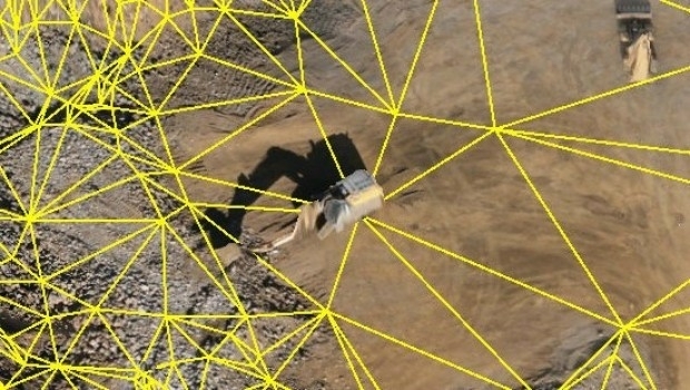
21st October 2017
Virtual Surveyor Unveils Productivity Tools at Commercial UAV Expo21st October 2017
NFSP Fire & Rescue Services helped to improve their service21st October 2017
Hexagon Supports Zurich’s Public Transportation Network
20th October 2017
Maintenance of the utility networks with Mobile Mapping technology18th October 2017
Enhanced and Improved Functionalities for New Release of Global Mapper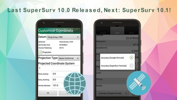
18th October 2017
Last SuperSurv 10.0 Update Released, Next: SuperSurv 10.1!17th October 2017
OceanWise Offers Continuity for Marine Mapping Users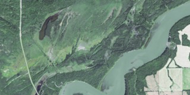
17th October 2017
Earth-i’s satellite imagery chosen to monitor tree logging in Canada
16th October 2017
Topcon launches three new technology updates for the built environment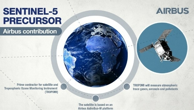
14th October 2017
Sentinel-5P successfully launched to monitor world’s pollution
13th October 2017
Maptek Announces New Montréal and Vancouver Offices
13th October 2017
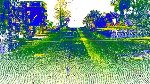
Airborne LiDAR production fully integrated with Leica HxMap workflow