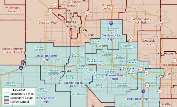
New 2018 School District Data for Maptitude Mapping Software
14th March 2018
New 2018 School District Data for Maptitude Mapping Software
14th March 2018
New 2018 School District Data for Maptitude Mapping Software

14th March 2018
Hemisphere GNSS New Atlas®-Capable Vector™ V1000 GNSS Receiver
13th March 2018
Septentrio announces special version of AsteRx-U MARINE receiver
9th March 2018
Jamie Watson Joins Intelligent Telematics As Field Operations Manager
8th March 2018
EOMAP appointed as Satellite Derived Bathymetry provider
8th March 2018
smartStation: The intelligent stop of the future8th March 2018
Esri Releases Survey123 for ArcGIS with New Spike Integration8th March 2018
Space Flight Laboratory to Highlight Missions at Satellite 2018
7th March 2018
Garmin® grows Connext® wireless cockpit connectivity portfolio
6th March 2018
Data for Use with Maptitude for entire USA
6th March 2018
NavAidDrone: new drone-based measurement system6th March 2018
Adapting satellite technologies for general aviation operations
5th March 2018
Woodland Managers in Sweden Choose Globalstar’s SPOT Gen35th March 2018
HERE Technologies autonomous machines study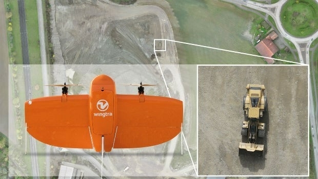
28th February 2018
Wingtra selects Septentrio GNSS board for new drone26th February 2018
TEOCO launches UAV Service Enablement Platform for Drones26th February 2018
Esri Acquires ClearTerra Location Data Extraction Technology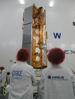
22nd February 2018
Airbus-built PAZ radar satellite successfully launched
22nd February 2018
Fugro Returns To China For Gas Hydrate Research Project
22nd February 2018
BMW Group to switch on HERE HD Live Map for future models


20th February 2018
Autopilot for the Mayflower Autonomous Ship equiped
20th February 2018
Class approval for Drone inspection of confined spaces for RIMS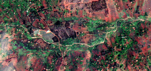
20th February 2018
Earth-i receives £2.7 million from UK Government to improve crop yield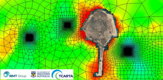
15th February 2018
Satellite Derived Bathymetry from TCarta Plays Key Role in Aquaculture14th February 2018
Microsoft and Ordnance Survey join forces13th February 2018
National Gendarmerie Conducts Post-Hurricane Missions with SimActive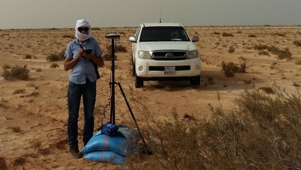
13th February 2018
Mauritanian HV Electric Transmission Corridor to be Surveyed13th February 2018
AirGon LLC Appointed North American Distributor for YellowScan
9th February 2018
Bentley Systems Expands Concrete Building Design and Documentation8th February 2018
GSSI Proudly Announce Launch of New Website
8th February 2018
ESA and Airbus Sign Partnership Agreement
7th February 2018
3DUserNet To Power Texodrone Online 3D Data Platform7th February 2018
Dubai and HERE with data infrastructure for driverless transportation
7th February 2018
Teledyne Optech Titan lidar enables discovery of extended Mayan ruins7th February 2018
Cepton and May Mobility Accelerate the Delivery of Autonomous Vehicles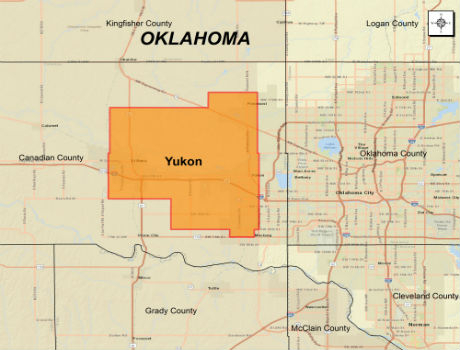
6th February 2018
CGG Extends Oklahoma Coverage with Yukon Multi-Client Survey6th February 2018
Trimble Announces New MX9 Mobile Mapping System
6th February 2018
YellowScan unveils its new UAV-LiDAR System
6th February 2018
A partnership to integrate LiDAR and Photogrammetric technologies
6th February 2018
Announcement at the International LiDAR Mapping Forum Symposium5th February 2018
Sundbybergs Stadsnät increases the control of the fiber network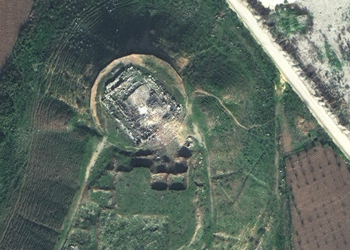
5th February 2018
Satellite Images of Afrin Identifies Massive Damage to Ancient Temple
3rd February 2018
Fugro’s Rig Positioning Services Reduce Mobilisation Time For Statoil