
Elbit Systems Launches MAY, a Wide-area Acoustic-based Situational Awareness Solution
7th June 2018
Elbit Systems Launches MAY, a Wide-area Acoustic-based Situational Awareness Solution
7th June 2018
Elbit Systems Launches MAY, a Wide-area Acoustic-based Situational Awareness Solution
6th June 2018
2018 World Football Championship stadiums seen from space
6th June 2018
Earth-i Expands Team To Meet Demand for Insight and Analysis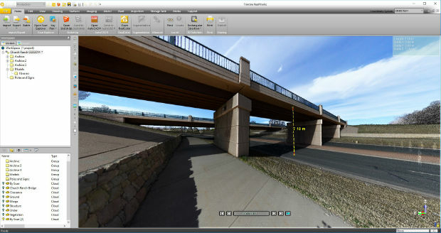
6th June 2018
Trimble RealWorks Announces Performance and UI Enhancements
6th June 2018
SXblue Introduces Android Application ToolBox
5th June 2018
Airbus-built Aeolus wind sensor satellite ready for shipment5th June 2018
CGG GeoSoftware Releases PowerLog 9.7.2 Petrophysical Software5th June 2018
Nanotron to showcase swarm bee location awareness technology5th June 2018
SSTL awards Launch Services Agreement to Firefly Aerospace4th June 2018
BARTHAUER at IFAT: a successful event with effective know-how transfer4th June 2018
Airbus-built SES-12 dual-mission satellite successfully launched4th June 2018
Cyberbit, Raises $30 Million from Claridge Israel1st June 2018
UK BIM Alliance Publish Constructing Plain Language Charter31st May 2018
Stericycle Selects Surecam Connected Vehicle Cameras31st May 2018
Merrick Releases Version 2018 MARS® Software Suite31st May 2018
Elbit Systems Subsidiary in Canada Awarded a Contract in South Korea31st May 2018
ATrack 4G LTE AK11 and AX11 Wins COMPUTEX TAIPEI Best Choice Award 201830th May 2018
Esri Announces Release of Sentinel-2 Image Services30th May 2018
RIEGL to Exhibit and Present at SPAR 3D Expo & Conference 2018!29th May 2018
NavVis to present M6 indoor mobile mapping system at SPAR 3D29th May 2018
GeoSLAM to Demo Fast, Easy and Versatile 3D Mobile Laser Scanning29th May 2018
ABPmer welcomes Paul Clement as Oceanographic Survey Business Manager29th May 2018
Major GNSS project to boost potential for ‘satellite’ farming in Brazil29th May 2018
JLT Mobile Computers Presents New Rugged Tablet and IT Solutions29th May 2018
Airbus wins major NATO communications system contract
25th May 2018
BARTHAUER and bluemetric agree on cooperation25th May 2018
Airbus teams up to develop Space CARBon Observatory (SCARBO)24th May 2018
Elbit Systems to Display Advanced Solutions at CANSEC 201824th May 2018
Topcon system integrates with Volvo CE Dig Assist23rd May 2018
Sokkia introduces new high-performance manual total station23rd May 2018
Fugro's Contribution To Global Ocean Mapping Earns NOAA Commendation23rd May 2018
Global Mapper Helps Aerial Filmworks, Win Pulitzer Prize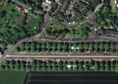
22nd May 2018
Satellite Image Shows Massive Royal Wedding Crowds22nd May 2018
QuestUAV - Survey Mapping of Port of Sunderland22nd May 2018
Skyline Software Systems Releases Photomesh™ 7.422nd May 2018
Expanded Enterprise Focus at Largest Commercial Drone Show in USA21st May 2018
KOREC invests in ‘New Generation’ Trimble MX9 Mobile Mapping System21st May 2018
CGG GeoConsulting Launches Robertson New Ventures Suite19th May 2018
Focus 35 Total Station with Auto Scan Helping Build China’s Expressway18th May 2018
EARSC and Eurochile join forces to promote Earth observation18th May 2018
Gatwick’s new passenger app wins two awards at separate ceremonies18th May 2018
SpaceDataHighway: 10,000 successful laser connections17th May 2018
TCarta Delivers Satellite Derived Bathymetry Data