
Data Capture
Don't miss a beat, sign up to our newsletter

Airbus and Dassault Aviation sign Joint Concept Study contract
7th February 2019
Airbus and Dassault Aviation sign Joint Concept Study contract
Pioneering steps into fixed wing - water landing drones in marine ecology
7th February 2019
Pioneering steps into fixed wing - water landing drones in marine ecology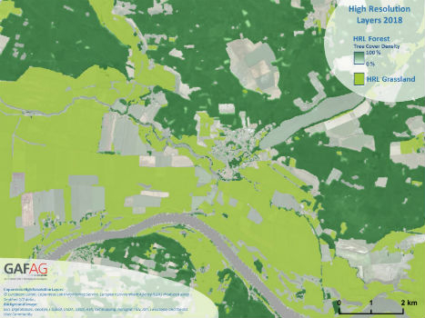
Copernicus Land Monitoring: High-Resolution Layers 2018 kick off!
7th February 2019
Copernicus Land Monitoring: High-Resolution Layers 2018 kick off!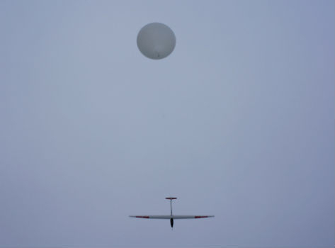
HiDRON Measured Weather Conditions In The Stratosphere
6th February 2019
HiDRON Measured Weather Conditions In The Stratosphere
Airbus and Dassault Systèmes embark on strategic partnership
6th February 2019
Airbus and Dassault Systèmes embark on strategic partnership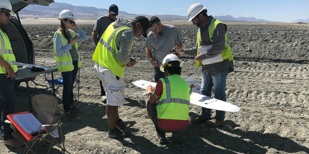
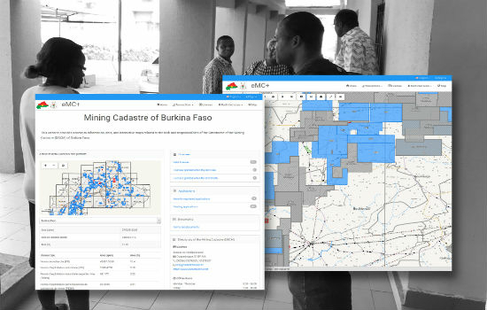
Burkina Faso Establishes Computerised Mining Cadastre
5th February 2019
Burkina Faso Establishes Computerised Mining Cadastre
Goonhilly & Shetland Space Centre join forces for new space opportunities
5th February 2019
Goonhilly & Shetland Space Centre join forces for new space opportunities
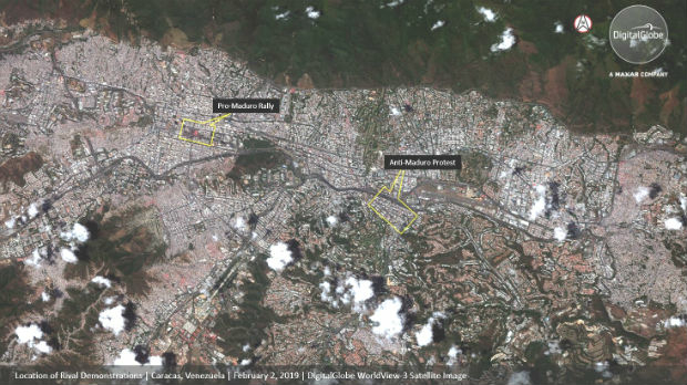
DigitalGlobe Satellite Imagery: Protests in Caracas, Venezuela
5th February 2019
DigitalGlobe Satellite Imagery: Protests in Caracas, Venezuela
Airbus adds new service Verde to its precision farming portfolio
4th February 2019
Airbus adds new service Verde to its precision farming portfolio
Elbit Systems U.S. Subsidiary Awarded a Contract to Provide Avionics
4th February 2019
Elbit Systems U.S. Subsidiary Awarded a Contract to Provide Avionics
Instituto Geografico Nacional (IGN) Has Signed With Recursos Tecnicos Madrid, S.L.,
4th February 2019
Instituto Geografico Nacional (IGN) Has Signed With Recursos Tecnicos Madrid, S.L.,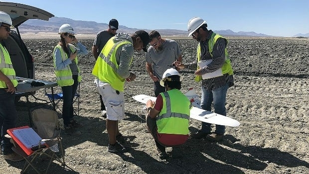
Lockheed Martin purchase an Aeromapper Talon UAS
3rd February 2019
Lockheed Martin purchase an Aeromapper Talon UAS
Greenvalley International Launches Premium Handheld Mobile Mapping
2nd February 2019
Greenvalley International Launches Premium Handheld Mobile Mapping
CompassDrone, Newest Division Of CompassData,
1st February 2019
CompassDrone, Newest Division Of CompassData,
Worldwide Open Public Safety Technology Standards
1st February 2019
Worldwide Open Public Safety Technology Standards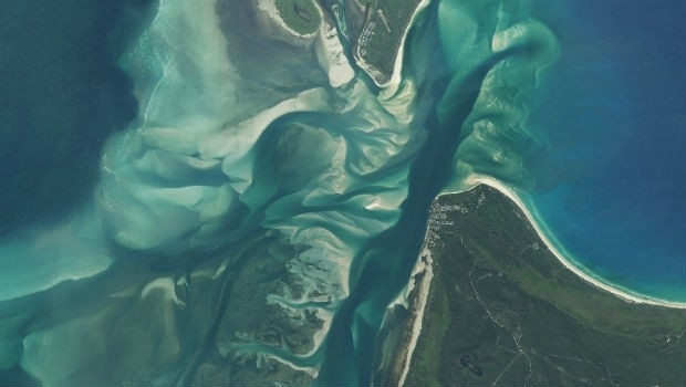
Earth-i Updates Satellite Map of Queensland, Australia
31st January 2019
Earth-i Updates Satellite Map of Queensland, Australia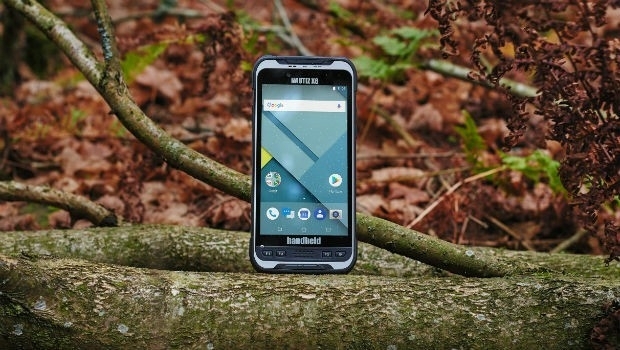
Handheld launches a new ultra-rugged Android phablet, the NAUTIZ X6
31st January 2019
Handheld launches a new ultra-rugged Android phablet, the NAUTIZ X6
Juniper Systems Limited Expands EMEA Team
31st January 2019
Juniper Systems Limited Expands EMEA Team
Juniper Systems Limited Announces New Technical Support Manager Role
31st January 2019
Juniper Systems Limited Announces New Technical Support Manager Role
Garmin® announces availability of the GPS 3000
31st January 2019
Garmin® announces availability of the GPS 3000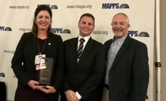
RIEGL Wins the Prestigious MAPPS Geospatial Products
30th January 2019
RIEGL Wins the Prestigious MAPPS Geospatial Products
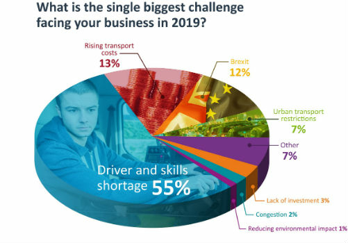
Integrated Technology Playing Critical Part In Transport Planning
30th January 2019
Integrated Technology Playing Critical Part In Transport Planning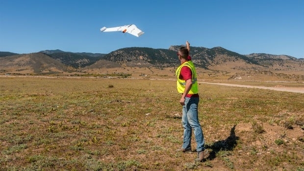
Delair opens first customer service centers in the US
30th January 2019
Delair opens first customer service centers in the US
GeoPlace recognises ‘Britain’s Most Fantastic Address’
28th January 2019
GeoPlace recognises ‘Britain’s Most Fantastic Address’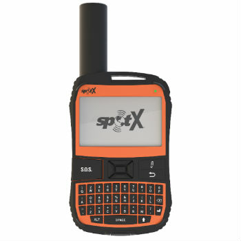
Globalstar launches SPOT X two-way satellite tracker
28th January 2019
Globalstar launches SPOT X two-way satellite tracker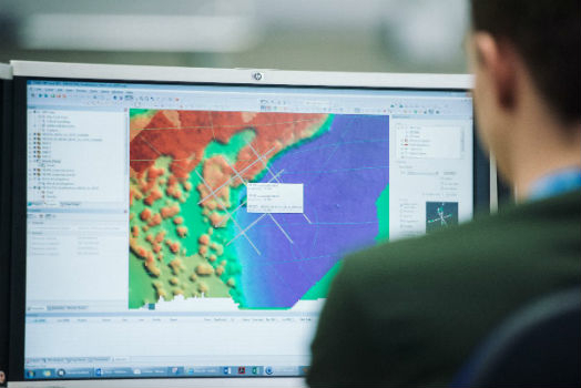
UK Hydrographic Office welcomes Department for Transport’s Maritime 2050 strategy
25th January 2019
UK Hydrographic Office welcomes Department for Transport’s Maritime 2050 strategy
Sky and Space Global Shortlisted for the Best Mobile Innovation
24th January 2019
Sky and Space Global Shortlisted for the Best Mobile Innovation
Airbus completes System Requirements Review
24th January 2019
Airbus completes System Requirements Review

Leica BLK3D Recognised by Prestigious Global Awards
24th January 2019
Leica BLK3D Recognised by Prestigious Global Awards
New bathymetric capabilities with CARIS software
23rd January 2019
New bathymetric capabilities with CARIS software
Telefónica and Samsung Utilize LuxCarta’s Advanced Geodata
23rd January 2019
Telefónica and Samsung Utilize LuxCarta’s Advanced Geodata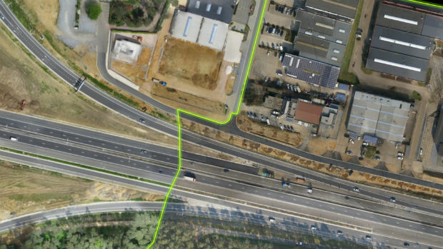
Virtual Surveyor 6.2 Now Processes Larger Drone Survey Projects
23rd January 2019
Virtual Surveyor 6.2 Now Processes Larger Drone Survey Projects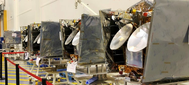
OneWeb Satellites has shipped first satellites
23rd January 2019
OneWeb Satellites has shipped first satellites
Bridgestone Europe To Acquire Tomtom Telematics
23rd January 2019
Bridgestone Europe To Acquire Tomtom Telematics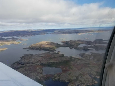
Fugro Uses Rapid Airborne Multibeam Mapping System (RAMMS)
19th January 2019
Fugro Uses Rapid Airborne Multibeam Mapping System (RAMMS)
Fugro Enhances IRM Capability With New Edda Sun ROV Support Vessel
19th January 2019
Fugro Enhances IRM Capability With New Edda Sun ROV Support Vessel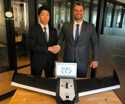
Terra Drone Japan and Plimsoll UAV in Brazil sign a joint venture agreement
17th January 2019
Terra Drone Japan and Plimsoll UAV in Brazil sign a joint venture agreement
Routescene and Caddis Aerial launch UAV LiDAR surveys
17th January 2019
Routescene and Caddis Aerial launch UAV LiDAR surveys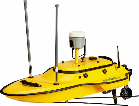
CHC Navigation introduces the APACHE 3 portable USV Solution.
17th January 2019
CHC Navigation introduces the APACHE 3 portable USV Solution.
Hexagon introduces rugged industrial computers for mining industry
16th January 2019
Hexagon introduces rugged industrial computers for mining industry