
Cartography
The compilation, reproduction and dissemination of maps and charts by means of manual (analogue) or digital techniques, tools and workflows. This topic covers the compilation, reproduction, dissemination and use of both analogue (paper) and digital maps, charts and atlases. As well as the science of cartography, including georeferencing and geocoding, digital techniques for compiling and generating various types of raster and vector maps and charts are covered, as are the digital mapping tools and Geographic Information Systems available for this purpose. The application of cartography for aeronautical, terrestrial and marine purposes is also covered

Ecometrica makes Deloitte 2016 Technology Fast 500 EMEA
14th December 2016
Ecometrica makes Deloitte 2016 Technology Fast 500 EMEA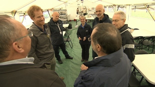
Prince Harry shines a light on the vital work of MapAction volunteers
14th December 2016
Prince Harry shines a light on the vital work of MapAction volunteers
Sercel Sell Four 508XT Acquisition Systems to Indian Seismic Companies
14th December 2016
Sercel Sell Four 508XT Acquisition Systems to Indian Seismic Companies
Itron Tops Navigant Research Leaderboard
14th December 2016
Itron Tops Navigant Research Leaderboard
Proteus Geo works with AECOM to test new Bathymetry Service
14th December 2016
Proteus Geo works with AECOM to test new Bathymetry Service
The Hydrographic Society UK Launches Alan Ingham Student Award Scheme
14th December 2016
The Hydrographic Society UK Launches Alan Ingham Student Award Scheme
Pavement Management with Fugro's Specialized Technology
14th December 2016
Pavement Management with Fugro's Specialized Technology
Award-winning engineering firm acquires Maptek tools
14th December 2016
Award-winning engineering firm acquires Maptek tools
Septentrio Provides Low-Power Embedded GNSS for Xeos Technologies
14th December 2016
Septentrio Provides Low-Power Embedded GNSS for Xeos Technologies
New Digital Mapping Tool for Citizens Introduced
14th December 2016
New Digital Mapping Tool for Citizens Introduced
Septentrio PolaRx5 GNSS receivers for volcano monitoring
13th December 2016
Septentrio PolaRx5 GNSS receivers for volcano monitoring
Geosoft announces technology partnership with Corescan
13th December 2016
Geosoft announces technology partnership with Corescan
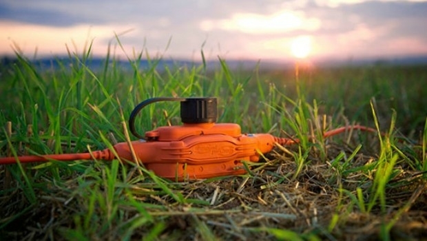
New Ultra-wide Band Radar Technology Saves Lives at Disaster Scenes
13th December 2016
New Ultra-wide Band Radar Technology Saves Lives at Disaster Scenes
Germany Receives First Tactical Standard Airbus A400M Airlifter
13th December 2016
Germany Receives First Tactical Standard Airbus A400M Airlifter
Charlotte Bishop Takes the Chair for the GRSG
12th December 2016
Charlotte Bishop Takes the Chair for the GRSG
Flanders, Belgium selects HERE C-ITS solution
12th December 2016
Flanders, Belgium selects HERE C-ITS solution
Garmin introduces VIRB Ultra 30 aviation in-cockpit bundle
9th December 2016
Garmin introduces VIRB Ultra 30 aviation in-cockpit bundle
Côte d'Ivoire adopts what3words as postal addressing system
9th December 2016
Côte d'Ivoire adopts what3words as postal addressing system
Councils input into new highways blueprint for Britain
8th December 2016
Councils input into new highways blueprint for Britain
PTV Group Receives Partner Innovation Award at GE’s Minds + Machines
8th December 2016
PTV Group Receives Partner Innovation Award at GE’s Minds + Machines
Magnetic inversion results for Ngamiland available for download
8th December 2016
Magnetic inversion results for Ngamiland available for download
The Highway Authority of Indonesia Chooses SuperGIS Desktop 10
8th December 2016
The Highway Authority of Indonesia Chooses SuperGIS Desktop 10
Indonesian Company Amilna Selects SuperGIS Desktop 10
8th December 2016
Indonesian Company Amilna Selects SuperGIS Desktop 10
Seismic monitoring and advanced CORS features on PolaRx5 product line.
8th December 2016
Seismic monitoring and advanced CORS features on PolaRx5 product line.
New Zealand Earthquake sees deployment of Fugro’s Airborne Technology
7th December 2016
New Zealand Earthquake sees deployment of Fugro’s Airborne Technology
Globalstar Helped Natural History Unit Film Wildlife Migrations
7th December 2016
Globalstar Helped Natural History Unit Film Wildlife Migrations
Hexagon Safety & Infrastructure for Incident & Emergency Management
6th December 2016
Hexagon Safety & Infrastructure for Incident & Emergency Management
Topcon announces next generation of online support and training
6th December 2016
Topcon announces next generation of online support and training
CGG Achieves Near Real-Time Imaging for Offshore Morocco Survey
6th December 2016
CGG Achieves Near Real-Time Imaging for Offshore Morocco Survey
West Yorkshire Police extend Cadcorp GIS Contract
6th December 2016
West Yorkshire Police extend Cadcorp GIS Contract
CSA and NOAA Case Study on Oil Spill Effects on Seagrass
6th December 2016
CSA and NOAA Case Study on Oil Spill Effects on Seagrass
International Wireless Communication Expo (IWCE)
5th December 2016
International Wireless Communication Expo (IWCE)
SP80 GNSS Receivers Increase Water Pipeline Survey Efficiency by 160%
5th December 2016
SP80 GNSS Receivers Increase Water Pipeline Survey Efficiency by 160%
Putting an end to laser attacks on planes
5th December 2016
Putting an end to laser attacks on planes
“Farmstar” Enriches its Offer With New Recommendations
5th December 2016
“Farmstar” Enriches its Offer With New Recommendations
Razor Secure CEO Warns Transport Companies of More Cyber Threats
5th December 2016
Razor Secure CEO Warns Transport Companies of More Cyber Threats
New app to help drone pilots comply with UK rules
3rd December 2016
New app to help drone pilots comply with UK rules
DigitalGlobe Releases First Image from WorldView-4 Satellite
3rd December 2016
DigitalGlobe Releases First Image from WorldView-4 Satellite
Kullasoft Ltd shortlisted for UK Rail Technology Award
2nd December 2016
Kullasoft Ltd shortlisted for UK Rail Technology Award