Cartography
The compilation, reproduction and dissemination of maps and charts by means of manual (analogue) or digital techniques, tools and workflows. This topic covers the compilation, reproduction, dissemination and use of both analogue (paper) and digital maps, charts and atlases. As well as the science of cartography, including georeferencing and geocoding, digital techniques for compiling and generating various types of raster and vector maps and charts are covered, as are the digital mapping tools and Geographic Information Systems available for this purpose. The application of cartography for aeronautical, terrestrial and marine purposes is also covered
LuxCarta for Global IoT Network Deployment Geodata Requirements
16th February 2017
LuxCarta for Global IoT Network Deployment Geodata RequirementsCGG Completes Industry-First FalconPlus Survey for Bapco
16th February 2017
CGG Completes Industry-First FalconPlus Survey for BapcoChange in the Division Management at PTV Transport Consult
16th February 2017
Change in the Division Management at PTV Transport Consult
Elbit US Subsidiary Receives $102m Contract From US Army
16th February 2017
Elbit US Subsidiary Receives $102m Contract From US ArmyEmlid unveils Reach RS: field-ready RTK GNSS receiver for only $699
16th February 2017
Emlid unveils Reach RS: field-ready RTK GNSS receiver for only $699
Advanced Groundwater Technologies Joins PCI Reseller Partner Network
16th February 2017
Advanced Groundwater Technologies Joins PCI Reseller Partner Network
Three reasons golf courses are the next drone mapping territory
15th February 2017
Three reasons golf courses are the next drone mapping territory
Djibouti adopts what3words as national postal addressing system
15th February 2017
Djibouti adopts what3words as national postal addressing system
UK’s national standard for engineering drawings revised
15th February 2017
UK’s national standard for engineering drawings revised
Smart Cities Challenged by Stakeholder Buy-in and Project Funding
15th February 2017
Smart Cities Challenged by Stakeholder Buy-in and Project FundingKoko GPS Watch providing parents with peace of mind
15th February 2017
Koko GPS Watch providing parents with peace of mind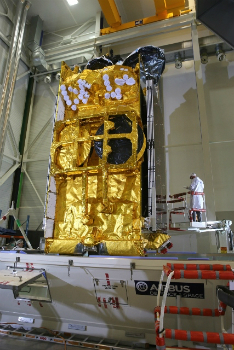
Airbus-built SKY Brasil-1 satellite successfully launched by Ariane 5
15th February 2017
Airbus-built SKY Brasil-1 satellite successfully launched by Ariane 5
Golden's new 2D and 3D Mapping, Modeling, and Analysis Software
15th February 2017
Golden's new 2D and 3D Mapping, Modeling, and Analysis Software
Fast Company's Top 10 Most Innovative Companies in Data Science
15th February 2017
Fast Company's Top 10 Most Innovative Companies in Data Science

VicRoads Builds for the Future with Yotta’s Horizons Software
14th February 2017
VicRoads Builds for the Future with Yotta’s Horizons Software
Exprodat Offers ArcGIS Pipeline Referencing Implementation Services
14th February 2017
Exprodat Offers ArcGIS Pipeline Referencing Implementation Services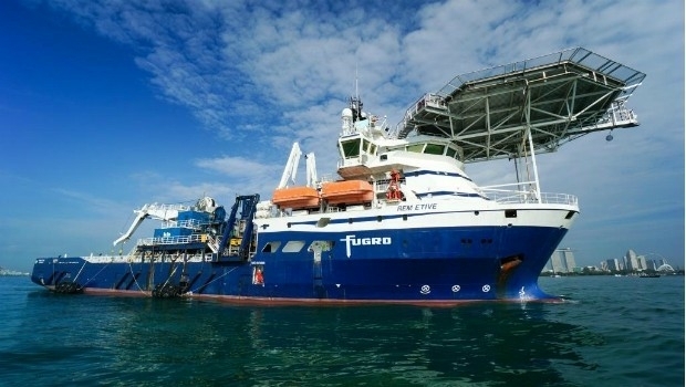
Fugro Acquires REM Etive IRM Support Vessel
14th February 2017
Fugro Acquires REM Etive IRM Support Vessel
Efficient and Safe Driving with Ctrack Vehicle Tracking System
14th February 2017
Efficient and Safe Driving with Ctrack Vehicle Tracking System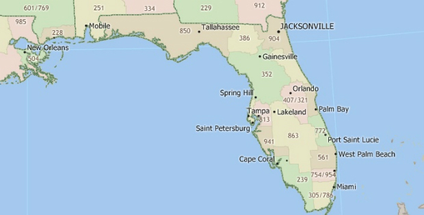
3D Repo Appoints Andrew Norrie as Commercial Director
14th February 2017
3D Repo Appoints Andrew Norrie as Commercial Director
Delegation from the emirate of Ajman visit Karlsruhe
14th February 2017
Delegation from the emirate of Ajman visit Karlsruhe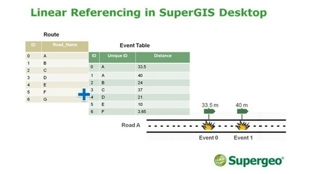
SuperGIS Desktop Will Have Linear Referencing Soon
14th February 2017
SuperGIS Desktop Will Have Linear Referencing Soon

Esri Partners Honored at Esri FedGIS Conference
13th February 2017
Esri Partners Honored at Esri FedGIS Conference
OGC invites expertise on underground maps and models
13th February 2017
OGC invites expertise on underground maps and modelsURISA's GIS Hall of Fame Nominations Process Opens
13th February 2017
URISA's GIS Hall of Fame Nominations Process OpensNew Leica SPL100 brings up to 10x more efficiency to airborne LiDAR mapping
13th February 2017
New Leica SPL100 brings up to 10x more efficiency to airborne LiDAR mapping
Maritime Safety and Security Centre in Cuxhaven officially open
13th February 2017
Maritime Safety and Security Centre in Cuxhaven officially openROC Friese Poort opens Inland Simulator Centre in Urk
13th February 2017
ROC Friese Poort opens Inland Simulator Centre in Urk
Prototype for "native LAS 1.4 extension" of LASzip LiDAR Compressor Released
13th February 2017
Prototype for "native LAS 1.4 extension" of LASzip LiDAR Compressor ReleasedEsri FedGIS Conference Showcases Cutting-Edge Technology
11th February 2017
Esri FedGIS Conference Showcases Cutting-Edge Technology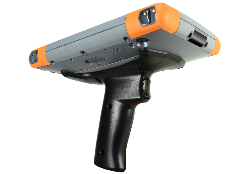
Pistol Grip Addition to Mesa 2 Rugged Tablet™ for Barcode Scanning
11th February 2017
Pistol Grip Addition to Mesa 2 Rugged Tablet™ for Barcode ScanningGeoscience Australia and Lockheed Martin Begin Collaborative Research Project
11th February 2017
Geoscience Australia and Lockheed Martin Begin Collaborative Research ProjectGeosoft presents Marine Geophysics Technology Showcase at Oceanology International North America
10th February 2017
Geosoft presents Marine Geophysics Technology Showcase at Oceanology International North AmericaFugro Wins Two Prestigious Rail Industry Awards
10th February 2017
Fugro Wins Two Prestigious Rail Industry AwardsTopcon GNSS modular receiver integrates with a wide-range of applications
10th February 2017
Topcon GNSS modular receiver integrates with a wide-range of applications
Ocean Business 2017 to host co-located Maritime Dual-use Events
10th February 2017
Ocean Business 2017 to host co-located Maritime Dual-use Events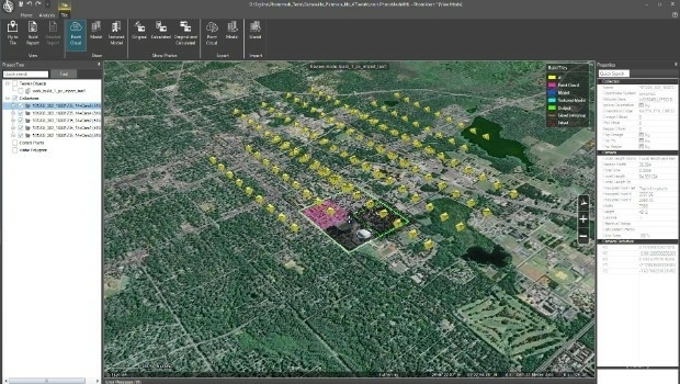
Skyline Software Systems Releases PhotoMesh 7.1
10th February 2017
Skyline Software Systems Releases PhotoMesh 7.1GNSS technology guarantees DEME's operations in areas of interference
10th February 2017
GNSS technology guarantees DEME's operations in areas of interference
The World’s Smartest Cities According to Unacast’s Report
10th February 2017
The World’s Smartest Cities According to Unacast’s Report