Cartography
The compilation, reproduction and dissemination of maps and charts by means of manual (analogue) or digital techniques, tools and workflows. This topic covers the compilation, reproduction, dissemination and use of both analogue (paper) and digital maps, charts and atlases. As well as the science of cartography, including georeferencing and geocoding, digital techniques for compiling and generating various types of raster and vector maps and charts are covered, as are the digital mapping tools and Geographic Information Systems available for this purpose. The application of cartography for aeronautical, terrestrial and marine purposes is also covered
Esri Will Donate Software to Fight Drug Addiction
15th March 2017
Esri Will Donate Software to Fight Drug Addiction
Drones Save Almost One Life Per Week on Average
15th March 2017
Drones Save Almost One Life Per Week on Average
Egis and Camas are creating an aviation academy in Abidjan
14th March 2017
Egis and Camas are creating an aviation academy in Abidjan
On-the-Fly Earth Observation Imagery Analytics in Your Browser
14th March 2017
On-the-Fly Earth Observation Imagery Analytics in Your Browser
RICS unveils plans to get tough on conflicts of interest:
14th March 2017
RICS unveils plans to get tough on conflicts of interest:
OGC announces kickoff of major innovation testbed – Testbed 1
14th March 2017
OGC announces kickoff of major innovation testbed – Testbed 1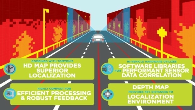
TomTom HD Map for Autonomous Driving Covers US Interstate Road Network
14th March 2017
TomTom HD Map for Autonomous Driving Covers US Interstate Road NetworkNew Alfa Romeo STELVIO launches with TomTom Navigation and Maps
14th March 2017
New Alfa Romeo STELVIO launches with TomTom Navigation and Maps
OS and Trimble collaborate to aid geospatial industry innovation
14th March 2017
OS and Trimble collaborate to aid geospatial industry innovation.jpg)
Spatial Startup Companies to Share the Latest Innovations
14th March 2017
Spatial Startup Companies to Share the Latest InnovationsOrbit GT and LiDAR USA upgrade ScanLook and Snoopy interoperability
13th March 2017
Orbit GT and LiDAR USA upgrade ScanLook and Snoopy interoperability

InterDrone Acquired by Emerald Expositions LLC
13th March 2017
InterDrone Acquired by Emerald Expositions LLC
Highways England renews Trimble VRS Now license
13th March 2017
Highways England renews Trimble VRS Now license
Cadcorp SIS service release supports latest OS products
13th March 2017
Cadcorp SIS service release supports latest OS products
ABPmer develops NW Europe tide and surge database
13th March 2017
ABPmer develops NW Europe tide and surge database
VSTEP and SMR Links team up to bring simulator solutions to UAE
13th March 2017
VSTEP and SMR Links team up to bring simulator solutions to UAE
Wärtsilä launches SmartPredict for safer ship manoeuvring guidance
13th March 2017
Wärtsilä launches SmartPredict for safer ship manoeuvring guidance
OGC publishes Moving Features Access specification
13th March 2017
OGC publishes Moving Features Access specification
Comment on proposed Unmanned Systems Domain Working Group
10th March 2017
Comment on proposed Unmanned Systems Domain Working GroupRugged GNSS Smart Antenna for Machine Control Applications
10th March 2017
Rugged GNSS Smart Antenna for Machine Control Applications
Fast LiDAR data viewer streamlines work of local governments
10th March 2017
Fast LiDAR data viewer streamlines work of local governments
NCTech announce ColourCloud processing hosted on Google Cloud Platform
10th March 2017
NCTech announce ColourCloud processing hosted on Google Cloud Platform
DFS and Unifly cooperate on the development of drone app
10th March 2017
DFS and Unifly cooperate on the development of drone app
1Spatial Enables Northumbrian Water to Save £8.75m
10th March 2017
1Spatial Enables Northumbrian Water to Save £8.75m
Topcon announces update to 2D indicate system for excavation
10th March 2017
Topcon announces update to 2D indicate system for excavation
Topcon announces new Wi-Fi capability for imaging station
10th March 2017
Topcon announces new Wi-Fi capability for imaging station
Oak Ridge National Laboratory Selects Esri
10th March 2017
Oak Ridge National Laboratory Selects Esri
Esri President Jack Dangermond to Talk at ASPRS IGTF 2017
10th March 2017
Esri President Jack Dangermond to Talk at ASPRS IGTF 2017
New remote job site support service with bundled cellular data
9th March 2017
New remote job site support service with bundled cellular data
Topcon announces integrated mass data processing software
9th March 2017
Topcon announces integrated mass data processing software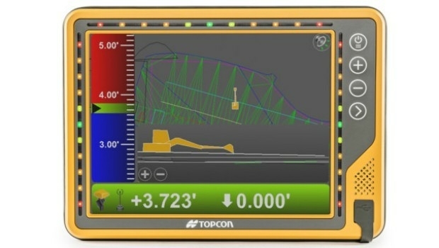
New 10-inch touchscreen display for construction machine control
9th March 2017
New 10-inch touchscreen display for construction machine control

Scottish / UK Post Brexit Maps Now Available on Avenza Maps
9th March 2017
Scottish / UK Post Brexit Maps Now Available on Avenza Maps
Common Object Model Container Standards Working Group
9th March 2017
Common Object Model Container Standards Working Group
GeoXphere & Skyline collaboration accelerates 3D City Model production
9th March 2017
GeoXphere & Skyline collaboration accelerates 3D City Model production

Geospatial mapping solution for New York Power Authority
9th March 2017
Geospatial mapping solution for New York Power Authority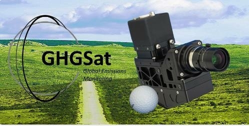
GHGSat Satellite Deploys Headwall’s Micro-Hyperspec Imaging Sensor
9th March 2017
GHGSat Satellite Deploys Headwall’s Micro-Hyperspec Imaging Sensor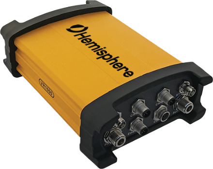
Vector™ VR1000 Rugged GNSS Receiver for Machine Control Applications
9th March 2017
Vector™ VR1000 Rugged GNSS Receiver for Machine Control Applications
OGC is seeking information on Geospatial APIs
9th March 2017
OGC is seeking information on Geospatial APIs