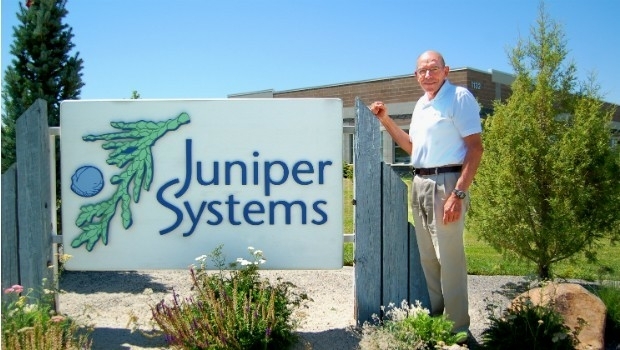
Juniper Systems Founder Ron Campbell Retires
30th June 2017
Juniper Systems Founder Ron Campbell RetiresThe compilation, reproduction and dissemination of maps and charts by means of manual (analogue) or digital techniques, tools and workflows. This topic covers the compilation, reproduction, dissemination and use of both analogue (paper) and digital maps, charts and atlases. As well as the science of cartography, including georeferencing and geocoding, digital techniques for compiling and generating various types of raster and vector maps and charts are covered, as are the digital mapping tools and Geographic Information Systems available for this purpose. The application of cartography for aeronautical, terrestrial and marine purposes is also covered
30th June 2017
Juniper Systems Founder Ron Campbell Retires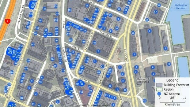
30th June 2017
Maptitude Now Has 2 Million New Zealand Address Points
29th June 2017
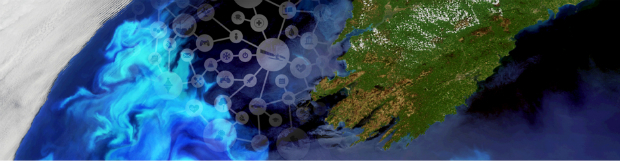
Dairy farmers to benefit from satellite data29th June 2017
CompassDrone™ to Demo Integration of DJI Video with ArcGIS
29th June 2017
IHO request to support latest ENC Validation Standard
29th June 2017
Orbit GT and Lehmann+Partner, Germany, sign Reseller Agreement29th June 2017
Advanced Guidance and Control Technologies for Autonomous Vehicles29th June 2017
Avineon Launches a Portal on the Innovation Lab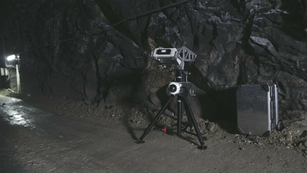
29th June 2017
Safety, stability monitoring radar for the underground mining industry
29th June 2017
Astun Technology Approved as G-Cloud 9 Supplier to UK Public Sector
29th June 2017
FREQUENTIS UK strengthens abilities thanks to increased investment29th June 2017
Ordnance Survey and Mountain Rescue England & Wales safety partnership29th June 2017
Elsevier and the Bureau of Economic Geology Partnership29th June 2017
Latest update to CH2M’s next generation Flood Modeller software
29th June 2017
Free Business Location Data for Use with Maptitude Mapping Software
28th June 2017
senseFly brings drone education to Esri User Conference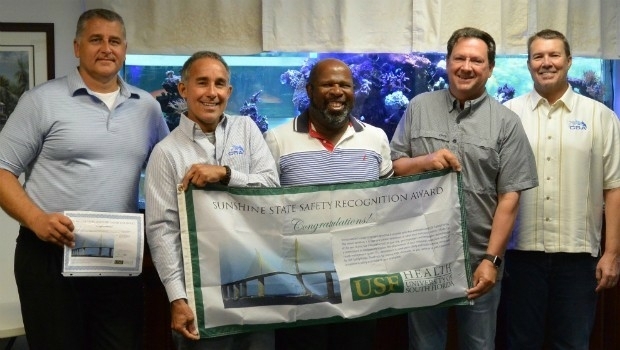
28th June 2017
CSA Ocean Sciences Receives Sunshine State Safety Recognition Award28th June 2017
HERE partners with Mapillary to make better maps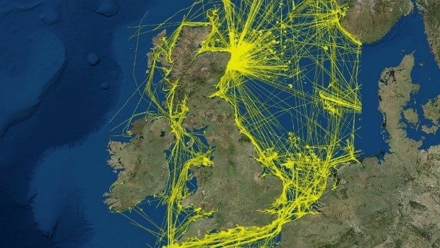
28th June 2017
View the new UK 2015 national dataset of marine vessel traffic
28th June 2017
ABPmer delighted with Planning Permission at Pagham Harbour
28th June 2017
Caroline Bellamy appointed new Chief Data Officer of Ordnance Survey
28th June 2017
GSDI Small Grants Program 2017 proposals have been reviewed
28th June 2017
Elbit's Seagull USV Demonstrated Unique Operational Capabilities28th June 2017
Global Mapper Supports Cloud-Based Data Management
28th June 2017
Calibration gas shipped within 24-hours: FastCalGas sets the bar28th June 2017
CompassCom to Debut Solutions at Esri User Conference28th June 2017
Remote sensing technologies key to the future of the oil palm industry27th June 2017
OS to map out greener communities at NWG Innovation Festival

27th June 2017
Assembly, Integration, and Test of OneWeb’s first satellites27th June 2017
Trimble Launches VRS Now Correction Service in France26th June 2017
Big success for first pan-European drone conference and trade fair26th June 2017
OceanWise and Seatronics Successfully Deliver Products to the UAE
26th June 2017
Nine More Satellites in exactEarth's Real-Time Constellation Launched26th June 2017
Second Lockheed Martin GPS Satellite Assembled Ready for Testing
26th June 2017
Orbit GT and WSP Group, Sweden update Gold Reseller status26th June 2017
NGA to Join Forces at upcoming GEOINT & Open Source Analytics Summit23rd June 2017
GIS-Pro 2017 Workshops Will Cover Important Topics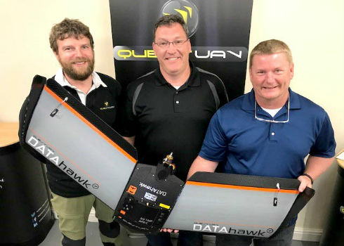
23rd June 2017
Precision Capture and QuestUAV Form Strategic Partnership
23rd June 2017
HR Wallingford rises to 15th place in NCE 100 rankings
23rd June 2017
Pix4D and Parrot announce the climate innovation grant winners
23rd June 2017
Experience the future of mobility in the Mobility Lab
22nd June 2017
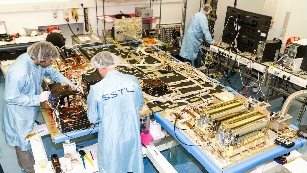
SSTL selected to build third batch of Galileo navigation payloads22nd June 2017
Garmin selects HERE map data and traffic for Russian PNDs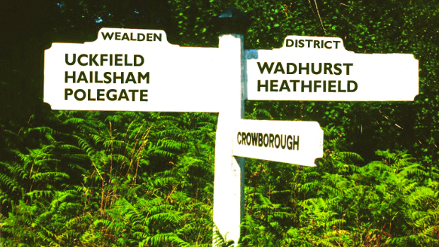
22nd June 2017
Cadcorp selected by Wealden District Council via G-Cloud for corporate GIS