Cartography
The compilation, reproduction and dissemination of maps and charts by means of manual (analogue) or digital techniques, tools and workflows. This topic covers the compilation, reproduction, dissemination and use of both analogue (paper) and digital maps, charts and atlases. As well as the science of cartography, including georeferencing and geocoding, digital techniques for compiling and generating various types of raster and vector maps and charts are covered, as are the digital mapping tools and Geographic Information Systems available for this purpose. The application of cartography for aeronautical, terrestrial and marine purposes is also covered
_.jpg)
Elbit Systems Subsidiary in Canada Awarded a Contract in South Korea
31st May 2018
Elbit Systems Subsidiary in Canada Awarded a Contract in South KoreaPointfuse Unlocks ‘As Built’ Data with Autodesk Integration
31st May 2018
Pointfuse Unlocks ‘As Built’ Data with Autodesk IntegrationBusiness Geografic creates a subsidiary in Montreal, Canada
31st May 2018
Business Geografic creates a subsidiary in Montreal, Canada
The smart city at INTERGEO – discover the urban future
31st May 2018
The smart city at INTERGEO – discover the urban futureATrack 4G LTE AK11 and AX11 Wins COMPUTEX TAIPEI Best Choice Award 2018
31st May 2018
ATrack 4G LTE AK11 and AX11 Wins COMPUTEX TAIPEI Best Choice Award 2018
Autodesk to showcase its BIM leadership at GEO|Design+BIM 2018
30th May 2018
Autodesk to showcase its BIM leadership at GEO|Design+BIM 2018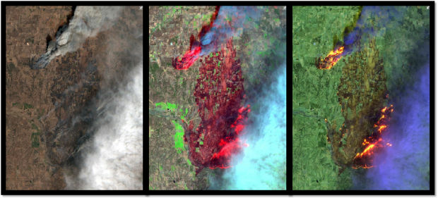
Esri Announces Release of Sentinel-2 Image Services
30th May 2018
Esri Announces Release of Sentinel-2 Image Services
RIEGL to Exhibit and Present at SPAR 3D Expo & Conference 2018!
30th May 2018
RIEGL to Exhibit and Present at SPAR 3D Expo & Conference 2018!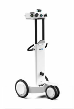
NavVis to present M6 indoor mobile mapping system at SPAR 3D
29th May 2018
NavVis to present M6 indoor mobile mapping system at SPAR 3DGeoSLAM to Demo Fast, Easy and Versatile 3D Mobile Laser Scanning
29th May 2018
GeoSLAM to Demo Fast, Easy and Versatile 3D Mobile Laser Scanning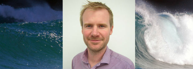
ABPmer welcomes Paul Clement as Oceanographic Survey Business Manager
29th May 2018
ABPmer welcomes Paul Clement as Oceanographic Survey Business Manager
Major GNSS project to boost potential for ‘satellite’ farming in Brazil
29th May 2018
Major GNSS project to boost potential for ‘satellite’ farming in Brazil
JLT Mobile Computers Presents New Rugged Tablet and IT Solutions
29th May 2018
JLT Mobile Computers Presents New Rugged Tablet and IT Solutions
Airbus wins major NATO communications system contract
29th May 2018
Airbus wins major NATO communications system contract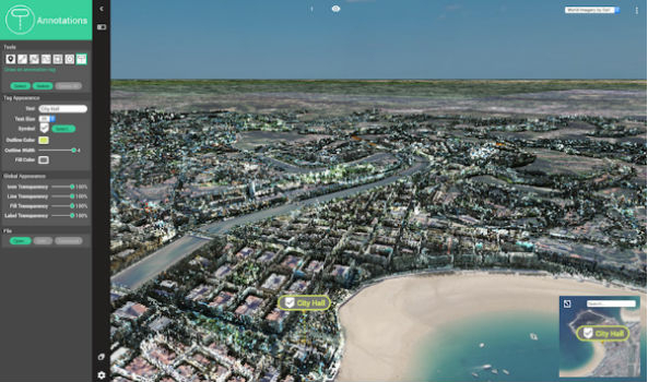
Orbit GT exhibits and showcases newest 3D Mapping Portfolio
29th May 2018
Orbit GT exhibits and showcases newest 3D Mapping Portfolio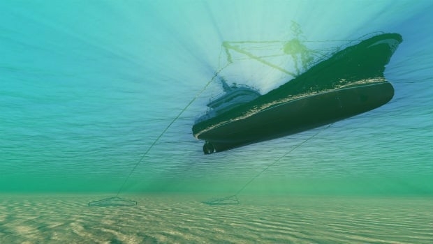
VSTEP introduces new Fishing module for its NAUTIS maritime simulators
29th May 2018
VSTEP introduces new Fishing module for its NAUTIS maritime simulators
Ordnance Survey announce rise in sales for both paper and digital OS Maps
25th May 2018
Ordnance Survey announce rise in sales for both paper and digital OS Maps
BARTHAUER and bluemetric agree on cooperation
25th May 2018
BARTHAUER and bluemetric agree on cooperation
Airbus teams up to develop Space CARBon Observatory (SCARBO)
25th May 2018
Airbus teams up to develop Space CARBon Observatory (SCARBO)
Airbus-led FUSE-IT project awarded ITEA Award of Excellence
25th May 2018
Airbus-led FUSE-IT project awarded ITEA Award of Excellence
Take a leap into the exciting world of Hyperspectral Imaging
25th May 2018
Take a leap into the exciting world of Hyperspectral Imaging

UK Hydrographic Office appoints Chief Technology Officer
24th May 2018
UK Hydrographic Office appoints Chief Technology Officer
Elbit Systems to Display Advanced Solutions at CANSEC 2018
24th May 2018
Elbit Systems to Display Advanced Solutions at CANSEC 2018
Topcon system integrates with Volvo CE Dig Assist
24th May 2018
Topcon system integrates with Volvo CE Dig Assist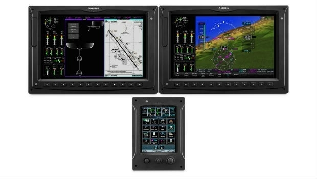
Garmin® introduces the G3000H integrated flight deck
24th May 2018
Garmin® introduces the G3000H integrated flight deck
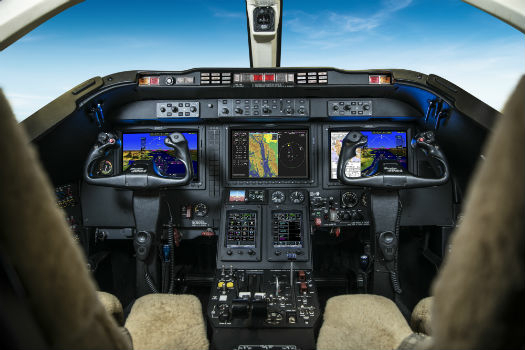
SUN-AIR of Scandinavia A/S selects the G5000 integrated flight deck
24th May 2018
SUN-AIR of Scandinavia A/S selects the G5000 integrated flight deck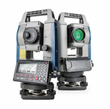
Sokkia introduces new high-performance manual total station
23rd May 2018
Sokkia introduces new high-performance manual total station
Boundless Introduces New Lightweight, Portable, Offline Basemap Server
23rd May 2018
Boundless Introduces New Lightweight, Portable, Offline Basemap Server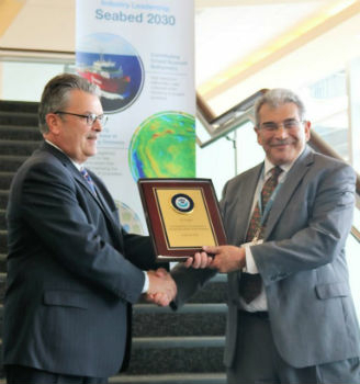
Fugro's Contribution To Global Ocean Mapping Earns NOAA Commendation
23rd May 2018
Fugro's Contribution To Global Ocean Mapping Earns NOAA Commendation
Global Mapper Helps Aerial Filmworks, Win Pulitzer Prize
23rd May 2018
Global Mapper Helps Aerial Filmworks, Win Pulitzer Prize
Workshop and Presentation Proposals Invited for 2019 GIS/CAMA
23rd May 2018
Workshop and Presentation Proposals Invited for 2019 GIS/CAMA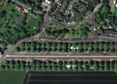
Satellite Image Shows Massive Royal Wedding Crowds
22nd May 2018
Satellite Image Shows Massive Royal Wedding Crowds
QuestUAV - Survey Mapping of Port of Sunderland
22nd May 2018
QuestUAV - Survey Mapping of Port of Sunderland
Leading location data providers rally around HD Live Map
22nd May 2018
Leading location data providers rally around HD Live Map
Stationary retail in Europe to grow by 2.1 percent in 2018
22nd May 2018
Stationary retail in Europe to grow by 2.1 percent in 2018
Skyline Software Systems Releases Photomesh™ 7.4
22nd May 2018
Skyline Software Systems Releases Photomesh™ 7.4
Bluesky Esri UK Partnership Helps Roll-Out of 5G and Full Fibre Networks
22nd May 2018
Bluesky Esri UK Partnership Helps Roll-Out of 5G and Full Fibre Networks

Expanded Enterprise Focus at Largest Commercial Drone Show in USA
22nd May 2018
Expanded Enterprise Focus at Largest Commercial Drone Show in USA
Jean-Paul Roux was appointed as new Chairman and CEO
22nd May 2018
Jean-Paul Roux was appointed as new Chairman and CEO
KOREC invests in ‘New Generation’ Trimble MX9 Mobile Mapping System
21st May 2018
KOREC invests in ‘New Generation’ Trimble MX9 Mobile Mapping System
CGG GeoConsulting Launches Robertson New Ventures Suite
21st May 2018
CGG GeoConsulting Launches Robertson New Ventures Suite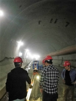
Focus 35 Total Station with Auto Scan Helping Build China’s Expressway
19th May 2018
Focus 35 Total Station with Auto Scan Helping Build China’s Expressway