
thinkWhere Appoints Louise Barnes as Chief Commercial Officer
11th September 2020
thinkWhere Appoints Louise Barnes as Chief Commercial Officer
11th September 2020
thinkWhere Appoints Louise Barnes as Chief Commercial Officer
10th September 2020
Smarter Data, Smarter World goes digital for 2020

28th August 2020
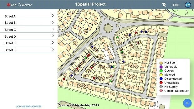
1Spatial to host online events focusing on supply chain innovation and collaboration

19th August 2020
Free webinar «Effectiveness & Safety operations in mining. How innovation will shape the current competitive environment»
30th July 2020
1Spatial become a corporate member of DAMA UK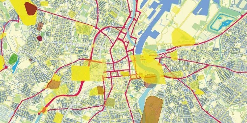
14th July 2020
Spatial unlocks the key to joined-up government
1st July 2020
PARSEC Business Accelerator Boosts EO Enterprises
19th June 2020
1Spatial reveals new and exciting webinars and training courses
12th June 2020
1Spatial plc secures US$2.6M Expansion Contract with the US State of Michigan
9th June 2020
23rd ICA Workshop on Map Generalisation and Multiple Representation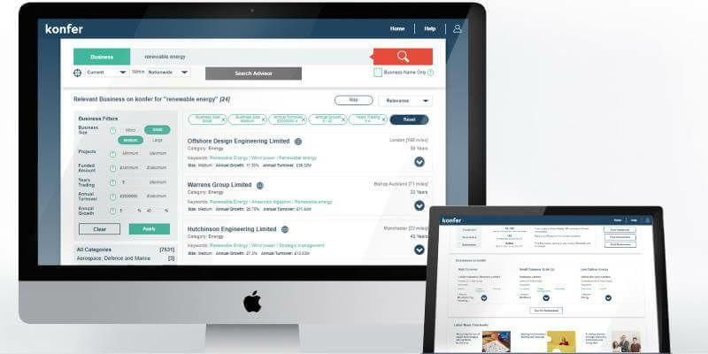
29th May 2020
SPRINT forms partnership with konfer digital innovation brokerage service


24th February 2020
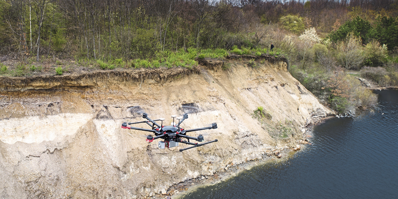
1Spatial announce new mobile platform for spatial data collection
13th February 2020
Landmark launches Premium Layers subscription for Promap
29th December 2019
AND (AND.AS) reaches agreement on a convertible loan of € 1million
27th November 2019
Entrepreneur raises £250k for GIS platform inspired by Olympics
21st November 2019
MGISS Ranked Fourth in North West Tech 50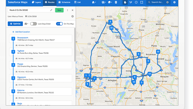
21st November 2019
Salesforce Selects Esri as Key Geospatial Partner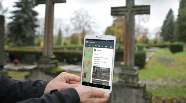
19th November 2019
Assetino Cloud Based Cemetery Mapping & Management Tool Launched

30th October 2019
T-MAPY User Conference Attracts Record Numbers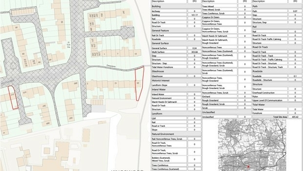
28th October 2019
Setting out weed control tender made easier with geospatial data analysis
28th October 2019
SimActive Software Used for Determining Financial Assistance
28th October 2019
Galbraith Adopts thinkWhere’s Web Mapping Tool
23rd October 2019
Pix4D launches 2D fast-mapping software Pix4Dreact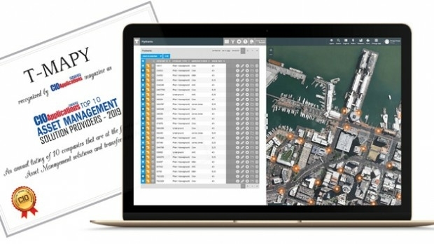
22nd October 2019
Assetino Asset Management Platform Scoops Top European Award
27th September 2019
Streetwise Services Improve Traffic Surveys with thinkWhere’s Online Maps
23rd September 2019
Data is the key to help mitigate safety risks when planning FTTH and utility projects, says Gaist5th September 2019
thinkWhere Supports Scottish Government Planning Process
25th July 2019
SoundHound Inc. Integrates HERE Mapping and Location Data i

27th June 2019
Geospatial solutions company Getmapping announces its new partnership with Hexagon’s Geospatial divi
31st May 2019
Envitia Selected by US Army Geospatial Center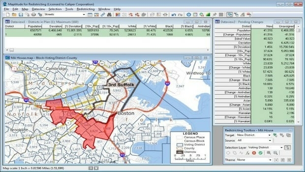
31st May 2019
Learn More About Maptitude for Redistricting at the NCSL29th May 2019
HERE Technologies Joins the MuleSoft Technology Partner Program
29th May 2019
CGG GeoSoftware Donates Geoscience Software Suite28th May 2019
HERE Technologies joins the Uptane Alliance

22nd May 2019
Mapillary announces the world's first demand-driven marketplace for map data
21st May 2019
Gaist’s mapping solution could boost efficiency for utilities market