
Esri Honors Partners for Exceptional Use of Mapping and Analytics
7th March 2017
Esri Honors Partners for Exceptional Use of Mapping and Analytics7th March 2017
Esri Honors Partners for Exceptional Use of Mapping and Analytics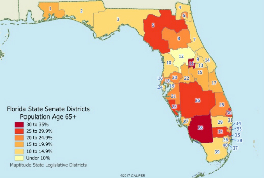
3rd March 2017
Caliper Offers State Legislative Districts with Updated Census Data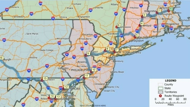
3rd March 2017
Maptitude 2017 Adds Enhanced MapPoint and Streets & Trips Features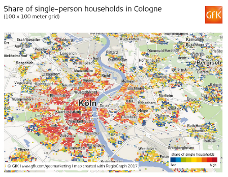
28th February 2017
Share of single-person households in Cologne22nd February 2017
CartoConsult Brings GIS Innovation to Government Programme to Tackle Traffic Congestion
22nd February 2017
Gritter Tracker coming to the rescue for snowed-in Scots
21st February 2017
Maxoptra Optimises Tahira’s Halal Food Delivery Routes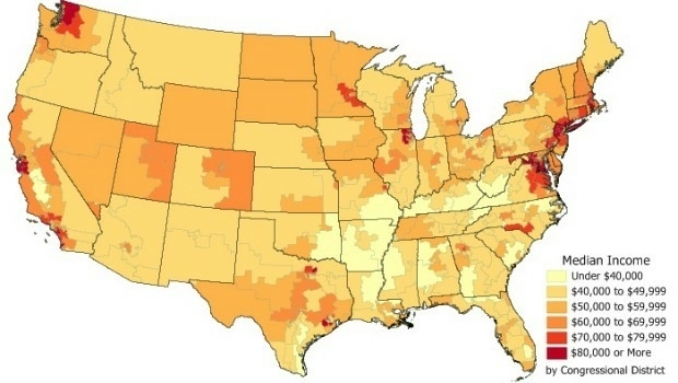
15th February 2017
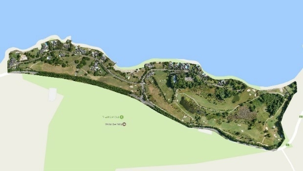
Three reasons golf courses are the next drone mapping territory15th February 2017
Golden's new 2D and 3D Mapping, Modeling, and Analysis Software
14th February 2017
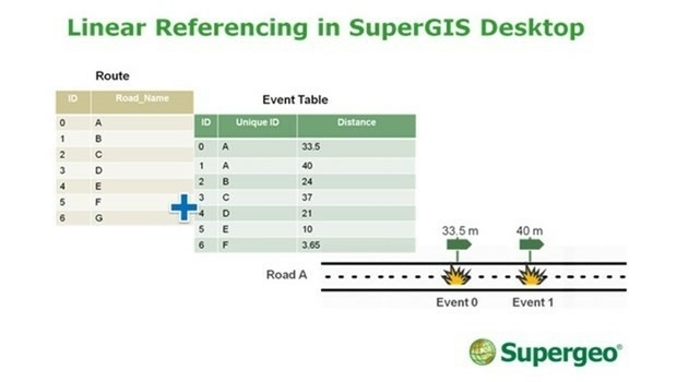
SuperGIS Desktop Will Have Linear Referencing Soon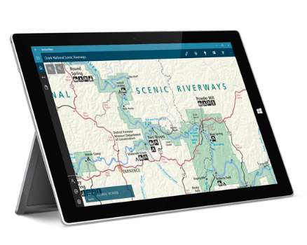
9th February 2017
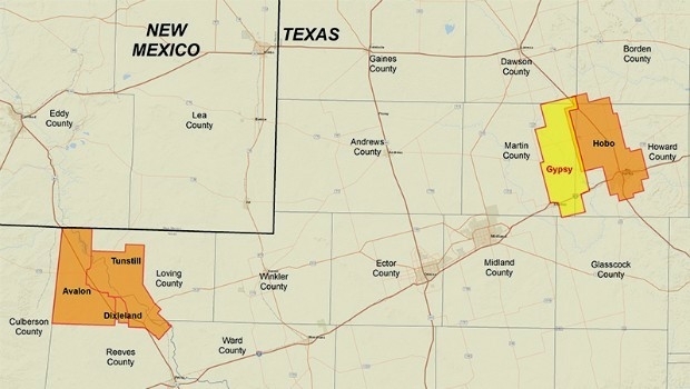
CGG Delivers Final PreSTM Data for Hobo Multi-Client Survey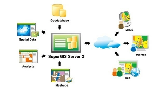

6th February 2017
Jesi, Historic City in Italy Uses SuperSurv to Collect Spatial Data26th January 2017
Requests for geocoding rising after Google changes pricing policy25th January 2017
Orbit GT releases Indoor Mapping solution with Floor Plan Builder
13th January 2017
The Excellent Helper for Processing Spatial Data—SuperGIS Desktop
4th January 2017
The Brand-new Online Tutorials of SuperGIS Desktop Are about to Release!
3rd January 2017
Cadcorp Web Map Tile Service simplifies the deployment of OS data29th December 2016
Seven Organizations Receive Cityworks Exemplary User Award22nd December 2016
The Best Choice of Central GIS for Enterprises- SuperGIS Server22nd December 2016
SuperGIS Desktop helps the Farmers in Saint Kitts and Nevis22nd December 2016
The Excellent Mobile GIS App - SuperSurv 10 Is Coming Soon19th December 2016
New Esri ArcGIS Release Transforms Spatial Analytics16th December 2016
Avenza Releases MAPublisher 9.9 For Adobe Illustrator9th December 2016
Côte d'Ivoire adopts what3words as postal addressing system8th December 2016
The Highway Authority of Indonesia Chooses SuperGIS Desktop 108th December 2016
Indonesian Company Amilna Selects SuperGIS Desktop 108th December 2016
Maxoptra route planning helps Hannah Foods improve its service30th November 2016
Esri Announces Additional Presenters for Geodesign Summit 201729th November 2016
Uncommon Information and Technology Leaders Form Partnership28th November 2016
Introducing Thematic Mapper for Easy In-map Analytics25th November 2016
what3words adopted by six national mapping agencies19th November 2016
Esri Creates First Global Map of the Catholic Church10th November 2016
Several new features in the latest version of dpSpatial 7.88th November 2016
To Help Create Safer Communities, Esri Hosts Public Safety Symposium8th November 2016
ADC WorldMap Releases Digital Atlas Version 7.3