
Vexcel Imaging Announces Newest UltraCam: Osprey 4.2
1st April 2025
Vexcel Imaging Announces Newest UltraCam: Osprey 4.2
1st April 2025
Vexcel Imaging Announces Newest UltraCam: Osprey 4.2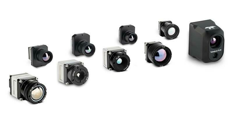
13th March 2025
Teledyne FLIR OEM Radiometric Thermal Boson+ and Hadron 640R+ Dual Thermal-Visible Camera Modules Now Available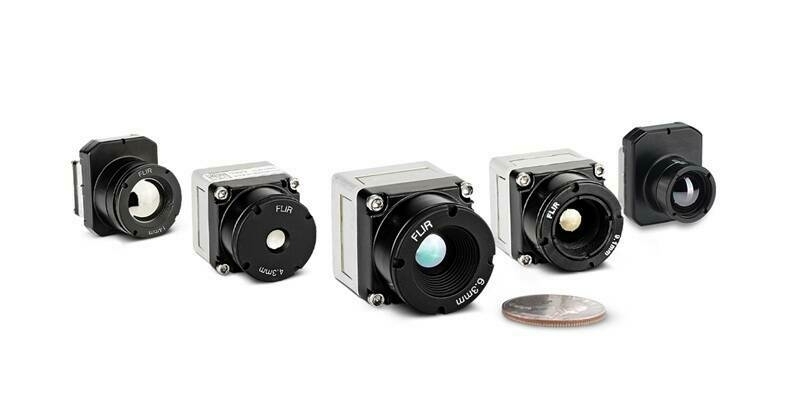
9th December 2024
Thermal by FLIR Collaborator Gremsy Provides Vio Drone Payload for Public Safety and Industrial Applications
27th November 2024
Bluesky National Tree Map data supports vital conservation work at Blenheim Palace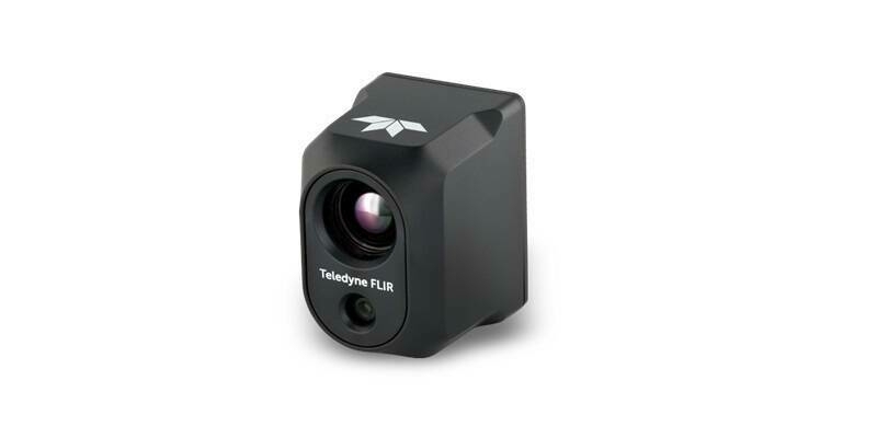
21st November 2024
Teledyne FLIR Selected as Thermal Camera Provider for the Red Cat Drone Black Widow U.S. Army SRR Program Award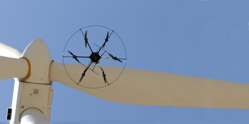
18th November 2024
Drone inspection — An unsuspected contributor to a greener future?
31st July 2024
Bluesky named sole supplier of aerial photography to UK Government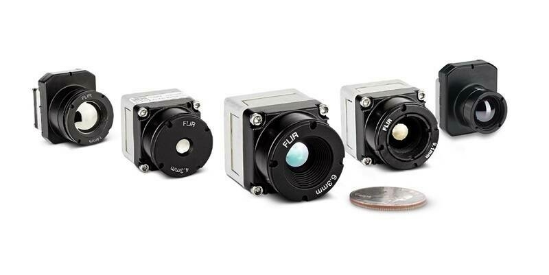
18th July 2024
Teledyne FLIR Boosts Boson+ Infrared Thermal Camera Performance with Embedded Software Upgrade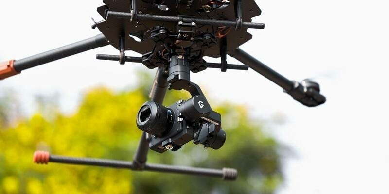
14th July 2024
Sony and Gremsy collaborate to deliver premium drone imaging solutions
5th July 2024
Are Larger Format Cameras Better for Mapping?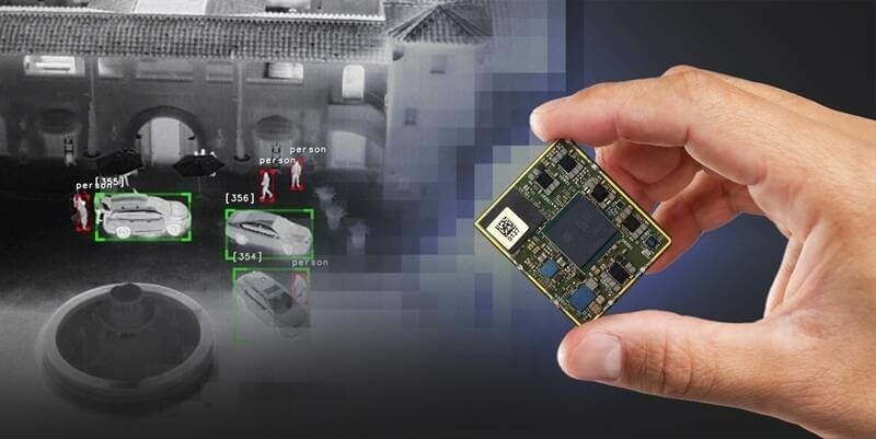
23rd April 2024
New Qualcomm-Built Advanced Video Processor by Teledyne FLIR Powers AI at the Edge
21st December 2023
Bluesky partners with Sensat providing data for new visualisation tool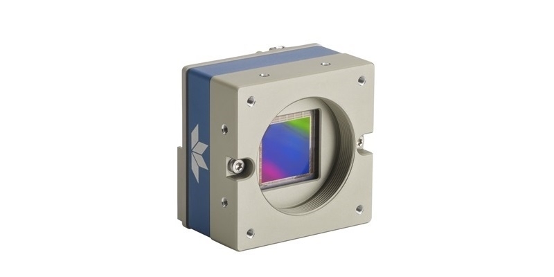
18th December 2023
Teledyne DALSA Genie Nano-10GigE cameras in full production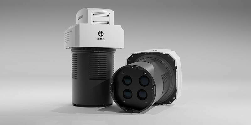
5th December 2023
Vexcel Imaging introduces new UltraCam Merlin 4.1 aerial camera system for elevated profitability and performance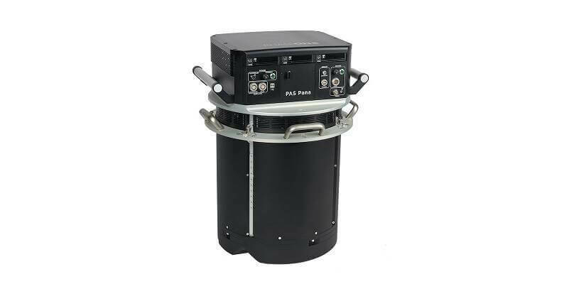
11th October 2023
Phase One Introduces PAS Pana at InterGeo 2023: The Most Effective Wide Area Camera for Aerial Mapping
4th October 2023
Richard Evans Appointed to Role of Sales Consultant at Bluesky International
11th September 2023
Bluesky Made a Record-Breaking Start to the 2023 Mapping Flying Season
1st September 2023
Bluesky Aerial Data Helps CGL Pinpoint Natural Hazards at Development Sites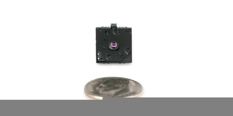
30th August 2023
Teledyne FLIR Introduces Lepton 3.1R Radiometric Thermal Camera Module for Integrators
16th August 2023
SimActive Used with Phase One Cameras for Precise Photogrammetry
9th August 2023
Webinar Topic: Cameras on Drones and Aircraft: Is Bigger Always Better?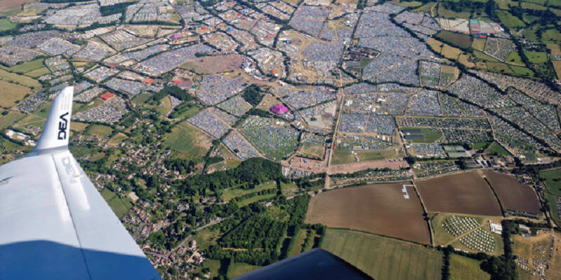
28th July 2023
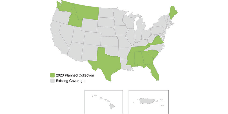
Hexagon to update high-resolution geospatial data of twelve US states
28th June 2023
Bluesky Makes a Record Breaking Start to the 2023 Mapping Flying Season
22nd June 2023
LexisNexis Improves Insurer Risk Assessment Portfolio with National Tree Map
16th June 2023
Bluesky Expands Commercial Team with Appointment of Bassett and Hoskins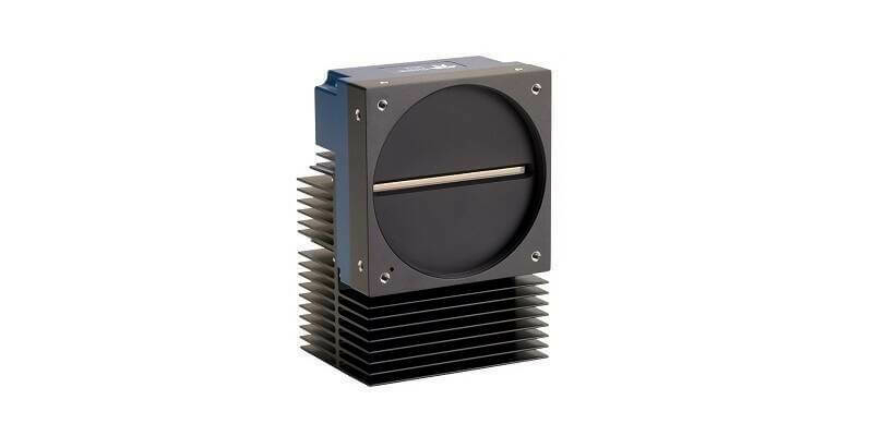
30th May 2023
Teledyne’s backside illuminated TDI camera delivers greater sensitivity for near ultraviolet and visible imaging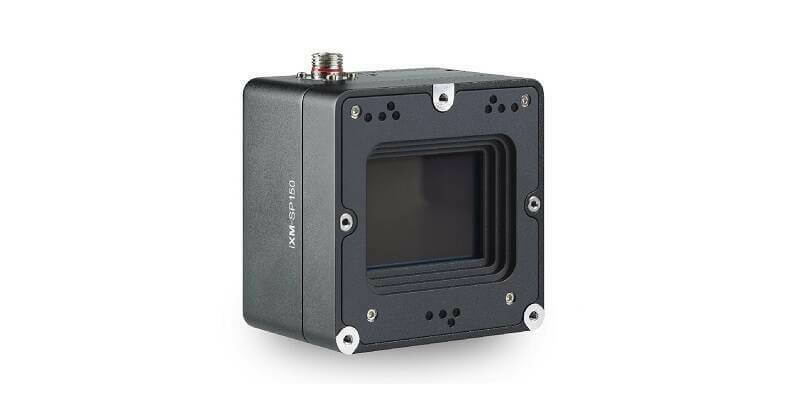
23rd May 2023
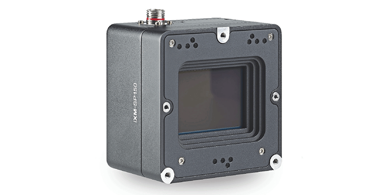
Phase One Announces iXM-SP150 at GEOINT - An Advanced 150 Megapixels Snapshot Matrix Camera for Earth Observation and Space Domain Awareness Applications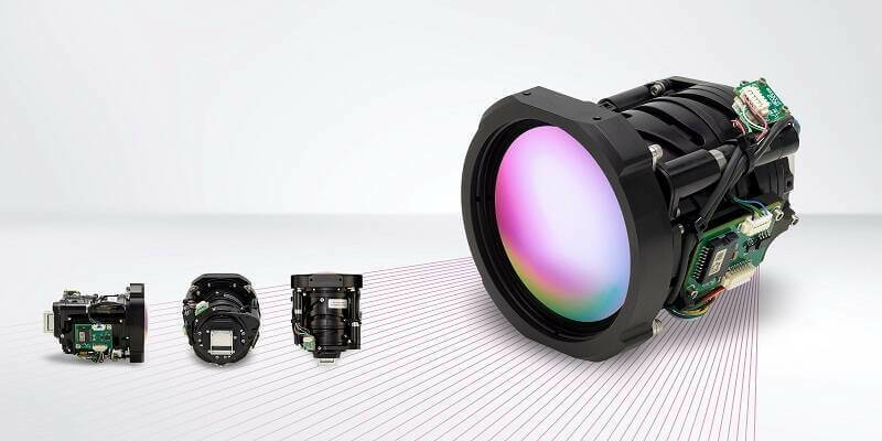
10th May 2023
Teledyne FLIR Boson+ Thermal Camera Now Available with Factory-Integrated Continuous Zoom Lens
2nd May 2023
Teledyne FLIR Announces Version 3.0 Release of Research Studio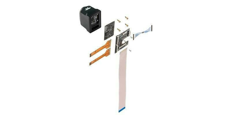
20th April 2023
Teledyne FLIR Adds Development Kits for Hadron 640R Dual Camera Module Integration for Qualcomm and NVIDIA Embedded Systems
29th March 2023
UP42 and Vexcel Team Up to Expand Aerial Imagery and Geospatial Data Portfolio on the Marketplace
1st March 2023
Bluesky Geospatial Launches Metrovista 3D Aerial Mapping Program in U.S.
1st March 2023
Aero-Graphics Purchases Two 4th Generation Ultracam Eagle 4.1 Aerial Cameras
15th February 2023
Aero-Graphics Purchases Two 4th Generation UltraCam Eagle 4.1 Aerial Cameras
18th January 2023
Navigate new waters with UltraMap version 6.0 for professional aerial data production
20th December 2022
EAASI Summit brings together the aerial surveying industry in Europe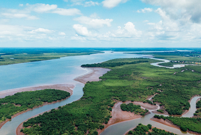
7th December 2022
Coastal concerns: how data can help us understand the pressure of climate change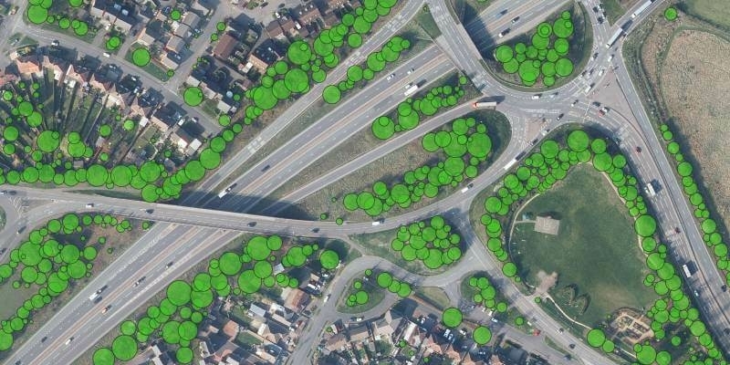
30th November 2022
Bluesky Tree Map Protects Leicestershire Highways from Falling Trees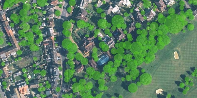
21st November 2022
Research Reveals How Trees Cover London’s Most Desirable Areas
4th November 2022
Hexagon to update aerial data of eight U.S. states at six-inch resolution in 2023 for the HxGN Content Program
2nd November 2022
New Vexcel partner Beijing GuoCe opens flagship store in China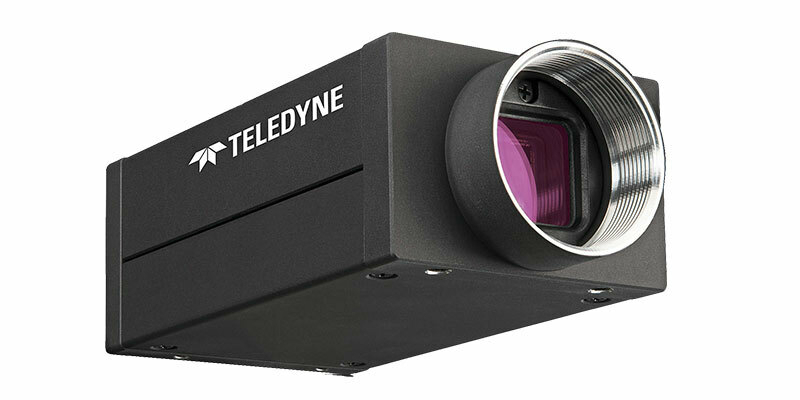
2nd November 2022
Teledyne announces next generation 5GigE area scan camera platform
19th October 2022
Bluesky International announced as supplier for new Ordnance Survey framework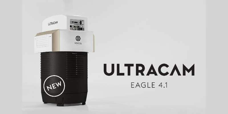
19th October 2022
Vexcel introduces new UltraCam Eagle 4.1 photogrammetric aerial camera
18th October 2022
Vexcel Imaging unveils its new UltraNav version 7 including a new partnership with TopoFlight