Content


Australian collaboration to deliver outstanding gyroscope technology
26th August 2020
Australian collaboration to deliver outstanding gyroscope technology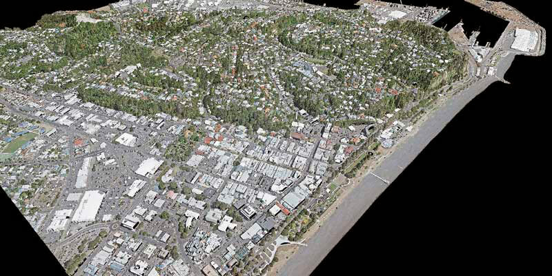
iXblue, Woolpert partner to deliver LiDAR mapping services to New Zealand Councils
26th August 2020
iXblue, Woolpert partner to deliver LiDAR mapping services to New Zealand Councils
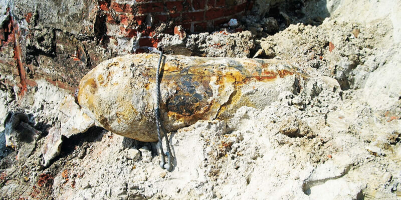
India: researchers to predict flood damage using satellite data
26th August 2020
India: researchers to predict flood damage using satellite dataTerra Drone Corporation Solidifies South Asia Presence
26th August 2020
Terra Drone Corporation Solidifies South Asia PresenceGeoCue Group Releases True View 615/620; RIEGL/Applanix-based UAS LIDAR System
26th August 2020
GeoCue Group Releases True View 615/620; RIEGL/Applanix-based UAS LIDAR System
Hexagon connects slope stability monitoring with mine operations
26th August 2020
Hexagon connects slope stability monitoring with mine operations
Eos Positioning Systems Releases Eos Tools Pro for Windows
26th August 2020
Eos Positioning Systems Releases Eos Tools Pro for WindowsRobert Mankowski Joins the Executive Board of the World Geospatial Industry Council
26th August 2020
Robert Mankowski Joins the Executive Board of the World Geospatial Industry Council
John Kimmance appointed as new MD of Ordnance Survey National Mapping Services
26th August 2020
John Kimmance appointed as new MD of Ordnance Survey National Mapping ServicesEUMETSAT Council appoints Philip Evans as next Director-General
26th August 2020
EUMETSAT Council appoints Philip Evans as next Director-GeneralThe 2020 Recipient of the Arthur C. Lundahl-Thomas C. Finnie Lifetime Achievement Award
26th August 2020
The 2020 Recipient of the Arthur C. Lundahl-Thomas C. Finnie Lifetime Achievement Award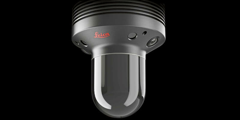
Leica Geosystems BLK247 Wins Security Industry Association’s Best New Product Award
26th August 2020
Leica Geosystems BLK247 Wins Security Industry Association’s Best New Product AwardAtlantic Purchases First Phase One Industrial Large-Format Camera In The USA
26th August 2020
Atlantic Purchases First Phase One Industrial Large-Format Camera In The USASchneider Electric Announces The New Geodatabase Manager Xi
26th August 2020
Schneider Electric Announces The New Geodatabase Manager XiGeneq Announces F100 the New Highly Integrated GNSS Receiver
26th August 2020
Geneq Announces F100 the New Highly Integrated GNSS ReceiverSolita and Unifly join forces to secure and advance international drone airspace
26th August 2020
Solita and Unifly join forces to secure and advance international drone airspace
PCI Geomatics Announces Partnership with GeoCloud
26th August 2020
PCI Geomatics Announces Partnership with GeoCloudBrandt Completes Sokkia Canada Acquisition
26th August 2020
Brandt Completes Sokkia Canada Acquisition
Satellite For Us Air Force Successfully Launches As Part Of L3harris’ Responsive Constellation Contract
26th August 2020
Satellite For Us Air Force Successfully Launches As Part Of L3harris’ Responsive Constellation ContractTDI-Brooks Purchases First US-Based Winghead System from Seahorse Geomatics
26th August 2020
TDI-Brooks Purchases First US-Based Winghead System from Seahorse GeomaticsThe Uavos Company Has Successfully Tested High-Altitude Flight Of The Uvh-170 Unmanned Helicopter
26th August 2020
The Uavos Company Has Successfully Tested High-Altitude Flight Of The Uvh-170 Unmanned Helicopter
Tech Soft 3D Helps Fieldwire Rapidly Bring BIM Viewing to Its Construction Management Platform
26th August 2020
Tech Soft 3D Helps Fieldwire Rapidly Bring BIM Viewing to Its Construction Management PlatformAirbus signs contract with Optus for OneSat
26th August 2020
Airbus signs contract with Optus for OneSatLactec and Eomap sign an unprecedented partnership in Brazil
26th August 2020
Lactec and Eomap sign an unprecedented partnership in BrazilA game changer for the European Railway Traffic Management System
26th August 2020
A game changer for the European Railway Traffic Management SystemMaxar Technologies Announced its Intention to Acquire Vricon
26th August 2020
Maxar Technologies Announced its Intention to Acquire VriconSBG Systems renews its popular line of miniature inertial sensors
26th August 2020
SBG Systems renews its popular line of miniature inertial sensorsThuraya and Telespazio Sign Partnership Agreement for Global Distribution
26th August 2020
Thuraya and Telespazio Sign Partnership Agreement for Global DistributionFugro wins Innovate UK ‘First of a Kind’ funding to support rail industry innovation
26th August 2020
Fugro wins Innovate UK ‘First of a Kind’ funding to support rail industry innovationVirtual Surveyor Drone Surveying Software Update
26th August 2020
Virtual Surveyor Drone Surveying Software Update
Hexagon to suport eau de Paris in agricultural aid project
26th August 2020
Hexagon to suport eau de Paris in agricultural aid project
Riegl Usa Construction Update Website, Ultimatelidar.Com, Is Live
26th August 2020
Riegl Usa Construction Update Website, Ultimatelidar.Com, Is LiveSimActive Software Used for Oil and Gas Seismic Exploration
26th August 2020
SimActive Software Used for Oil and Gas Seismic ExplorationProstar joins Trimble’s GIS Business Partner Program
26th August 2020
Prostar joins Trimble’s GIS Business Partner ProgramCovid-19 is making us all socially distant. But we’re all having to look at new ways of understanding location at a distance
26th August 2020
Covid-19 is making us all socially distant. But we’re all having to look at new ways of understanding location at a distanceArchive