
SkyTraq Launches Miniature Low-Power RTK Receiver
28th October 2015
SkyTraq Launches Miniature Low-Power RTK Receiver28th October 2015
SkyTraq Launches Miniature Low-Power RTK Receiver28th October 2015
Rolta Wins 13 million Dollar Contract for Engineering Systems28th October 2015
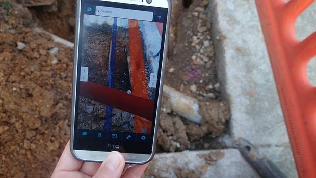
FOIF GNSS Receivers Aid Australian Pipeline Survey28th October 2015
Geological Survey of Israel Chooses SuperGIS Desktop28th October 2015
Tallysman™ introduces the VeraPhase™ 6000 High Precision GNSS Antenna Series28th October 2015
Trimble’s New High-Speed Data Communications Link for Industrial Applications28th October 2015
Digital photogrammetry and 3D perception: the new conquests28th October 2015
FLIR Introduces New Professional-Grade Thermal Camera for Commercial Drones28th October 2015
UNAVCO Names Septentrio as Preferred Vendor for GNSS Reference Stations28th October 2015
Fugro Begins Final Geotechnical Investigations In Borssele Offshore Wind Area28th October 2015
Specim releases first professional quality hyperspectral sensor range28th October 2015
senseFly eXom drone proved capable of producing millimetre accurate 3D data28th October 2015
Elsevier and the American Geophysical Union Collaborate28th October 2015
PlanetObserver continues production of PlanetSAT 15 L8 imagery base map28th October 2015
Intergraph® presents the first truly Green GIS28th October 2015
IDV Solutions launches Visual Command Center 4.528th October 2015
Fugro Integrates and Rebrands UK Based Geotechnical Specialists28th October 2015
VSTEP introduces Advanced Fire Fighting Simulator for shipboard incidents28th October 2015
Digital Element1s IP geolocation technology helps mbr with marketing28th October 2015
Red Cross Offers Interactive Tool to Access and Track Live, Wildfire Information28th October 2015
Spacemetric and ÅAC Microtec partner on smart downlinking of Earth observation data28th October 2015
Earth-i announces forthcoming operational data services from the DMC3/TripleSat Constellation28th October 2015
Aibot X6 Version 2 first UAS with RTK - High Precision GNSS as a serial product28th October 2015
ClearEdge3D and Gexcel Announce Software Marketing Partnership28th October 2015
Topcon’s Mass Data Collection Range Takes Off With New UAS28th October 2015
Arborists whittle away Time and Money on Mapping with MGISS!28th October 2015
MDA expands imaging modes for RADARSAT-2 for ocean applications28th October 2015
miso launches a brand new approach to processing data28th October 2015
Septentrio Names New Dealer for UAV Market28th October 2015
VisionMap Thermal Airborne Imaging System Maps German Pipelines28th October 2015
LandScan 2014 Global Population Database Released by East View28th October 2015
Drones and cultural heritage in Medellín (Badajoz, Spain).

28th October 2015
INTERGEO 2015 Review - Going global. Going great!