Share
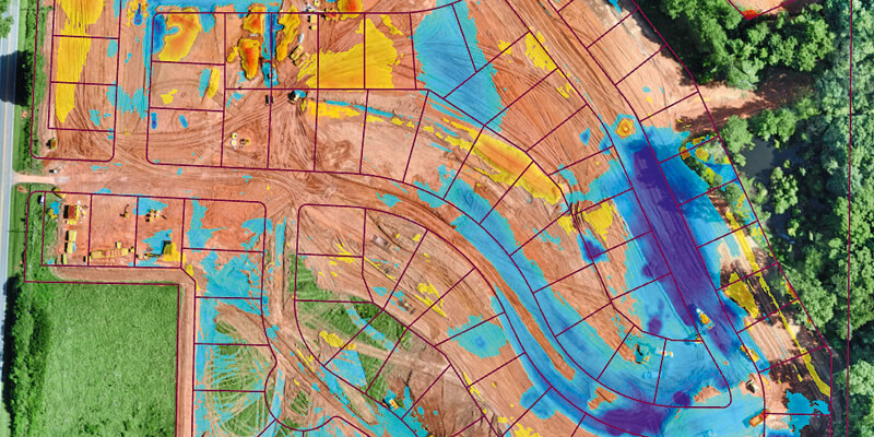
Virtual Surveyor has introduced new functionality in Version 7.3 of its popular drone surveying software to create a simplified workflow for monitoring earthworks progress at construction sites. The productive workflow enables construction managers to quickly calculate cut-and-fill changes over time for comparison with the Earthworks design plan. Virtual Surveyor software is a powerful construction monitoring tool because it bridges the gap between Unmanned Aerial Vehicle (UAV) photogrammetric processing applications and engineering design packages. The software generates an interactive onscreen environment with drone orthophotos/DSMs and/or LiDAR point clouds where the user can compare multiple drone surveys in a matter of seconds.
www.virtual-surveyor.com


