Europe’s first dedicated centre for hyperspectral imaging training opened in December. But the arrival of the coronavirus means it has had to adapt to quarantine restrictions. Ross Nakatsuji explains its new focus and how it is doing hands-on training differently

Europe’s first dedicated centre for the support and development of practical applications for hyperspectral imaging in remote sensing opened in December with an online webinar. Several hundred registrants viewed a presentation on the use of lightweight UAVs to monitor and analyse vegetation encroachment on infrastructure using a combination of hyperspectral imaging (HSI) and LiDAR. Fused data from spectrally classified pixels, a 3D point cloud, and precise positioning via high-performance yet compact GPS/IMU payload showed how even a short five-minute flight could greatly aid planned clearing operations.
The Center for Hyperspectral Remote Sensing Europe (CHRSE) hosted another webinar in February on the use of lightweight UAVs for airborne hyperspectral imaging over experimental agricultural fields. Again, hundreds of researchers from universities, companies, governments and institutes attended to see how new and refined geospatial tools allow better visualisation, analysis and ultimately action can be taken before telltale signs become visible to the human eye.
Why would so many people log into these webinars and continue to view the recordings?
“It’s about value,” says Christian Felsheim, director of Headwall Photonics Europe. “Researchers and technicians know that the technology exists to serve their needs, whether they are breeding disease-resistant crops or in charge of keeping towers, railways, or conservation land safe from potentially damaging and dangerous overgrowth and invasive species. But they need a place to come together to see, train with, or perhaps even help develop new solutions.”
“We have the facility,” adds Thomas Muhr, founder of geo-konzept GmbH. “What better place to locate the CHRSE than on a working farm with easy access to an international airport in Munich? We have a history of independence as an authority on applications and technology solutions, and we see this an opportunity for our customers, who benefit from new tools such as UAVs with HSI and LiDAR, software, and our real-world experience in the field.”
So, while preparing to open the physical location with large fields for unmanned UAV flights and indoor teaching and application-development areas, the founding companies hosted a series of webinars with images and data gathered on the premises or nearby. The idea is that a facility with hands-on access to the latest UAVs and multimodal imaging payloads can help promote a level of comfort with sophisticated technology that online viewing cannot.
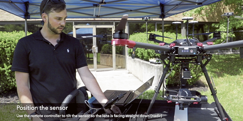
It is one thing to see video of someone developing a flight plan and then piloting the drone, and another thing to be physically present to also touch and experience a flight. For some who are new to these unmanned systems, an important aspect is learning to trust the vehicle and the onboard sensors, as well as understanding what the capabilities and limitations are.
Quarantine postponements
With a completely full-to-capacity inaugural event at the CHRSE planned for March, it was a tremendous disappointment to have to postpone it in accordance with local health authorities’ recommendation due to the ongoing Covid-19 outbreak. Many attendees had even booked travel to the CHRSE from other countries.
In the meantime, the focus has shifted back to online events such as webinars until people feel safe traveling again. Headwall and the University of Florida Gainesville hosted an online seminar during the height of the coronavirus in the US, with more than 600 people registering to attend. The online event was quickly organised after the original on-site event was cancelled out of concern by university authorities that the large group of attendees could pose a health risk. The CHRSE was mentioned prominently during the seminar, since the webinar could now reach more than those who originally planned to attend the original on-site event in Gainesville, Florida.
If there is a bright spot during the outbreak, it is that modern online meeting platforms stepped up to the task and have enabled people, including researchers who have common interests, to safely interact. As the world temporarily postpones public gatherings because of the coronavirus, the CHRSE is planning to host a series of online seminars using GoToWebinar, which successfully enabled a large worldwide group of attendees to take part in the Gainesville seminar.
The challenge for everyone right now is to reduce the risk of infection, and until we are confident in the safety of a public event, we’re going to stick with online events and possibly use some video that we shot months before the outbreak to at least give people a taste of what flying one of these UAVs is like.
So back to the original question – the answer is that judging from this level of interest, there appears to be a need and people want to see value. The CHRSE has carved out a task for itself from which very many researchers and companies aspire to benefit.
Ross Nakatsuji is marketing communications manager at Headwall (www.headwallphotonics.com)


