Share
An aircraft tracking system that uses machine learning to cut fuel consumption could save airlines money – and protect the environment. Regine Heue explains how it works
In 2018, the total number of passengers carried by plane was 4.3 billion, while the number of departures reached 37.8 million in 2018, a 3.5% increase. Those figures increased by 4.2% in 2019 and before the Covid-19 pandemic grounded most air traffic, that figure was projected to grow by another 4.1% this year.
That means the world’s aircraft fleet will more than double in the next 15 years, with almost 20,000 additional aircraft expected to be put into operation each day. The demand for fuel and the absolute fuel consumption of the air traffic segment will increase dramatically as result. The airline industry works on small profit margins. Each kilogram of fuel saved on a flight makes a difference. It can determine whether or not the flight is profitable, since fuel consumption accounts for around 30% of the total operating costs of a commercial flight. Therefore, reducing operational costs is a key aspect in achieving higher profitability. With higher overall fuel consumption, emissions (CO2, NOx) will also grow in the near future.
Additionally, many airports are already operating at their capacity limits and are not able to handle more flight movements without reciprocal effects and efficiency losses. Of course, many airports in Europe are growing, but much more slowly than needed.
One example is the third runway at Vienna airport. After starting 2007 in court, it is now finally approved and will presumably be finished in 2030. That means 23 years to build an additional runway. This leads to severe capacity bottlenecks in aircraft operations, which, again, result in delays, huge losses in operational efficiency, and high costs relating to passenger compensation rights.
Pushback
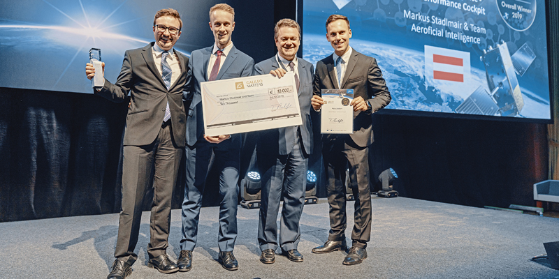
Aeroficial Intelligence – launched by Julian Jank, Johannes Schuster and Markus Stadlmair – at the ESA Business Incubation Center (BIC) Graz tries to make such unpredictable developments in air traffic predictable. Its “Performance Cockpit” web-based front-end, which can predict upcoming traffic situations, delays and related operational processes at and around airports, won the 2019 Galileo Masters competition’s Overall Winner award. Its solution enables the situational awareness of the operations department and the operational efficiency to be increased dramatically. Furthermore, flight planning will become more robust and operational risks can be mitigated effectively.
One major factor which affects the taxi-out time is the correct time of pushback and the engine run-up. This often leads to queues before the holding point before entering the runway. The waiting times lead to excessive and unnecessary fuel burn. Additionally, taxi stops and the moving on of the aircraft after a full stop increase fuel consumption.
By analysing ground traffic at major airports, Aeroficial Intelligence calculated possible savings for an Airbus A320 – a standard-sized short- to mid-range aircraft. It is absolutely feasible to achieve a potential taxi-time saving of one minute per aircraft by preventing four stops in one day. With an airline with a fleet of 40 A320s, this adds up to a taxi-time saving of 40 minutes a day, which equates to nearly €350k per year.
ADS-B technology
Aeroficial Intelligence’s solution is based on data used by Air Navigation Service Providers (ANSP). This data is generated using Automatic Dependent Surveillance – Broadcast (ADS-B) technology and transmitted by an antenna mounted on the fuselage of an aircraft. These messages are freely accessible and so the reception and processing of the data is straightforward. Receivers located near airports will ensure a constant data feed to a cloud-based database.
The system works automatically without any external work by air traffic control and relies on aircraft broadcasting their identity, GNSS coordinates, barometric altitude and other information from their on-board systems. The data is broadcast every half a second and can be received publicly. The ADS-B system performs better and is cheaper than traditional radar systems.
Vertical and horizontal geographical precision is increased using EGNOS satellites. The EGNOS reference stations pick up signals from GPS satellites, which are processed in mission control centres. The accuracy of the original signals is determined and confounding factors are corrected. This data is then incorporated into EGNOS signals and sent to its three geostationary satellites. The satellites relay these signals back to users on the ground, providing greater positioning accuracy than would be achieved through GPS alone. Increased accuracy and integrity mean the decision height can be decreased to as low as 60m, depending on local geography.
To access this data, Aeroficial Intelligence will roll out a system of receiver stations to collect operational data of aircraft approaching, departing and operating on the ground at airports. These receivers are placed strategically at airports to have maximum coverage of the surface operations. After receiving this data, the data stream is passed on to a cloud database, where the information is stored permanently.
The stored data is analysed in the backend of the IT infrastructure. These algorithms are developed in close cooperation with customers – airports, ANSPs or airlines. Due to the large amount of historical data collected by the receivers and the extension of the data pool with additional information from airlines and airports and weather data, machine-learning algorithms will be used. New models will be established by analysing patterns from this data pool. For example, taxi-out time, congestion in the airside operations of the airport and estimated time of arrival are predicted.
Performance Cockpit
Performance Cockpit shows the results of the data acquisition and the aviation analytic logics, tailored to the demands of the customer. It is connected by an API to the backend. Customers can also connect to the backend and pick up data to incorporate into their systems.
Aeroficial Intelligence’s cloud platform analyses different flight tracking data – ADS-B, ASTERIX and radar data – to evaluate different flight phases. The results include:
- Approach and departure analysis
- Detour/holding benchmarking
- Taxi speeds/distances
- Competition benchmarking on airport basis
- Ground stops and waiting times during taxiing
Around 2,500 raw messages are processed per second at the moment and the Performance Cockpit can visualise more than 50 KPIs on highly customisable dashboards and map visualisations. This enables the user to analyse its own operations as well as those of its competitors to gain an advantage.
“We incorporate all flight-operative positions around the airport and airfield. The data obtained is processed and analysed by our system developed in-house using AI, and then made available to our airlines, ANSPs and airport customers – in real time,” emphasises Markus Stadlmair, co-founder of Aeroficial Intelligence. “So, they are able to react promptly to the results and take necessary measures. This means that bottlenecks on the taxiway and ‘departure jams’ can be avoided. That saves pure money.”
Regine Heue is head of marketing and communications at AZO Anwendungszentrum GmbH Oberpfaffenhofen (azo-space.com)


