Share
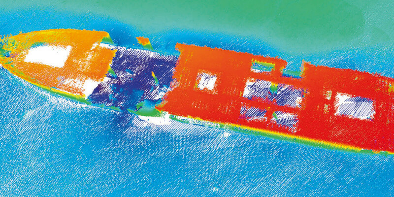
TDI-Brooks recently mapped the Liberty Ship George Vancouver off Freeport, Texas while out on a seabed survey project with the R/V Brooks McCall. The multiple multi-phase geophysical and geotechnical site surveys program consisted of pipeline routing and subsea structures to facilitate route and project design for offshore developers.
Equipment used to map the ship was a Teledyne Reson SeaBat T-20 multibeam sonar with integrated Applanix POSMV for Motion. Applying the mesh tools to the multibeam survey shows an example of the shipwreck. www.tdi-bi.com


