Share
Hurricanes leave a trail of devastation in their wakes, so how best to survey what’s left behind? Brynna King looks at what one university is doing to enable its students to study in the field the natural processes they learn about in classes – easily and safely
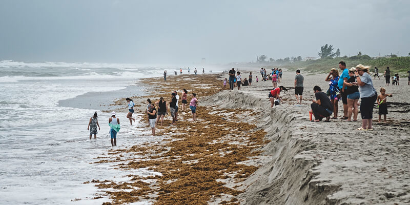
Hurricanes that originate in the Atlantic Basin strike the East Coast of the US about twice a year on average. The most destructive hurricanes leave permanent marks on coastal communities and sear their names into national memory.
But while the large-scale human and property loss of the worst storms are often well publicised, the ongoing environmental impacts of frequent tropical storms, large and small, receive less attention – even though they have important implications for both people and wildlife.
Researchers at the University of North Carolina Wilmington (UNCW)’s Coastal Hazards Lab are doing the important environmental work of analysing coastal change after storm events – most recently, Hurricane Isaias (2020), Hurricane Dorian (2019) and Hurricane Florence (2018) – as they teach and mentor UNCW students.
Dr Joseph Long teaches undergraduate classes and mentors graduate students at UNCW. He headed up a National Science Foundation-funded research project focused on the impacts of Hurricane Florence on North Carolina’s coastal topography, and his research also includes studies of coastal change processes that happen during calmer wind and wave conditions.
UNCW emphasises applied learning: giving students the opportunity to step outside the classroom, observe the natural processes they are learning about, and collect and analyse data in the field.
Long uses the Handheld Group’s Algiz 8X rugged tablet computer, along with an external high-accuracy GNSS receiver, to perform topographic surveys at Masonboro Island, an uninhabited barrier island near Wilmington that is part of the National Estuarine Research Reserve system. The island’s habitats include beach, dune, grassland, shrub thicket, salt marsh and mud flats, supporting wildlife including the more common foxes, raccoons, and native and migratory birds, as well as threatened species such as diamondback terrapins and loggerhead sea turtles.
Many researchers study the island and its inhabitants, with projects including turtle population surveys, water quality sampling and meteorological monitoring. The Coastal Hazards Lab has performed bi-monthly topographic surveys there since 2018 to measure how winds and wave energy cause sediment erosion and deposition on different parts of the island, and to assess the island’s ability to naturally repair between major storms.
“We conduct topographic surveys of coastal areas and study how beaches, dunes and barrier islands evolve due to winds, waves and nearshore currents,” Long explains. “Repeat topographic surveys help us to better understand the impacts of storm events and the role that natural recovery has in the resiliency of our nation’s coastline.”
Not just a walk along the beach
Taking research technology to the beach could be a recipe for disaster: “There is potential for the device to be exposed to saltwater, blowing sand or high temperatures,” Long says.
However, the Algiz 8X is built exactly for such applications. It is IP65-rated and tested to MIL-STD-810G US military standards, offering protection against water, small particles of dust and dirt, varying temperatures and repeated drops. Even if it gets covered in sand or immersed in water, users can wipe it off and keep working. It’s compact enough to carry, weighing in at about 1kg, and its 8” capacitive touchscreen still has plenty of space for viewing and manipulating maps, charts and other visuals. The tablet is also designed with features that support operation in bright sunlight and heavy rain or while wearing gloves, and its field-swappable 5,200mAh battery enables totally uninterrupted data collection.
Long and his students pair the Algiz 8X with an Eos Positioning Systems Arrow Gold RTK GNSS receiver acquired from Anatum GeoMobile Solutions. The Arrow Gold can use GPS, GLONASS, Galileo and BeiDou GNSS and implements three frequencies (L1, L2 and L5) and satellite-based RTK augmentation for 1cm horizontal real-time accuracy. The tablet and the receiver sync over Bluetooth and the Algiz 8X’s wireless cellular functionality enables users to pull in position data from the North Carolina GNSS Real Time Network for greater accuracy.
“The Algiz 8X tablet connects via Bluetooth to the Arrow Gold antenna and is either mounted on a survey pole to measure the elevation of individual points or mounted on a backpack for walking surveys where we ‘mow the lawn’ up and down the beach to get a 3D map of the coastal area,” Long explains.
Flexible, customisable surveying
Long uses several programs to interface with the receiver and says the Microsoft Store and the Algiz 8X’s communication capabilities are an added benefit: “I can load whatever software I need to program and deploy other types of sensors, such as water level loggers to measure how far and how long surge and waves inundate portions of the beach during storms. We can also retrieve and plot data and redeploy sensors directly in the field, and without a bulky rugged laptop.”
The lab using Esri’s ArcGIS Collector to collect data, as well as freeware GPS data-viewing program VisualGPS and proprietary software specific to its data collection instruments. ArcGIS Collector uses map-driven forms to enable users with any level of experience to capture field data, including photos, videos and audio recordings.
When cell service or WiFi is available, ArcGIS uploads data to the cloud-based ArcGIS Online platform in real time; when they aren’t, the Algiz 8X has 128GB of local storage to store all the data safely, which Long and his colleagues sync later. VisualGPS data is always stored on the device and downloaded via USB back on campus.
Mixing and matching technologies can provide better customisation than standard GPS surveying packages that bundle a data receiver, software and GPS antenna, Long says: “The combination of a bring-your-own-device GPS antenna and the rugged Handheld tablet was cost-effective and allows us to use the survey collection software of our choosing.”
At UNCW, rugged technology is empowering researchers to add to the scientific body of knowledge surrounding coastal habitats – and equipping tomorrow’s visionaries with the data and tools they need to preserve and protect our evolving world.
Brynna King is a freelance writer and editor (www.wordjones.com)


