Share
With claimed new levels of reliability and productivity, Trimble’s R12i GNSS receiver is aimed squarely at surveyors looking to up their game. With this in mind, GeoConnexion spoke to James Richards at Benchmark Surveys to find out how it measured-up in field testing
GEO: Benchmark Surveys has been operating out of Exeter as a family-owned business for the past 25 years. Can you give us an idea of the work you handle for customers?
JAMES RICHARDS (JR): While land and utility surveys are the mainstay of the business, building construction, volumetric and boundary surveys are also important. In addition to stakeout, measurement and levelling tasks, we also undertake 3D laser scanning, point cloud processing and drone surveys for a wide range of public and private sector customers across the UK.
GEO: What do you regard as the principal challenge for established businesses such as yours?
JR: Keeping up with the latest technology is, perhaps, our biggest challenge. We pride ourselves on the quality of our work - one reason why we keep all our services in-house and have only gradually expanded our seven-strong workforce. So within this constraint, any technology that helps us to deliver quality results – reliably and consistently - is a major asset. The pandemic has, of course, created its own challenge, but in contrast to many businesses, we have never been busier!
GEO: Presumably, you have been a user of Trimble instruments for some time?
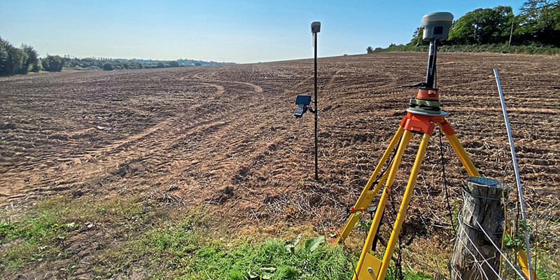
JR: Yes. We started with a Geodimeter back in 1995 and now have an inventory that includes the TX6 3D laser scanner. two S7 and one S3 robotic Total Stations, an R10 GNSS receiver and several TSC3 and TSC7 Controllers – all supplied and maintained by KOREC, Trimble’s leading distributor in the British Isles. And, of course, we now have the R12i GNSS receiver
GEO: I think you were one of the first in the UK to beta test the R12i. How did this come about?
JR: We do a lot of investigating before purchasing instruments and post a lot of our findings on Instagram. Being aware of this, Trimble approached us direct and invited to put the R12i through its paces.
GEO: And your initial impression?
JR: Really impressed! As we already had the R10, we saw the R12 as little more than an upgrade, so we had big expectations of the R12i. To be fair, it takes some getting used to, as its tilt compensation function means you don’t have to constantly level the pole when offsetting – something you would do naturally when handling an instrument of this type. But once you’ve mastered this new way of working, and with virtually instant start-up, it gives you a completely different perspective on how to go out and do a survey.
GEO: Did you test the R12i across a range of projects?
JR: Because we undertake such a range of jobs, we were able to test it quite extensively alongside the TSC7 Controller, both as a base rover and with RTK corrections from Trimble’s VRS Now service. The result: a massive improvement in speed of operation. Accuracy, too, was impressive – to within a couple of centimetres using Trimble’s CenterPoint RTX post processing service, and better than the R10 in terms of sub centimetre-level accuracy when used as a GNSS rover.
GEO: The R12i’s IMU-based tilt compensation technology is said to be particularly useful in challenging environments. Is this your experience?
JR: Absolutely. For example, I went out yesterday to survey a gravel stockpile and it was brilliant. I didn’t have to scrabble up and down the pile to capture points but could do this from the top or from a safe location simply by angling the pole to wherever I wanted a point.
It’s also great for doing boundary jobs and where ditches with overhanging foliage have traditionally made surveying both arduous and time-consuming. The same applies when spot levelling in windy conditions. Using an instrument like the R10, it can be really difficult to hold the pole within the green bubble for any length of time. With the R12i, it’s pretty much instant because you only have to watch the pole tip, not the bubble.
GEO: Trimble claims the R12i delivers more than 30 percent better performance in such challenging environments compared to the R10-2 receiver. Is this your finding?
JR: I wouldn’t disagree with that for the simple reason that the R12i gathers more information in significantly less time and with much reduced effort, especially in the type of areas and in the conditions I have mentioned. An extended battery life contributes to productivity, with a full day’s work being possible on a full charge.
GEO: Can you see the R12i opening-up new lines of work for the business?
JR: In gathering and equipping us with data we never had previously, the R12i certainly gives us a commercial edge. With a ROI firmly in mind, we are already using this data to augment our existing project deliverables and also actively exploring its wider uses.
GEO: And in terms of value-for-money?
JR: In a nutshell, it pays for itself. It’s one of those instruments we were all waiting for, and expectations were high when it was launched in September of this year. For us, those expectations have been more than fulfilled.


